
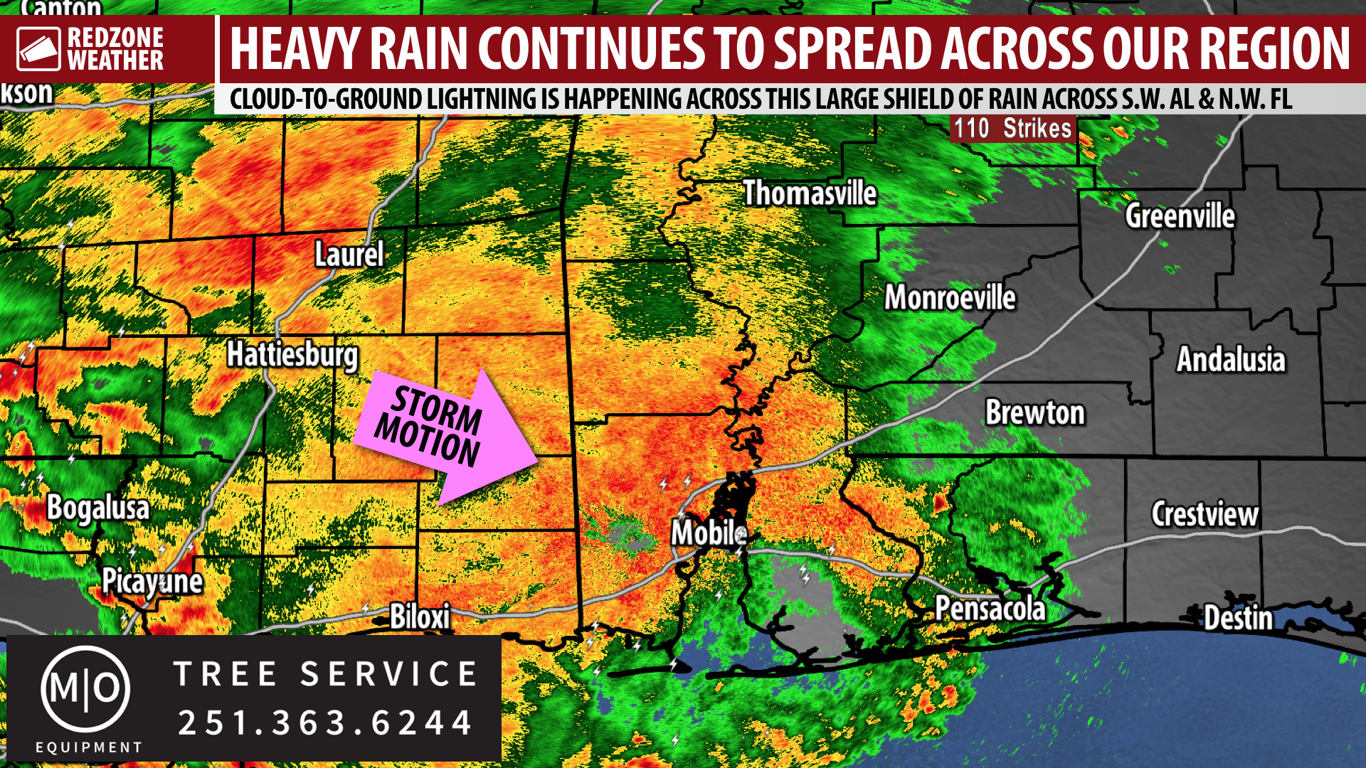
AFTERNOON UPDATE: THUNDERSTORMS SPREADING ACROSS THE AREA… Heavy rain and thunderstorms continue to spread southeastward across south Alabama and northwest Florida. No severe weather warnings have been needed thus far, thankfully, and it looks like the overall risk of hail and damaging winds today remains very low if not near zero in most spots. The storms moving across our region today ARE producing cloud-to-ground lightning and loud thunder in some cases.
WHAT TO EXPECT – NEXT FEW HOURS… Over the next few hours, you can expect this large mass of rain to continue moving east across the region. If you haven’t had any rain yet in your specific location, you probably will have rain before the end of the day. The chances of Butler and Covington counties getting rain today may be a bit less compared to areas farther west that are already having storms. We’ll keep you posted with radar updates over the next few hours in the RedZone Weather app.
MORE RAIN AND STORMS ON THURSDAY… Another round of rain and thunderstorms is expected to develop to our west tomorrow (Thursday) and spread across the region. The Storm Prediction Center maintains a low-end, Level 1 (out of 5) severe weather risk for coastal counties as some of the stronger storms tomorrow closer to the coast may produce gusty winds and hail.
I’ll have more updates over the next few hours in the RedZone Weather app.