
Sunset Mobile,Al @spann @NWSMobile @rzweather @StormHour @ThomasGeboyWX @michaelwhitewx @KDanielCCI @WKRGEd #sunset #mobwx https://t.co/I3bi4lWfOr
Tap below to support this RZW sponsor!


Sunset Mobile,Al @spann @NWSMobile @rzweather @StormHour @ThomasGeboyWX @michaelwhitewx @KDanielCCI @WKRGEd #sunset #mobwx https://t.co/I3bi4lWfOr


Some late afternoon rain pushed in over Wolf Bay just after 4 p.m. Here’s the view from the Osprey Cam when the rain arrived. @spann #alwx https://t.co/FNqE4lwv7b https://t.co/Hbcl38P8sW

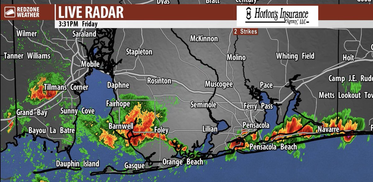
Heavy downpours of rain are happening near Navarre, Gulf Breeze, Pensacola Beach, Magnolia Springs, Barnwell, Clay City, and Theodore. Storms are moving southeast this evening. https://t.co/2WCjhKU69g

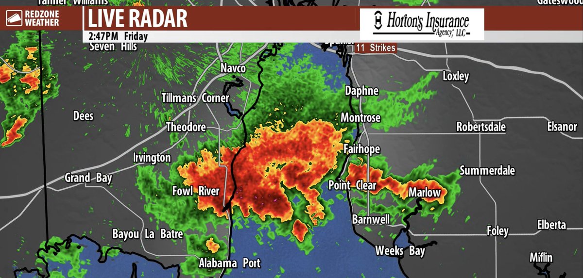
Heavier rain is happening this afternoon across parts of southern Mobile and Baldwin counties south of I-10 near places like Sunny Cove and Point Clear. Hearing some rumbles of thunder in these areas as well. This storm is sliding southeast. https://t.co/dsHaPuKuc2


