3:46AM July 30, 2026
Flash Flood Warning for Walton County in FL until 4:45am Thursday.
— Spinks Megginson (@rzweather) July 30, 2026

Flash Flood Warning for Walton County in FL until 4:45am Thursday.
— Spinks Megginson (@rzweather) July 30, 2026
Flash Flood Warning for Walton County in FL until 4:00am Thursday.
— Spinks Megginson (@rzweather) July 30, 2026

New thunderstorms are firing up as an outflow boundary moves west into Covington and Okaloosa counties. Don’t be surprised to hear some thunder overnight along with the potential for heavy rain at times in localized areas. https://t.co/V8rHxT9TAH
— Spinks Megginson (@rzweather) July 30, 2026

Flash Flood Warning for Walton County in FL until 1:15am Thursday.
— Spinks Megginson (@rzweather) July 30, 2026

Spotty showers are happening late this evening near Brewton, Appleton, Castleberry, Sandestin, and Freeport. Numerous storms are happening in parts of Holmes, Washington (FL), and Bay County.
Spotty storms will be possible overnight, mainly near the coast. Not expecting https://t.co/8zuYIaqVft
— Spinks Megginson (@rzweather) July 30, 2026

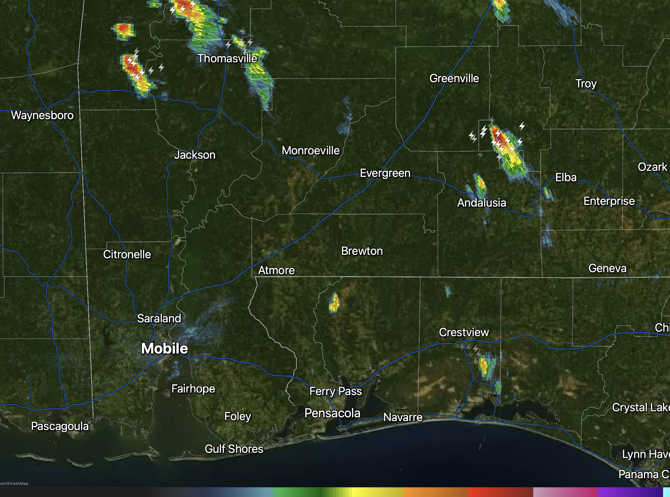
SPOTTY STORMS DRIFTING SOUTH… Scattered showers and storms continue to develop and drift south this evening. Rain is happening near Thomasville, Rose Hill, and Coffeeville.

Only a few isolated showers and thunderstorms are in progress across the region this evening just after 5 o’clock.
Rain is happening near Gulf Breeze, Pensacola Beach, Beulah, Crestview, Baker, Appleton, Greenville, and Thomasville.
I expect an increase in coverage in pop-up https://t.co/ZdIXF3BJyH
— Spinks Megginson (@rzweather) July 29, 2026
