Next formidable chance of rain happens on Saturday, but not before a slew of nice, sunny days! https://t.co/0kX1wNRHsF

Next formidable chance of rain happens on Saturday, but not before a slew of nice, sunny days! https://t.co/0kX1wNRHsF
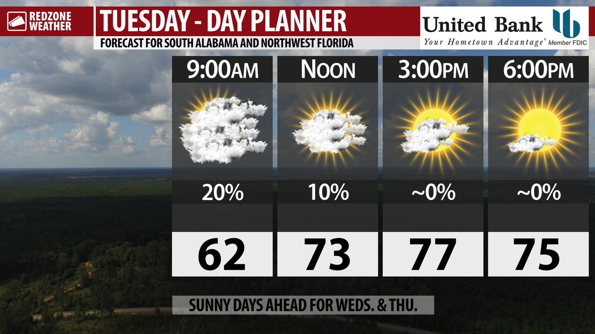
FEW CLOUDS THIS MORNING; SUNNY DAYS AHEAD… Clouds will move out later today as we begin a short stretch of sunny, nice days. High temperatures on this Tuesday will be in the upper-70s across the region. Cooler air will move in tonight into Wednesday with high temperatures expected to be a bit cooler on Wednesday, in the low-70s in many spots. Overnight lows on Thursday morning are expected to be in the low-40s ahead of a warmup in temperatures this weekend. Our next real shot of experiencing rain and storms happens Friday evening into Saturday as a frontal boundary approaches from the northwest. While strong to marginally severe thunderstorms appear possible, the greater concern will probably end up being heavy rainfall that could lead to flash flooding. Fortunately, this will be a quick-hitting system (compared to the numerous, day-after-day rain events we had last week) that moves out by Sunday afternoon. I’ve got your Tuesday forecast details below.
COLD TEMPS AHEAD FOR THURSDAY MORNING… Unseasonably cool temperatures are ahead for Wednesday night into Thursday morning as a deep trough happens across the eastern half of the continental United States. This means that overnight lows locally will dip well into the 40s with some spots near and just north of the U.S. Highway 84 corridor possibly dipping into the upper-30s. Some patchy light areas of frost farther inland may be possible. Freezing and below freezing temperatures are NOT expected, however. Temperatures will quickly rebound on Thursday into the low-70s by the early afternoon hours.
NICE WEATHER THROUGH FRIDAY MORNING… Clear skies with plenty of sunshine each day are ahead for both Wednesday and Thursday. High temperatures each day will be in the low-70s. The clear skies in the early morning hours on Thursday morning are one of the reasons temperatures will be so chilly in the early morning hours.
SCATTERED SHOWERS & STORMS ON SATURDAY… We could have a few showers as early as Friday evening locally, but clearly Saturday will be our active weather day across south Alabama and northwest Florida. Scattered showers and thunderstorms are expected from the early morning hours through at least the early evening hours. A few strong to severe thunderstorms may become possible. Rain is expected to be east of our area by early Sunday morning.
HEAVY RAIN & FLASH FLOODING CONCERNS SATURDAY… While convective hazards (outlined below) will be possible Saturday, widespread heavy rain could lead to flash flooding across the area, particularly in coastal counties where soil remains highly saturated due to recent rainfall. Rain totals of 2-3″ may be possible across the region.
STRONGER STORMS POSSIBLE SATURDAY… In addition to the flash flooding potential setting up for Saturday, isolated strong to marginally severe thunderstorms could become possible. Gusty winds and large hail will be the main concerns with a few tornadoes also being possible. Be sure to check back in for updates over the next few days on this evolving situation as we begin to nail down more details.
APP ALERTS… redzoneweather.com/app is the link where you can download the free RedZone Weather app. We post brief updates throughout each day in the app, keeping you up-to-date about the latest happenings in weather across south Alabama and northwest Florida. Once you have the free app downloaded to your iOS or Android device, be sure to visit the Alerts tab (lower right corner) then tap the large, yellow Alert Settings button to customize the alerts you would like to receive straight from me.
See all the details in your Tuesday #rzw forecast video. Have a great day!

Looking forward to more sunshine later today! High temperatures today will be in the upper-70s. Cooler air arrives tomorrow! https://t.co/Fr172j0NrY

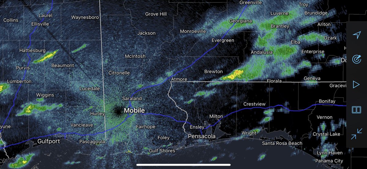
Light rain or sprinkles will be possible over the next few hours. I suspect much of this action visible on radar isn’t reaching the ground. https://t.co/zpe18Steu7