Rain north of Mobile, AL this evening.
@NWSMobile @spann @rzweather @WKRGEd @ThomasGeboyWX https://t.co/fJuutFiPcR

Rain north of Mobile, AL this evening.
@NWSMobile @spann @rzweather @WKRGEd @ThomasGeboyWX https://t.co/fJuutFiPcR

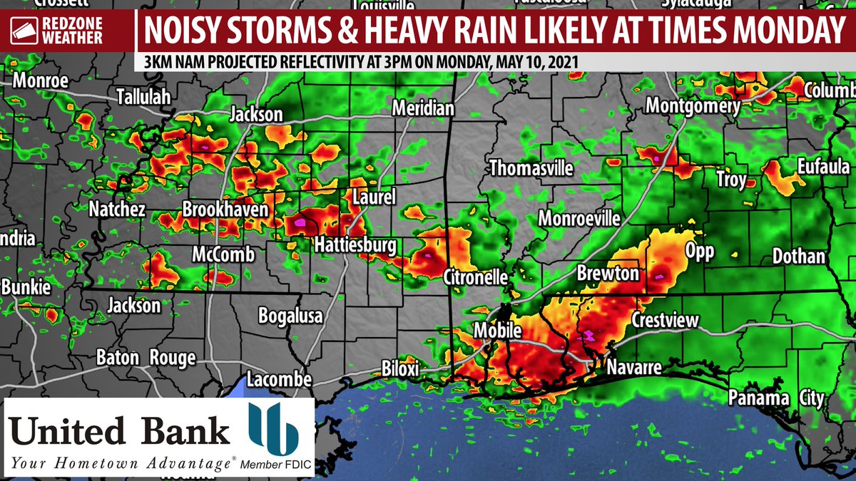
RAIN & STORMS LIKELY MONDAY; LOW-END SEVERE WEATHER RISK… Rain and thunderstorms are set to return to south Alabama and northwest Florida tonight into tomorrow (Monday, May 10, 2021) with a low-end chance of a few strong to severe thunderstorms. The main concern in any storms that can become strong on Monday will be gusty winds and small hail. The overall tornado risk remains quite low. Right now, it looks like our first round of rain and storms (out of several rounds in the next few days) will happen on Monday morning. There is a bit of uncertainty in terms of timing (more details on that below), but confidence is high that rain and storms will kick off at some point in the early morning hours and perhaps extend into the afternoon and evening hours.
UNCERTAIN TIMING OF RAIN & STORMS MONDAY… Thunderstorms are expected to begin across our local area at some point on Monday morning. Some model guidance points to an earlier arrival of rain and storms, perhaps as early as 2-3AM. Other models like the North American Model (NAM) show only spotty showers overnight ahead of a line of stronger storms pushing across our region after sunrise. Regardless, rain and storms will be possible at times throughout the day on Monday.
MAIN CONCERNS: GUSTY WINDS & SMALL HAIL… Heavy rain and loud thunder are what most locales across south Alabama and northwest Florida will experience on Monday at times. A few of the thunderstorms that move across our area may briefly ramp up and produce small (likely less than quarter size in most cases) hail and gusty winds capable of knocking down a few trees. The overall tornado risk remains quite low. I cannot completely rule out a tornado or two, but the risk is very low.
UNSETTLED PATTERN THIS WEEK… The storms on Monday are slated to be the first round in what will likely be several rounds of rain and storms over the next few days. Tuesday and Wednesday will probably be wet at times with multiple mesoscale convective systems (MCSs) likely moving across our region. High temperatures will be near 80 over the next few days.
GORGEOUS SUNDAY IN PROGRESS… Before we get to the rain and storms in the overnight hours and on Monday, we have had a beautiful Sunday in progress across the region. Temperatures peaked in the mid-80s inland with temps near 80 closer to the coast earlier this afternoon. Cloud coverage will gradually increase over the next several hours ahead of a few showers becoming possible late tonight into the very early morning hours of Monday.
APP ALERTS… If you haven’t already, be sure to download the free RedZone Weather app to keep up with all the latest information on the world of weather in south Alabama and northwest Florida. redzoneweather.com/app is the link for the free download. Once you have the app downloaded to your iOS or Android device, be sure to visit the Alerts tab (lower right corner) and tap the large, yellow Alert Settings button to customize the alerts you would like to receive straight from me.
I will have your next full forecast video posted by 7:15AM on Monday morning with the very latest information on our active weather week ahead. Have a nice Sunday evening!

Storms will be possible overnight into Monday. Multiple batches of rain and storms could produce loud thunder at times. Sunday evening update just posted here: https://t.co/aPNzVodrhg https://t.co/D8Z1OgLgKE

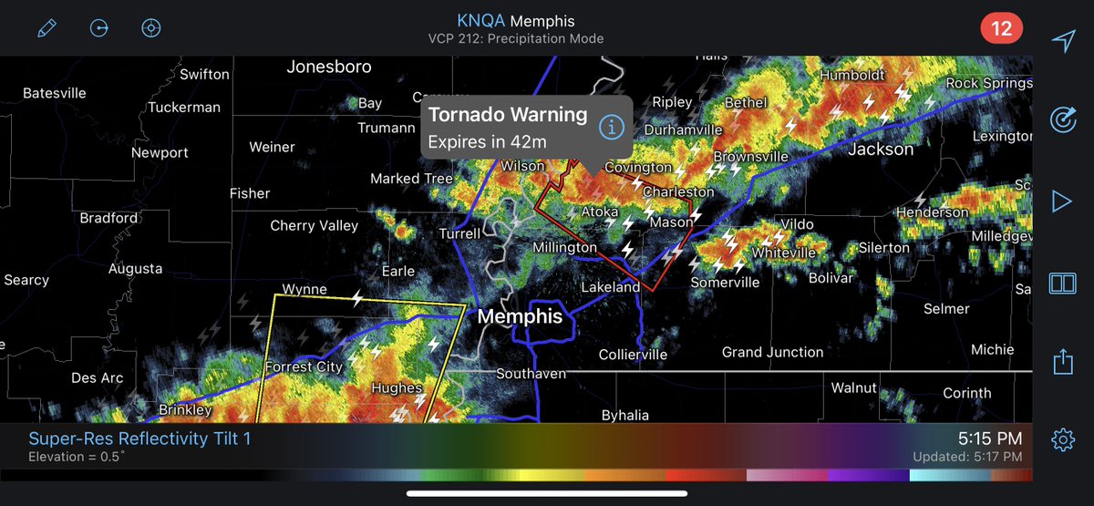
Tornado Warning till 6PM for parts of Tipton, Fayette, and Shelby counties in western Tennessee. This is northeast of the Memphis, TN metro area. https://t.co/kmoKe5aJ6q