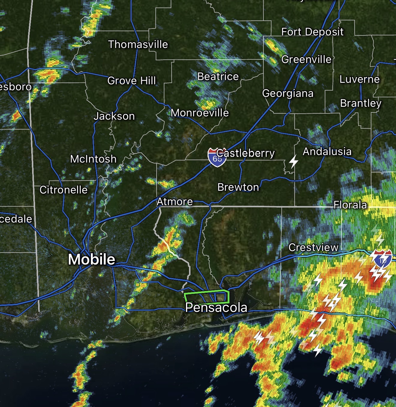
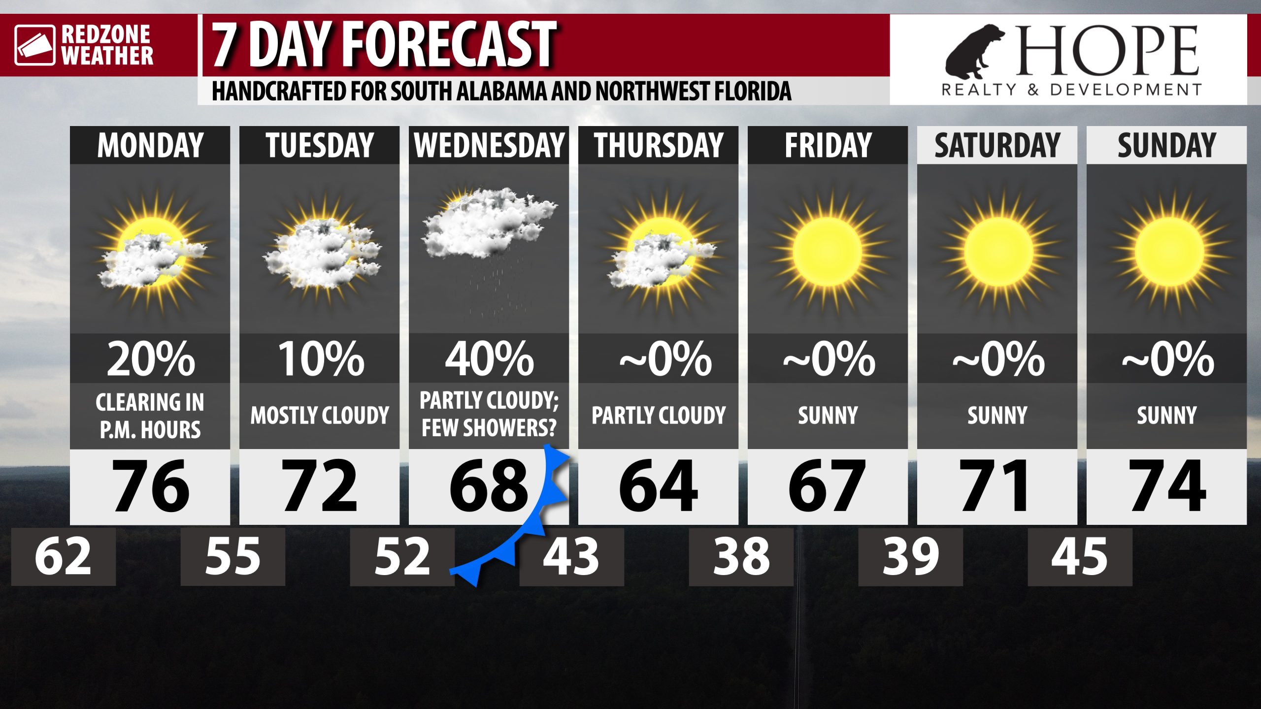
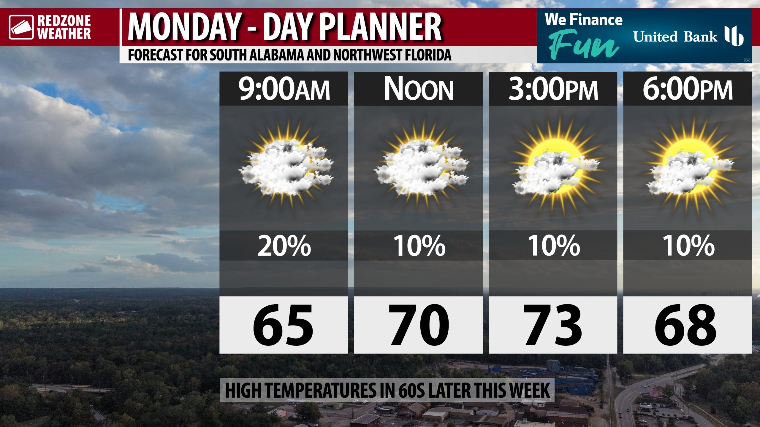
ISOLATED SHOWERS POSSIBLE TODAY; RAIN WEDNESDAY AHEAD OF COLDER TEMPS THURSDAY… If you’re ready for a significant cooldown, this is going to be the week for you! We have much cooler temperatures on the way for Wednesday night into Thursday and Friday after a cold front moves by on Wednesday evening. Before we get there, a few showers may be possible across the region on this Monday. I expect most communities to remain completely dry, but I can’t rule out a few showers (specifically across south central Alabama and places further to the east) due to some wrap around moisture on the western flank of an area of low pressure that is exiting our region to the east. High temperatures will be in the low 70s in most spots today.
MOSTLY CLOUDY TUESDAY… Tomorrow will be a mostly dry day with mostly cloudy skies likely throughout the day. Afternoon highs will again be in the low to mid 70s. A stray shower can’t completely be ruled out, but rain chances remain quite low (less than a 10% chance of rain).
SHOWERS POSSIBLE WEDNESDAY AHEAD OF COLD FRONT… Scattered showers and perhaps a few thunderstorms will become possible on Wednesday ahead of colder, drier air surging into our region Wednesday night. High temperatures on Wednesday will be in the upper 60s and near 70.
COLDER TEMPS THURSDAY AND FRIDAY… Skies will clear out on Thursday with mostly sunny skies likely for much of the day. High temperatures on Thursday will be in the low to mid 60s. This will be the first real chance of overnight lows in the 30s coming up Thursday night into Friday morning. I expect inland communities to be in the 30s with low 40s likely as far south as the Alabama and northwest Florida beaches. Friday will also have high temperatures in the 60s.
NICE WEEKEND UPCOMING… The initial forecast for the upcoming weekend looks quite nice. High temperatures will rebound into the 70s on Saturday and Sunday with overnight lows expected to be in the 40s. This weekend should be a lot nicer in terms of weather compared to our last two weekends across the region.
TROPICS: CATASTROPHIC DAMAGE POSSIBLE IN JAMAICA DUE TO HURRICANE MELISSA… Jamaica could have catastrophic damage due to Hurricane Melissa, currently a high-end, category 4 hurricane approaching the island. A Hurricane Warning is now in effect for all of Jamaica and eastern Cuba, specifically areas near Guantanamo. Melissa very easily could make landfall in Jamaica tonight or tomorrow as a category 5 hurricane with extreme wind damage possible. Melissa will cross eastern Cuba on Wednesday ahead of impacts being possible in the Turks & Caicos islands and eventually Bermuda later this week.
TROPICS: GULF REMAINS QUIET… The Gulf remains quiet with no new tropical storms expected to form over the next 5-7 days.
APP… If you haven’t already downloaded the RedZone Weather app, now is a great time to do that. redzoneweather.com/app is the link to the free download. Once you have the RZW app installed on your iOS or Android device, be sure to visit the Alerts tab to turn on the specific notifications you’d like to receive. All notifications are handcrafted by me. No automation and we promise not to bug you!
See all the details in your Monday morning RedZone Weather forecast video. My next forecast video will be posted by 7:15AM tomorrow morning. I will have updates posted throughout the day, as needed, in the RedZone Weather app.
Have a nice start to your week!