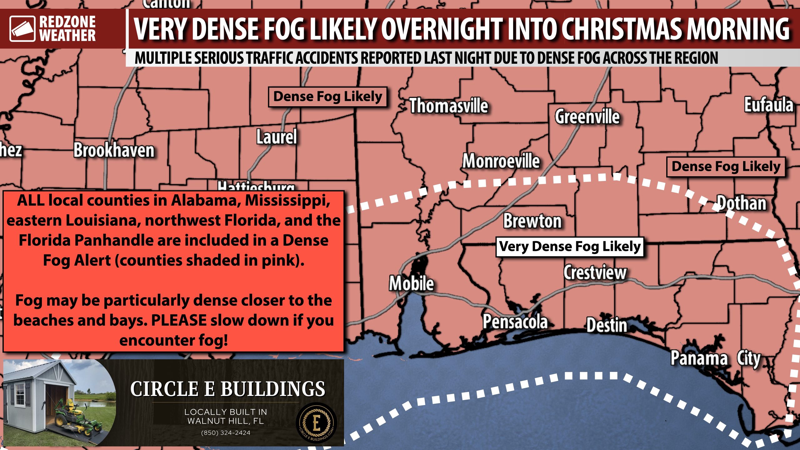
DENSE FOG CAUSED MULTIPLE SERIOUS ACCIDENTS LAST NIGHT; VERY DENSE FOG TONIGHT… Every county within 100 miles of south Alabama and northwest Florida is involved in a Dense Fog Alert overnight into Christmas Day morning. Dense fog will quickly become an issue later this evening in many communities across the region. If you have travel plans this evening, overnight, or into Christmas Day morning through 9-10AM, **please** slow down if you encounter foggy conditions. Fog will probably be the most dense between 3AM and 8AM. The greatest concern zone is south of US84 in places like Mobile, Daphne, Orange Beach, Foley, Pensacola, Atmore, Brewton, Andlausia, Opp, Florala, Milton, Pace, Jay, Walnut Hill, Century, Baker, Crestview, Niceville, Destin, Fort Walton Beach, Geneva, Panama City, Ponce De Leon, Port St. Joe, and Marianna.
TRAVEL CONCERNS OVERNIGHT INTO CHRISTMAS MORNING DUE TO FOG… I spoke with an official with one of the local sheriff’s offices who indicated multiple traffic accidents happened last evening due to the dense fog, including a few accidents with very serious injuries. According to eyewitness reports last night on the scene, at least two fatalities happened in one of the accidents. This underscores the seriousness of the situation when dealing with dense fog, particularly tonight into tomorrow morning with a lot of folks traveling across the region. Please take it slow and plan a little extra time in the schedule if you’ll be traveling later tonight or tomorrow morning!
CHRISTMAS DAY FORECAST… Afternoon highs will be in the upper 70s tomorrow with plenty of sunshine in the late morning, afternoon, and early evening hours. Fog will be a concern tomorrow morning before burning off in the 9-10AM hour.
MILD TEMPS FOR FRIDAY AND THE WEEKEND… Fog will be a concern each morning through Sunday morning. Mostly sunny skies are expected Friday, Saturday, and Sunday with afternoon highs in the mid 70s. Morning lows will be in the upper 50s in most communities.
COLD FRONT APPROACHES SUNDAY NIGHT; COLD START TO NEXT WEEK… Sunday will be a mild day but cold temperatures return Sunday night into Monday. Afternoon highs on Monday will only be in the upper 40s and low 50s. We’ll be near or just below the freezing mark by Tuesday morning. High temperatures on Tuesday will be in the 40s. Milder temperatures return by late next week.
APP… If you haven’t already downloaded the RedZone Weather app, now is a great time to do that. redzoneweather.com/app is the link to the free download. Once you have the RZW app installed on your iOS or Android device, be sure to visit the Alerts tab to turn on the specific notifications you’d like to receive. All notifications are handcrafted by me. No automation and we promise not to bug you!
I will have the latest forecast rundown posted in the morning forecast video tomorrow morning at 7:15AM.
Have a great Christmas Eve!


