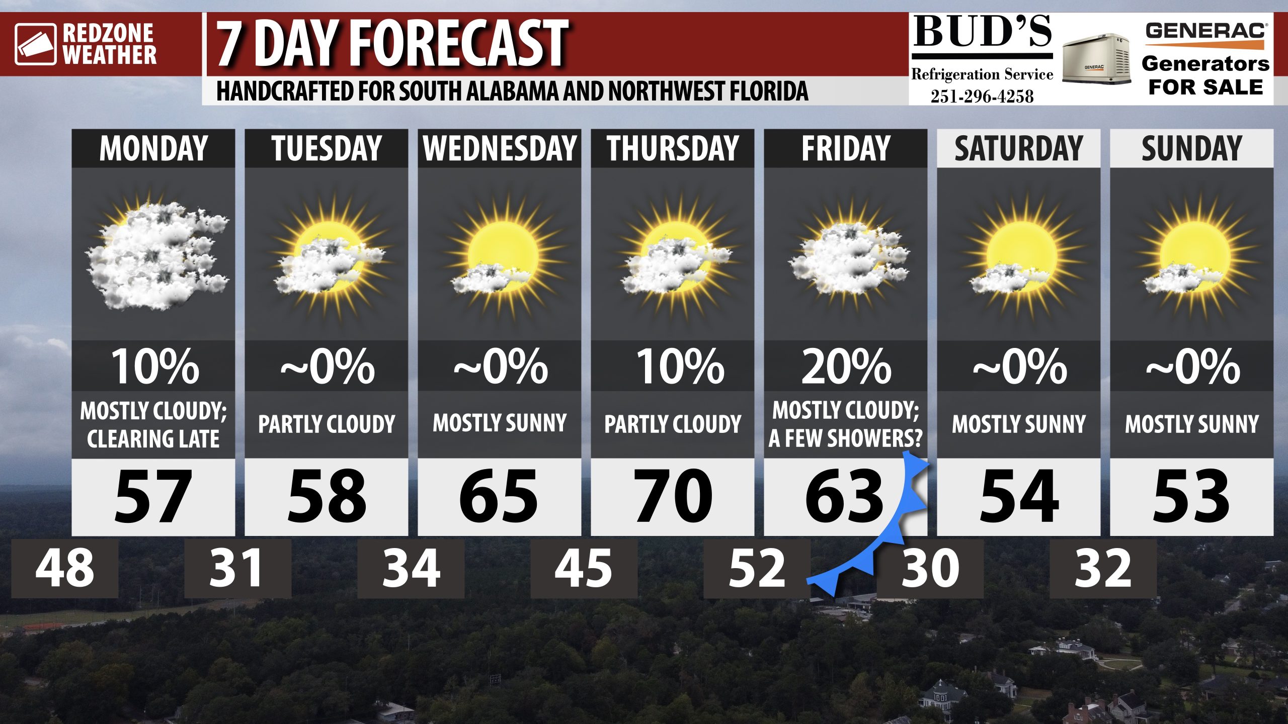
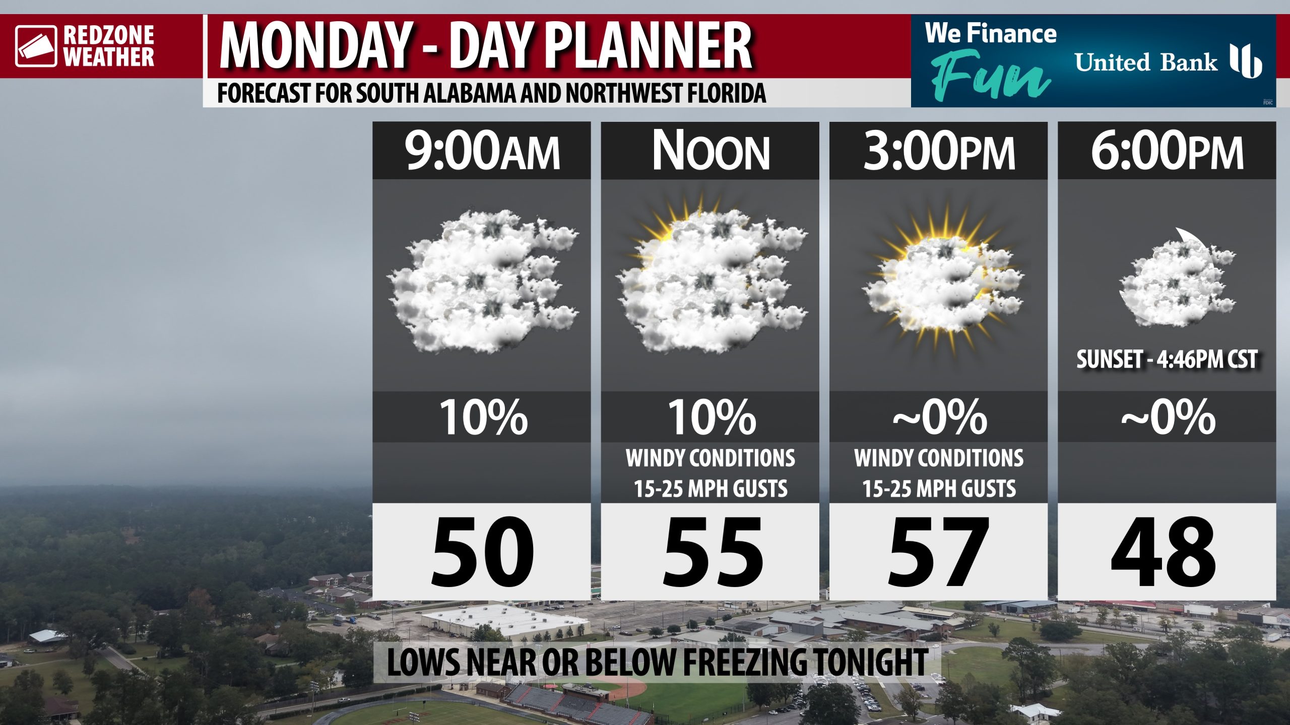
WINDY, COOL MONDAY; TEMPS NEAR & BELOW FREEZING TONIGHT… Lingering sprinkles and showers will rapidly move to the east of our local area over the next several hours as we trend toward a drier pattern this week. Afternoon temperatures will be in the 50s for the most part today with the exception of the immediate coast where temperatures in the low 60s will be possible. Wind gusts of 15-25 mph will be possible throughout the day, particularly this afternoon into this evening. Winds will be out of the northwest behind the cold front advancing across our local area. This cold front will usher in a cold, dry air mass that will allow temperatures to be near or just below the freezing mark tonight.
FREEZING TEMPERATURES INLAND TONIGHT… Overnight lows will be at or just below the freezing mark in communities north of Interstate 10 tonight. Some communities north of US84 (like Thomasville, Beatrice, Forest Home, and Greenville) will be in the upper 20s by 6AM Tuesday. Tonight will be the coldest night this week, most likely.
COOL TEMPS TOMORROW; SLIGHTLY WARMER WEDNESDAY & THURSDAY… High temperatures will again be in the mid 50s tomorrow after a cold start to the day. Overnight lows Tuesday night into early Wednesday morning will be in the low 30s. We rebound into the low 60s for afternoon highs on Wednesday. Highs will approach the 70 degree mark on Thursday.
A FEW SHOWERS POSSIBLE FRIDAY… Isolated showers may become possible Thursday evening into Friday morning, although confidence in the forecast in that range remains low. This does not look like a significant rain event, but we may have isolated showers around as a cold front approaches from the northwest.
APP… If you haven’t already downloaded the RedZone Weather app, now is a great time to do that. redzoneweather.com/app is the link to the free download. Once you have the RZW app installed on your iOS or Android device, be sure to visit the Alerts tab to turn on the specific notifications you’d like to receive. All notifications are handcrafted by me. No automation and we promise not to bug you!
See all the details in your Monday morning RedZone Weather forecast video. My next forecast video will be posted by 7:15AM tomorrow morning. I will have updates posted throughout the day, as needed, in the RedZone Weather app.
Have a great start to your week!