8:35PM January 22, 2026
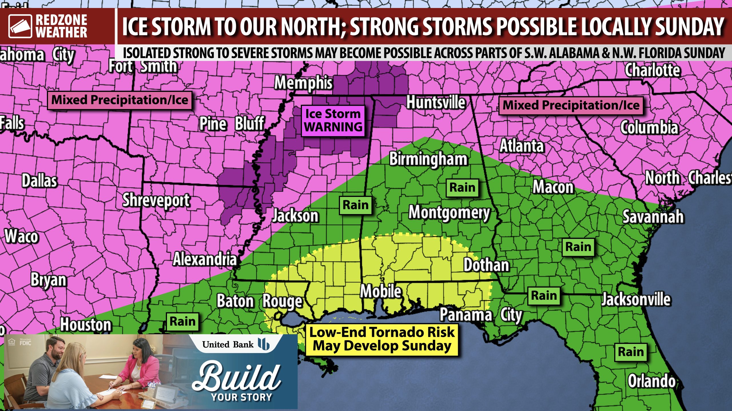
MAJOR WINTER STORM ISSUES EXPECTED TO OUR NORTH; STRONG STORMS POSSIBLE SUNDAY LOCALLY… Significant, long-lasting winter weather impacts are expected across parts of north Mississippi, north Alabama, Tennessee, Georgia, and surrounding states over the next 3-4 days as a major winter storm moves east across the region. Thankfully, our local area in south Alabama will remain in the warm sector, likely preventing any significant ice issues locally. We’re seeing indications that a low-end risk of a few isolated severe storms may happen on Sunday ahead of an advancing cold front.
SEVERE WEATHER TIMING – SUNDAY… 8AM to 6PM Sunday will be the window for the low-end severe weather risk on Sunday, January 25, 2026 across south Alabama and northwest Florida. The concern will be gusty winds in the strongest of the storms and perhaps a tornado or two. Very cold, drier air arrives Sunday night. Wind chill values will be in the 10s by Monday morning at 6AM.
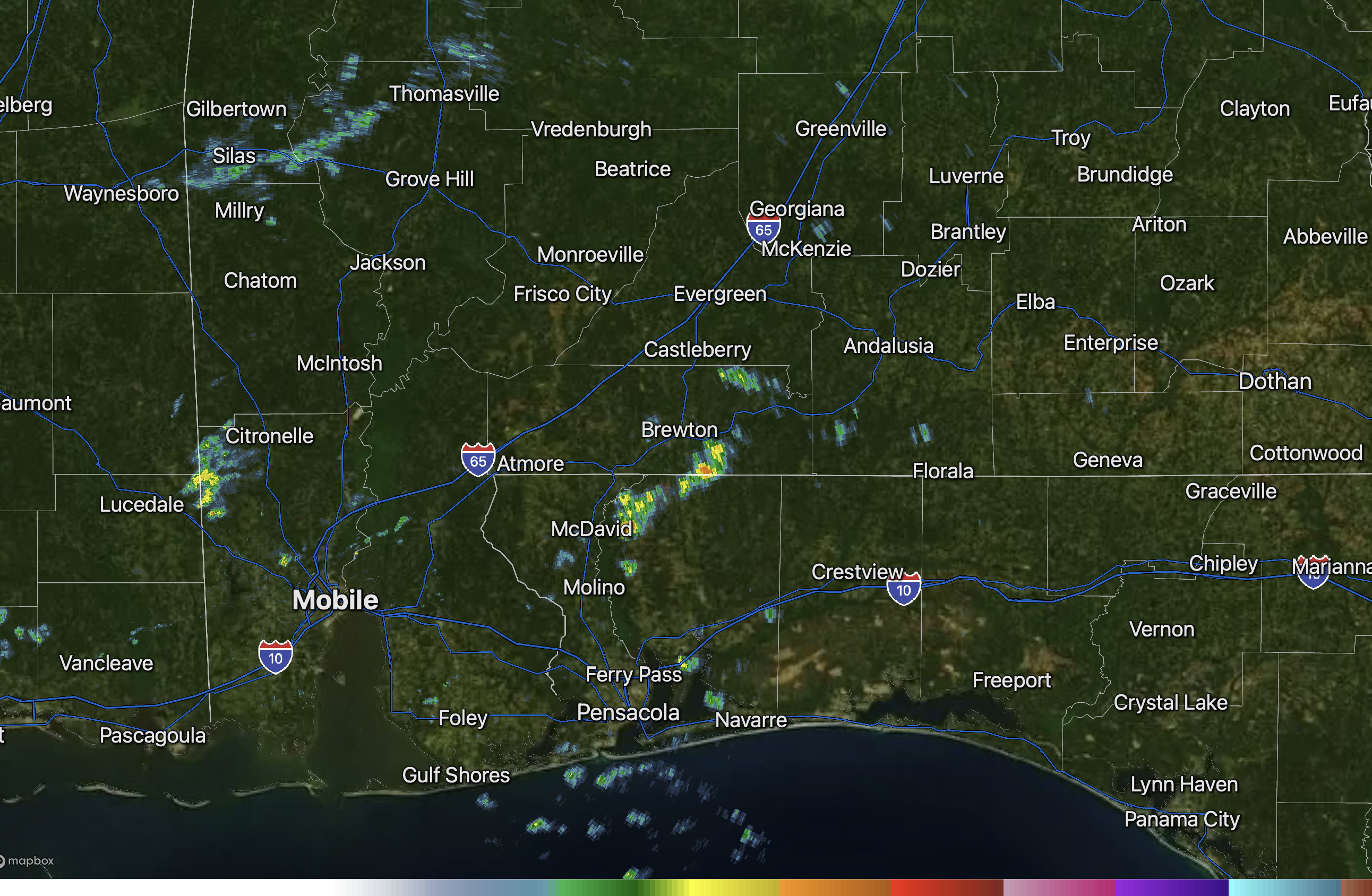
WHAT TO EXPECT – TOMORROW AND SATURDAY… Spotty rain showers will be possible across the region tomorrow and into Saturday. I expect showers to remain widely spaced tomorrow and during the daytime hours on Saturday. The more significant rain will start Saturday night and last into Sunday. Rain amounts of 1-2″ (in total) will be likely across a large chunk of the region. Afternoon high temperatures tomorrow and Saturday will be in the upper 60s.
ICE STORM WARNING FOR PARTS OF NORTH ALABAMA… Significant and long-lasting icing is expected across parts of north Alabama through the weekend. This likelihood has prompted the National Weather Service in Huntsville to issue a rare Ice Storm Warning for Lauderdale, Colbert, and Franklin counties in northwest Alabama. This includes places like Tuscumbia, Florence, Muscle Shoals, Sheffield, Red Bay, and Russellville. Total snow and sleet accumulations up to one inch and ice accumulations between one quarter of an inch to one inch are likely. The language from NWS Huntsville is very concerning: “Roads, and especially bridges and overpasses, will likely become slick and hazardous. Significant ice accumulation on power lines and tree limbs may cause widespread and long-lasting power outages. Expect power outages that last more than a day and extensive tree damage due to the ice. Travel could be impossible. Significant cold weather is expected after this winter weather, so any power outages may result in dangerous indoor temperatures.”
APP… If you haven’t already downloaded the RedZone Weather app, now is a great time to do that. redzoneweather.com/app is the link to the free download. Once you have the RZW app installed on your iOS or Android device, be sure to visit the Alerts tab to turn on the specific notifications you’d like to receive. All notifications are handcrafted by me. No automation and we promise not to bug you!
I will have the next regularly scheduled RedZone Weather forecast video posted by 7:15AM tomorrow morning. Please let me know if you have specific questions. Have a great Thursday evening!