11:00AM January 10, 2026

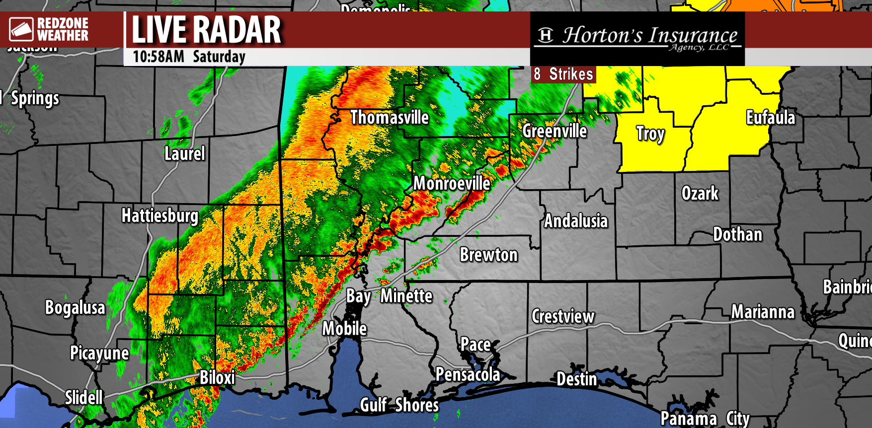
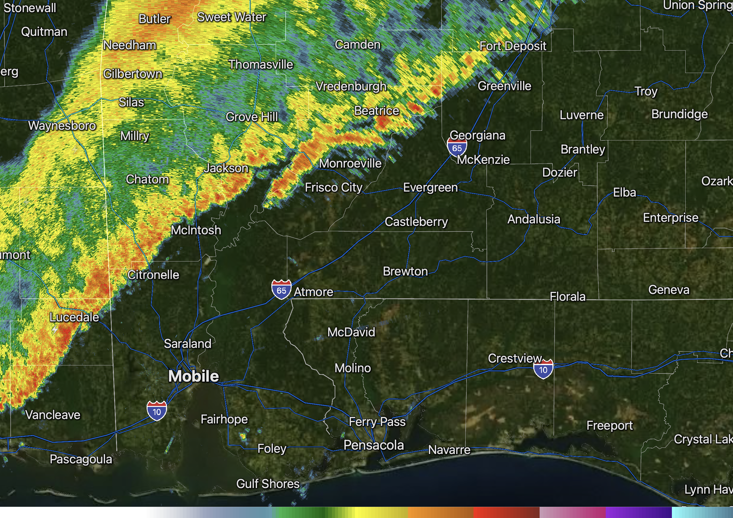
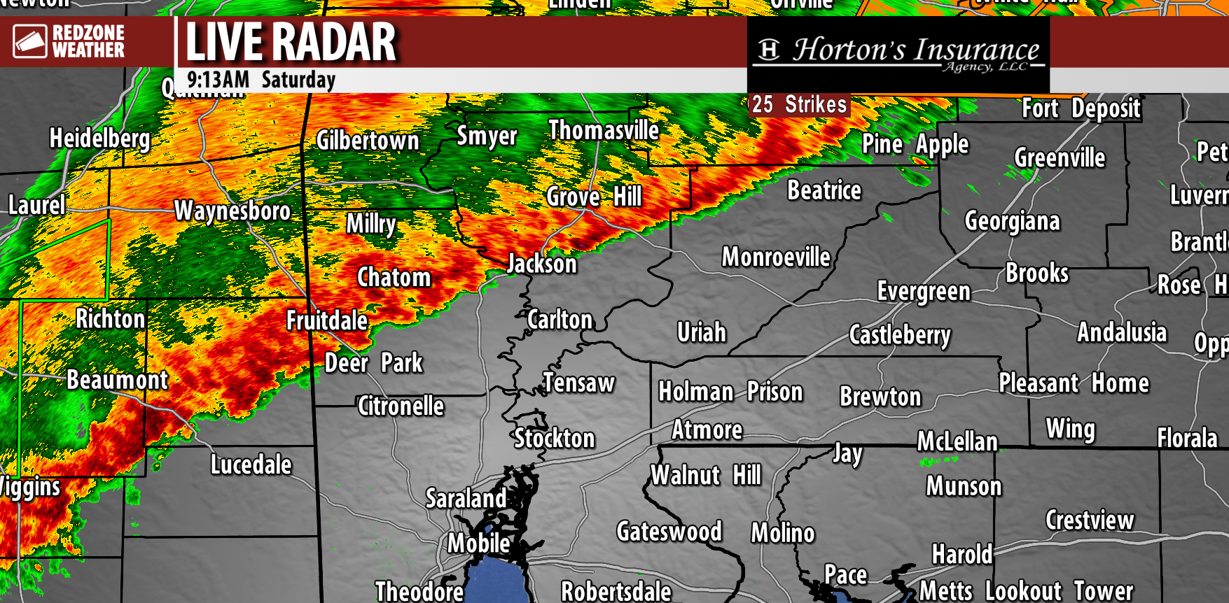
RAIN & STORMS SLOWLY MOVING EAST… Scattered thunderstorms continue to slowly advance eastward on this Saturday. Heavy rain is happening near Burnt Corn, Nichburg, Belleville, Repton, Megargal, Excel, Chrysler, Blacksher, Chastang, Mauvilla, and Tanner Williams.

Rain begins soon near places like Georgiana, McKenzie, Evergreen, Owassa, Lenox, Range, Bay Minette, Atmore, Huxford, Uriah, Satsuma, Saraland, Creola, and West Mobile.

10:57AM January 10, 2026

✅ ALL CLEAR FOR CLARKE, WASHINGTON, AND WILCOX COUNTIES… All clear for all parts of Clarke, Washington, and Wilcox counties as of 10:57AM CDT January 10, 2026. The severe weather risk has ended in all parts of these counties today. The severe weather risk continues for areas to the southeast.

Rain will continue to be possible at times over the next few hours.

Clarke, Washington, and Wilcox counties join Choctaw, Marengo, and Dallas counties that previously received the all clear message earlier.

10:07AM January 10, 2026

RAIN MOVING EAST; LOW-END SEVERE WEATHER RISK… The overall risk of severe weather across south Alabama and northwest Florida is now lower. This is due to the greater shear values rapidly moving away from our area to the north. We’re still tracking a line of thunderstorms that extends from Forest Home to Citronelle, currently bringing heavy rain to parts of Washington, Clarke, Monroe, Wilcox, and Butler counties.

This line of storms is expected to break up a bit and become scattered showers and thunderstorms. The severe weather risk does not drop to zero until after this line of storms moves through your location, although the risk IS lower now than it was earlier this morning.

A Tornado Warning was posted earlier for parts of Autauga and Elmore counties in central Alabama. Several damage reports have come into the National Weather Service office in Birmingham, indicating either a tornado or damaging wind gusts happened near Wetumpka. That same storm is likely producing damaging wind gusts in east Alabama now. Auburn and Opelika in Lee County are under a Severe Thunderstorm Warning at the time I am writing this at 10:03AM.

Scattered showers and storms will be likely through this afternoon. I will have more updates posted in the RedZone Weather app with the latest info over the next few hours. IF we happen to have a tornado warning locally, we will “go live” to bring you the latest.

9:52AM January 10, 2026

✅ ALL CLEAR FOR CHOCTAW, MARENGO, AND DALLAS COUNTIES… All clear for all parts of Choctaw, Marengo, and Dallas counties as of 9:52AM CDT January 10, 2026. The severe weather risk has ended in all parts of these counties today. The severe weather risk continues for areas to the southeast.

Rain will continue to be possible at times over the next few hours.

9:17AM January 10, 2026

STORMS SLOWLY MOVING EAST… Rain and storms are slowly moving east in parts of Monroe, Clarke, and Washington counties as of 9:17AM.

Rain likely soon near Beatrice, Tunnel Springs, Peterman, Monroeville, Mexia, Perdue Hill, Eliska, Carlton, Gosport, McIntosh, Sunflower, Deer Park, and Citronelle.

The line of storms is far under severe limits, for now, across southwest Alabama.

Odds are we see even more weakening with the line of storms, overall. Can’t completely rule out a pop-up severe storm over the next few hours as a slow eastward progression continues. I expect most spots across south Alabama and northwest Florida to simply have rain and thunder.

9:03AM January 10, 2026