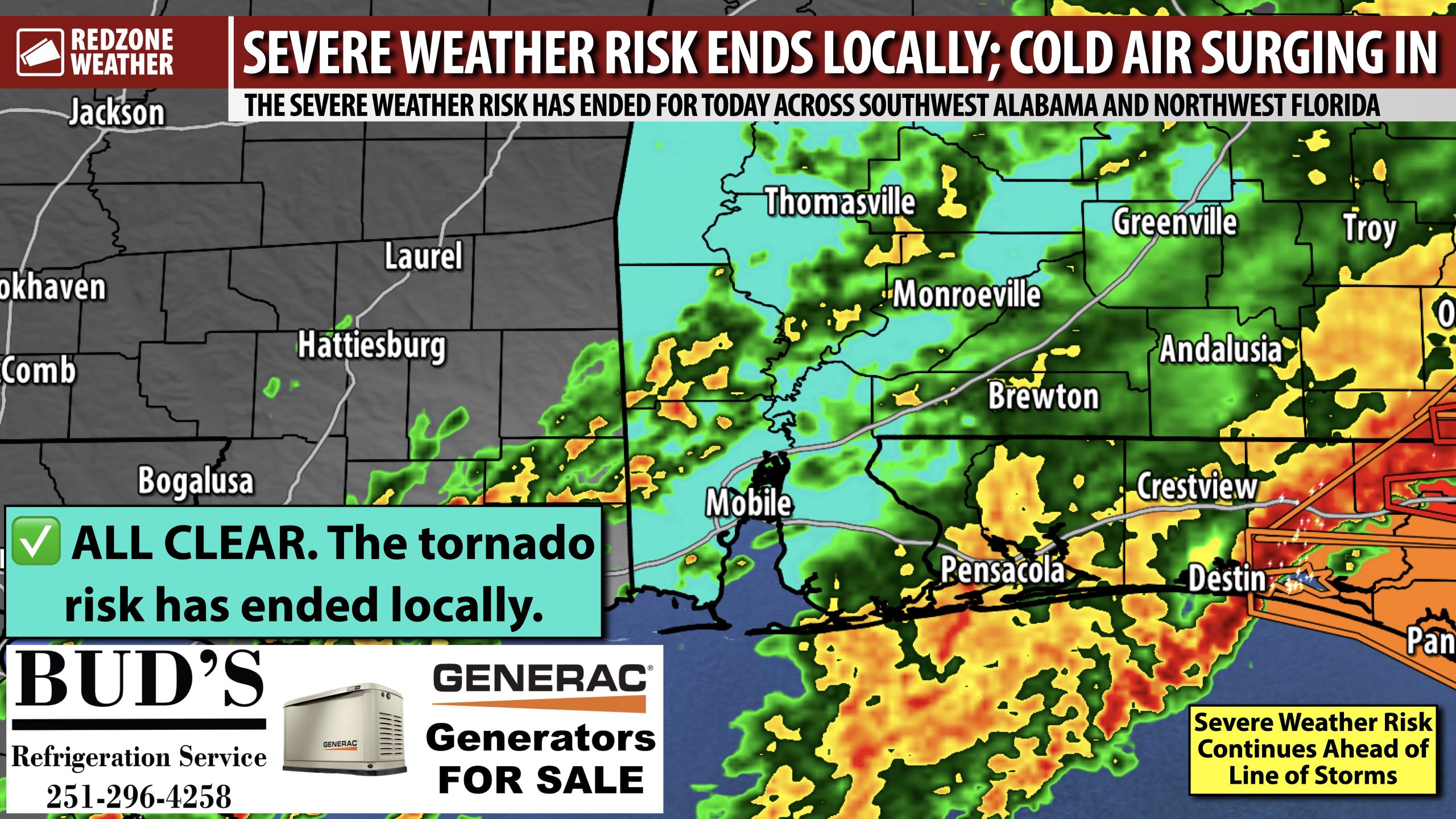
ALL CLEAR FOR S.W. ALABAMA & N.W. FLORIDA; STORM DAMAGE REPORTED… The severe weather risk has officially ended for today (Sunday, January 25, 2026) across southwest Alabama and northwest Florida for areas west of Opp, Crestview, and Destin. Multiple severe thunderstorm warnings and tornado warnings continue as of 2PM across parts of southeast Alabama and the Florida Panhandle region to our east. Rain will continue at times over the next several hours but the risk of tornadoes has ended across our local area.
STORM DAMAGE REPORTED… Several power outages were reported due to tree damage in parts of Clarke and Monroe counties earlier. I received multiple viewer photos of trees down near Excel, AL. So far, at least one tornado has been confirmed. It happened in Walton County, FL (which is just east of our local area) just northwest of DeFuniak Springs. The tornado was likely brief but we know damage happened as debris was lofted into the sky and detected by the local radar. Please let me know if you have had storm damage!
EXTREME COLD WARNING – TONIGHT… The National Weather Service has a rare Extreme Cold Warning in place for ALL local counties across south Alabama and northwest Florida valid from midnight tonight to Noon on Monday. Dangerously low wind chills as low as 10 degrees will be possible tonight into Monday morning. Air temperatures will be in the 10s in many communities by 6AM Monday.
BLACK ICE LESS LIKELY LOCALLY… Due to storms moving through earlier, it looks like the back edge of the rain will likely move to the east of southwest Alabama and northwest Florida this afternoon into the early evening hours. This means that at least 4-6 hours of drying time should exist between when rain/storms depart and when freezing temperatures happen. The cold, dry air will filter in with the blustery conditions behind the advancing cold front. This should help to mitigate the overall potential of black ice across much of the region this evening into tonight. Patchy areas of black ice may be possible in highly isolated areas tomorrow morning, but I do not expect this to be the norm.
NEXT WEEKEND MORE LIKELY TO BE SUNNY & QUIET… Model support for a snow/winter storm event NEXT weekend has collapsed, meaning all of the major global models are now showing sunny, dry weather for the local area. While it is far too early to rule out snow, for sure, it appears model support for a sunny, quiet pattern appears to be increasing. Models basically show the area of low pressure developing about 500 miles to our south and remaining far enough south in the Gulf that no precipitation would happen locally. This is something that will need to be monitored over the next few days as changes will be possible. I would question any “source” that has promoted a snow potential 7-10 days out – a totally irresponsible and unwise thing to do considering it is nearly impossible to forecast snow in the Deep South 3-4 days out, let alone 7-10 days.
APP… If you haven’t already downloaded the RedZone Weather app, now is a great time to do that. redzoneweather.com/app is the link to the free download. Once you have the RZW app installed on your iOS or Android device, be sure to visit the Alerts tab to turn on the specific notifications you’d like to receive. All notifications are handcrafted by me. No automation and we promise not to bug you!
I will have updates posted in the hours ahead in the RedZone Weather app. My next regularly scheduled forecast video will be posted by 7:15AM tomorrow morning.
Have a great Sunday evening!


