SUNNY MONDAY; MILD DAYS, COOL NIGHTS UPCOMING… Sunny, nice weather is expected today and tomorrow across south Alabama and northwest Florida. High temperatures will be upper 60s today. Tonight will be chilly, just like last night. Most locales will dip into the upper 30s inland with temperatures near 40° across a big chunk of the local area. Clear skies are expected overnight. Plenty of sunshine is likely on Tuesday, Wednesday, and Thursday, ahead of our next potential chance of rain on Friday and Saturday.
WARMER TEMPERATURES LATER THIS WEEK… High temperatures will progressively climb into the mid 70s by Wednesday with temperatures near the 80 degree mark by Friday afternoon. Overnight lows will also be increasing each morning to the upper 40s by Thursday morning.
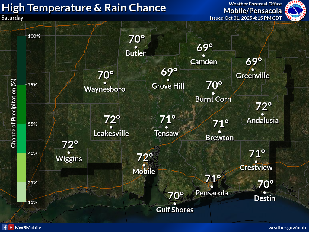
NEXT CHANCE OF RAIN MAY HAPPEN FRIDAY INTO SATURDAY… A frontal boundary slated to cross our region from northwest to southeast will approach on Friday. This feature may cause just enough lift to spark off a few showers and perhaps a few thunderstorms near the coast. I will be closely monitoring model trends over the next several days to see if we see an uptick in rain chances. For now, we’ll call it only a 10% chance of rain on both Friday and Saturday.
TROPICS ARE QUIET… The Gulf, Caribbean, and entire Atlantic Basin are expected to remain quiet this week. I am not expecting any new tropical storms to develop over the next 5-7 days. There is a growing probability we may have had the final named tropical system of the year, although it certainly wouldn’t be completely unprecedented to have a named storm in November. For now, the global models are not suggesting any significant development over the next 7-10 days in the Atlantic Basin. The 2025 Atlantic Hurricane Season will end on Sunday, November 30.
APP… If you haven’t already downloaded the RedZone Weather app, now is a great time to do that. redzoneweather.com/app is the link to the free download. Once you have the RZW app installed on your iOS or Android device, be sure to visit the Alerts tab to turn on the specific notifications you’d like to receive. All notifications are handcrafted by me. No automation and we promise not to bug you!
See all the details in your Monday morning RedZone Weather forecast video. My next forecast video will be posted by 7:15AM tomorrow morning. I will have updates posted throughout the day, as needed, in the RedZone Weather app.
Hope you have a great start to your week!