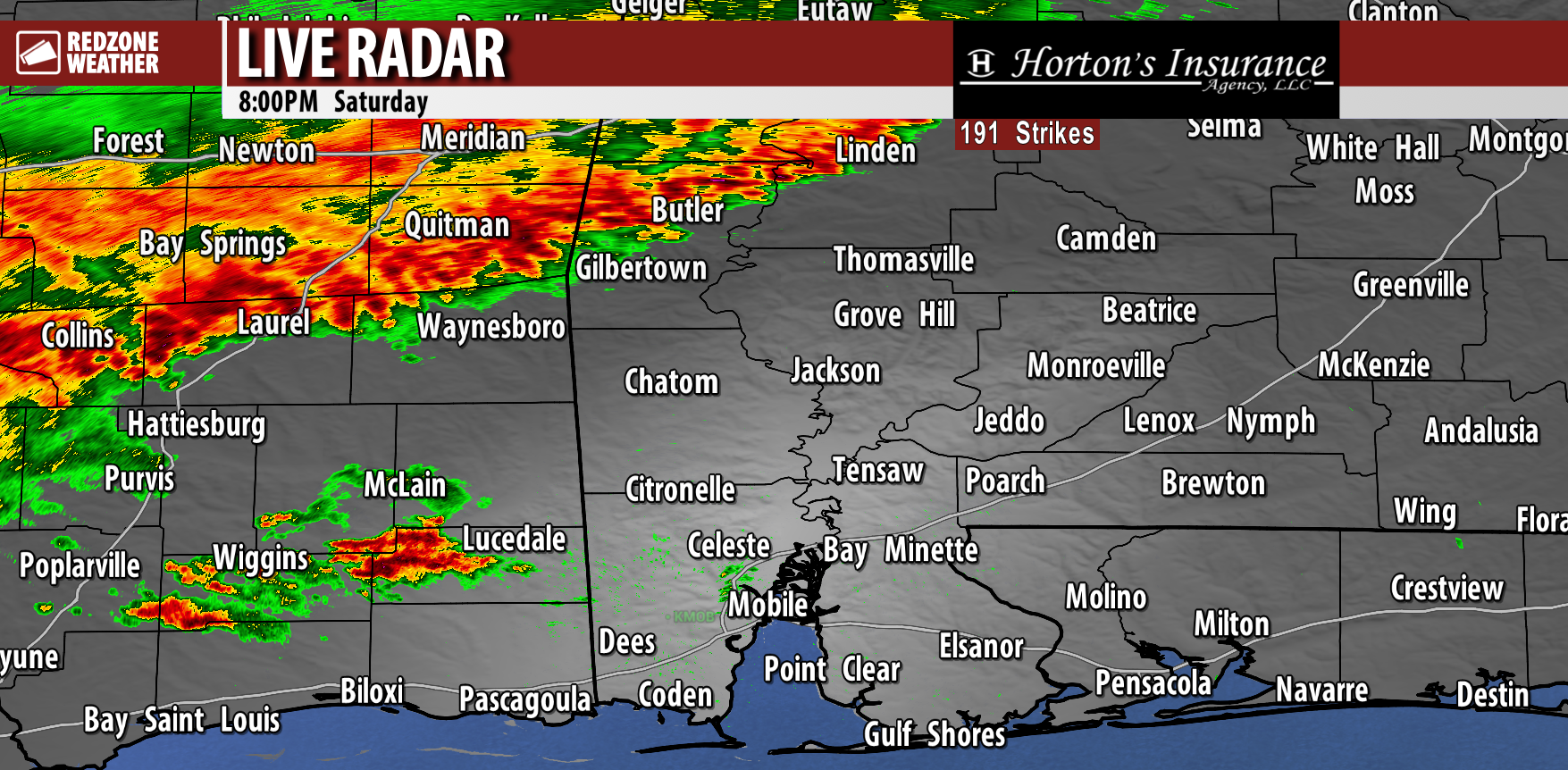
RAIN & STORMS LIKELY AT TIMES OVERNIGHT… Thunderstorms across southeast Mississippi are slowly moving into southwest Alabama this evening. At 8:07PM, a line of thunderstorms extends from near Demopolis, Linden, and Butler in west Alabama southeast to Kentwood (LA) and McComb (MS). This line of thunderstorms will continue to slowly weaken as it moves southeast. Rain will arrive first in Washington and Clarke counties in southwest Alabama around 9-10PM. Rain and storms will progress into Mobile, Baldwin, Monroe, Conecuh, Butler, and Escambia (AL) counties between 10PM-1AM. Showers and storms will move into Covington, Crenshaw, Geneva, Coffee, Escambia (FL), Santa Rosa, Okaloosa, and Walton counties after 1AM, most likely.
Thankfully, widespread severe storms are NOT expected with this event. Gusty (20-30 mph) winds may happen along the leading edge of the storms. Lightning output continues to decrease, but as always with thunderstorm events, cloud-to-ground lightning and loud thunder will be possible.
Quite frankly, this will be more of a beneficial rain event than anything else. This won’t be “drought busting” rain, but it will be helpful. Most spots across south Alabama and northwest Florida will pick up between 0.5″ and 1.5″ of rain in total.
I will have radar updates posted throughout the night, as needed, in the RedZone Weather app. Please remember, I only “go live” when there are actually storms that could be problematic and/or hazardous. When we are not live, I am posting updates in the RZW app and on RedZoneWeather.com.
Have a great night!


