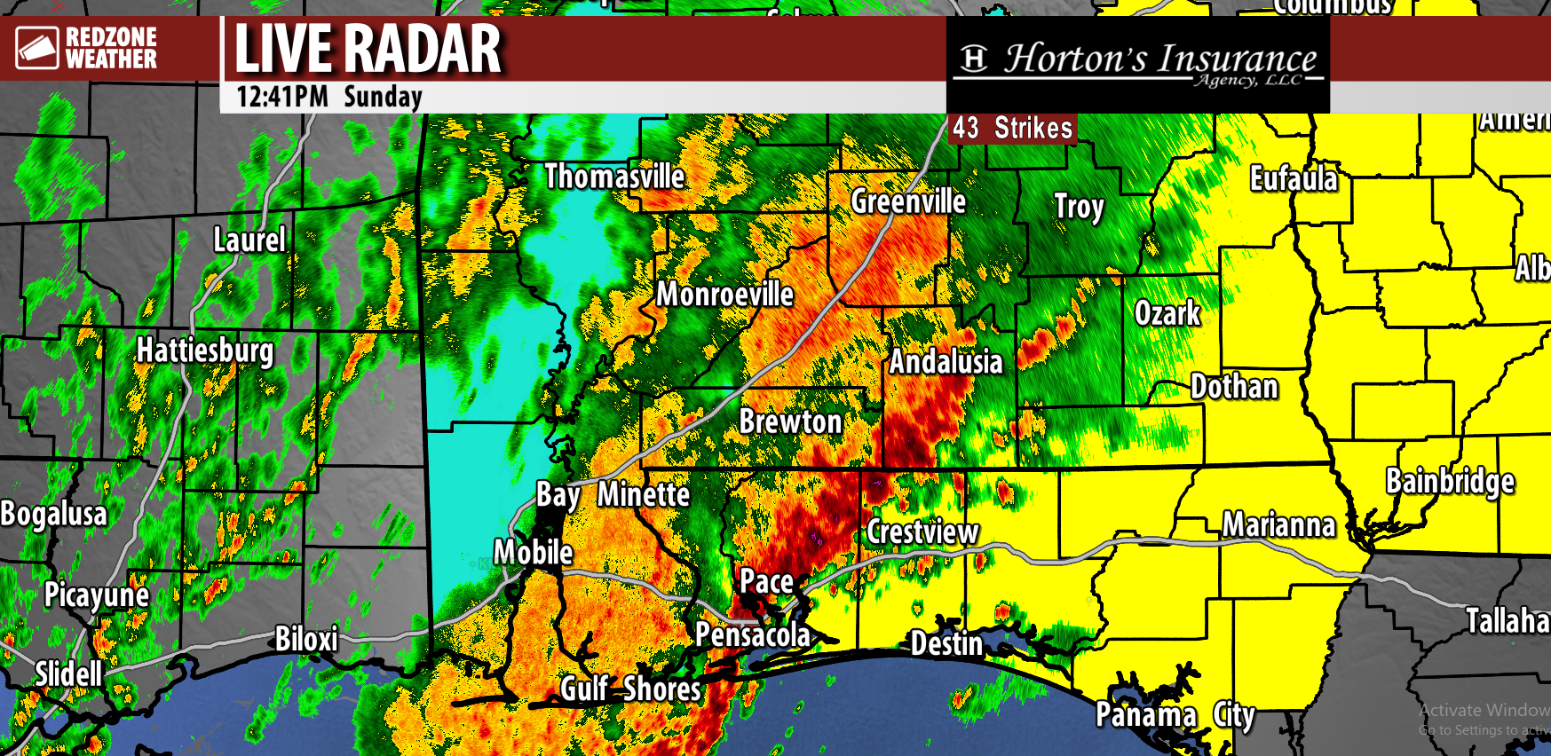
6:12PM September 10, 2025
Clear tonight with lows in the low to mid 60s inland to near 70 along the coast. pic.twitter.com/myo6rm6ASy
— NWS Mobile (@NWSMobile) September 10, 2025
Clear tonight with lows in the low to mid 60s inland to near 70 along the coast. pic.twitter.com/myo6rm6ASy
— NWS Mobile (@NWSMobile) September 10, 2025
We knew the lull in activity probably wouldn't last! The National Hurricane Center has posted a 20% chance of development zone for much of the central Atlantic Ocean due to a tropical wave expected to move off the western coast of Africa later this week. pic.twitter.com/BHimRMM9sd
— Spinks Megginson (@rzweather) September 10, 2025
MOSTLY SUNNY, DRY WEDNESDAY; NICE, DRY WEEKEND COMING UP… If you missed rainfall over the last couple of days (most of us, not all, did), you’re going to have to wait for quite some time for the next opportunity for significant rainfall. South Alabama and northwest Florida have an extended streak of dry weather in store with increasingly warm temperatures as we get into next week. High temperatures on this Wednesday will be in the upper 80s and near the 90 degree mark. Looking ahead, drought conditions will likely worsen. The good news is we have no tropical trouble brewing in the Gulf or Caribbean anytime soon.
NICE WEATHER DAYS AHEAD… Quiet, dry weather is set to continue tomorrow, Friday, and into the upcoming weekend. High temperatures will creep into the low 90s in the days ahead with morning lows in the mid to upper 60s. No rain is expected tomorrow, Friday, Saturday, or Sunday. We should have a full supply of sunshine each day with a limited amount of cloud cover.
DROUGHT CONDITIONS DEVELOPING… The U.S. Drought Monitor already has included much of our local area in their “abnormally dry” category. We’ll get an update tomorrow midday showing the latest drought conditions. I expect much of the region to be upgraded into the Level 1 (out of 4) drought delineation. Unfortunately, I do not see any signs of significant rainfall over the next 10-14 days.
TROPICS QUIET… Today and tomorrow are the peak of the 2025 Atlantic Hurricane Season. Remarkably, the entire Atlantic Basin, including the Gulf and Caribbean, are quiet with no tropical storms expected to form in the next 5-7 days.
APP… If you haven’t already downloaded the RedZone Weather app, now is a great time to do that. redzoneweather.com/app is the link to the free download. Once you have the RZW app installed on your iOS or Android device, be sure to visit the Alerts tab to turn on the specific notifications you’d like to receive. All notifications are handcrafted by me. No automation and we promise not to bug you!
See all the details in your Wednesday morning RedZone Weather forecast video. My next forecast video will be posted by 7:15AM tomorrow morning. I will have updates posted throughout the day, as needed, in the RedZone Weather app.
“Moonlight shining through the trees.”
Mobile, Alabama
September 7, 2025#Moon #ALwx @NWSMobile @JasonSmithWX @spann @rzweather @WKRGEd @AlanSealls @kelly_dubs @WEARAllenStrum @StormHour pic.twitter.com/lMjfpUSPxX— Stephen Simpson 🇺🇦 ProperGander (@BamaStephen) September 10, 2025
Great day at EPIC Prep Academy at their Crestview North and Crestview South locations in Crestview, Florida. Severe weather safety is vital for EVERYONE! pic.twitter.com/lggOLeGsCH
— Spinks Megginson (@rzweather) September 10, 2025