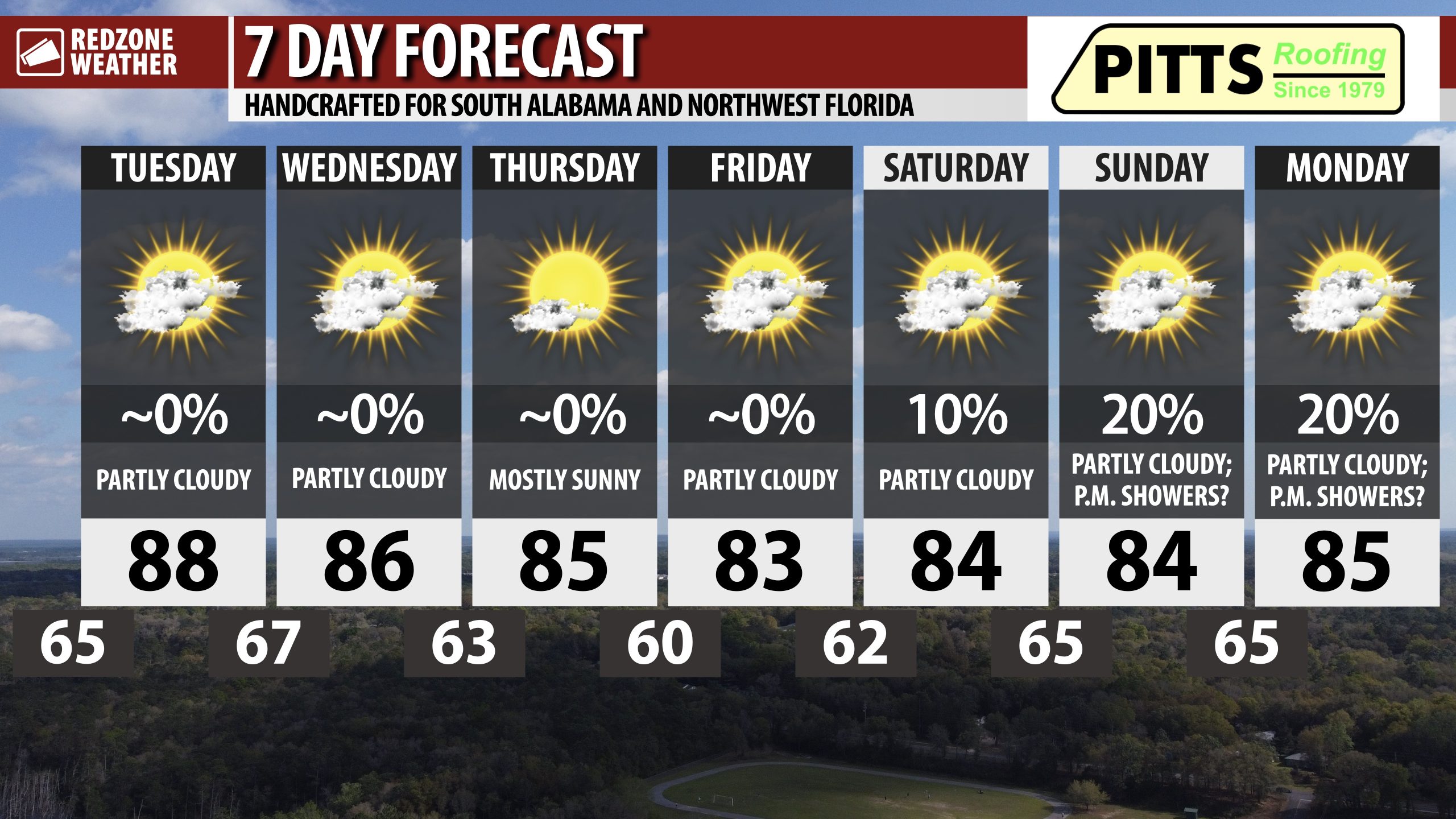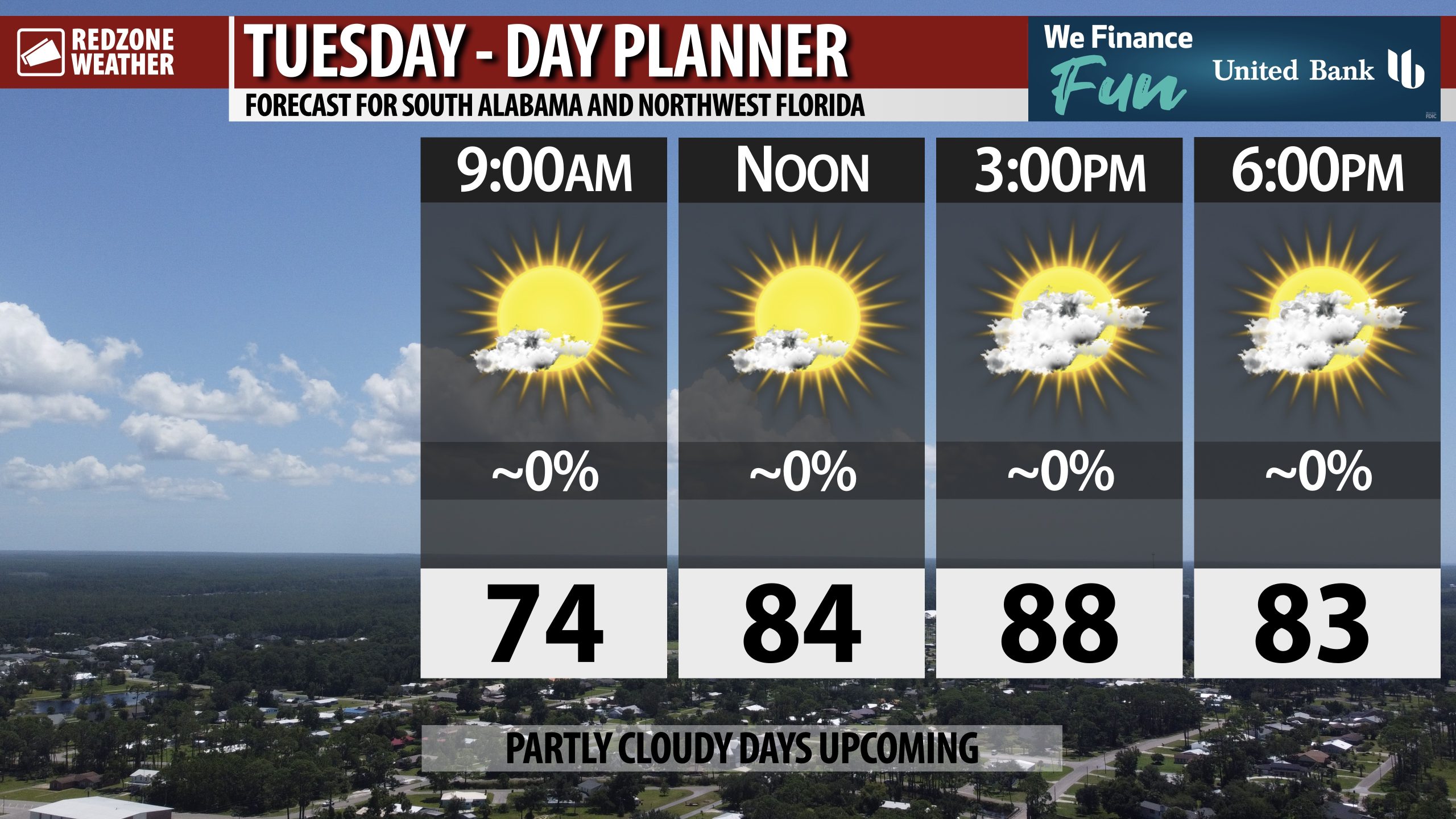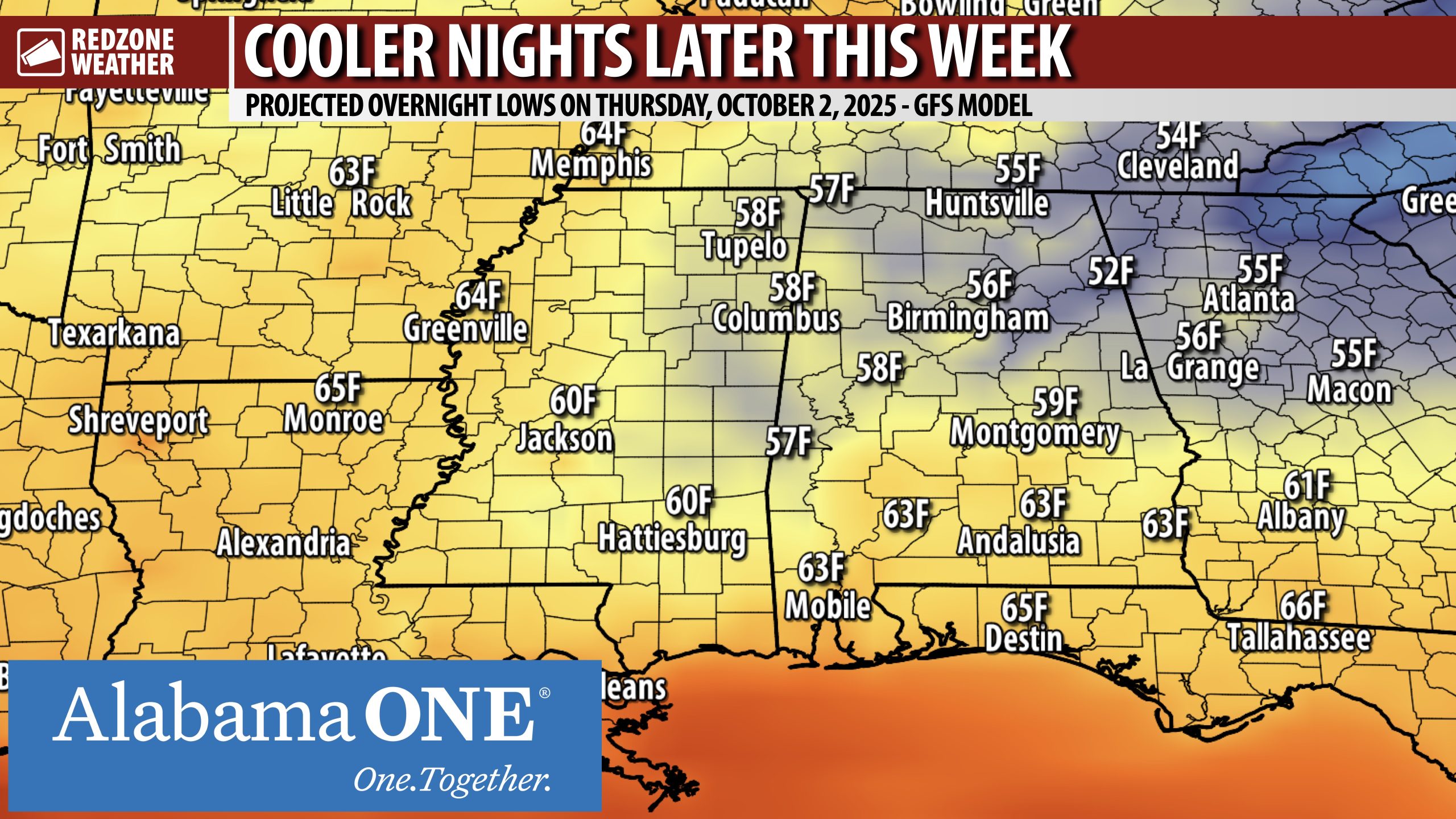
SLIGHTLY COOLER LATER THIS WEEK INTO THE WEEKEND… Overnight lows will be in the upper 50s further inland with 60s likely across much of south Alabama and northwest Florida as we get into the latter part of the week and into the upcoming weekend. The map attached highlights projected overnight lows on Thursday night into early Friday morning. It’s a sign that fall is coming. We usually have a slow progression of cooler temperatures in the fall months and this year will be no exception. Highs will be in the upper 80s tomorrow with low 80s expected for highs later this week.
SHOWERS POSSIBLE AT TIMES THIS WEEKEND INTO EARLY NEXT WEEK… You may see some information suggesting the potential for a tropical storm in the northern Gulf later this week or this weekend. That is because one model (the American-based GFS) has been fairly consistent in showing a Gulf low developing and moving inland this weekend. This would pave the way for scattered showers and storms across our local area, perhaps on Sunday into Monday. We note that other major models, including the ECMWF/Euro, show a less robust system with only isolated showers around this weekend into early next week. That is the solution we will go with in our 7 Day Forecast, for now. We simply need more evidence to be able suggest higher rain chances – and right now, that evidence simply isn’t there. If that changes, I’ll let you know about it in the RedZone Weather app.
APP… If you haven’t already downloaded the RedZone Weather app, now is a great time to do that. redzoneweather.com/app is the link to the free download. Once you have the RZW app installed on your iOS or Android device, be sure to visit the Alerts tab to turn on the specific notifications you’d like to receive. All notifications are handcrafted by me. No automation and we promise not to bug you!
My next forecast video will be posted by 7:15AM tomorrow morning. I will have updates posted throughout the evening, as needed, in the RedZone Weather app.
Have a nice Monday evening!