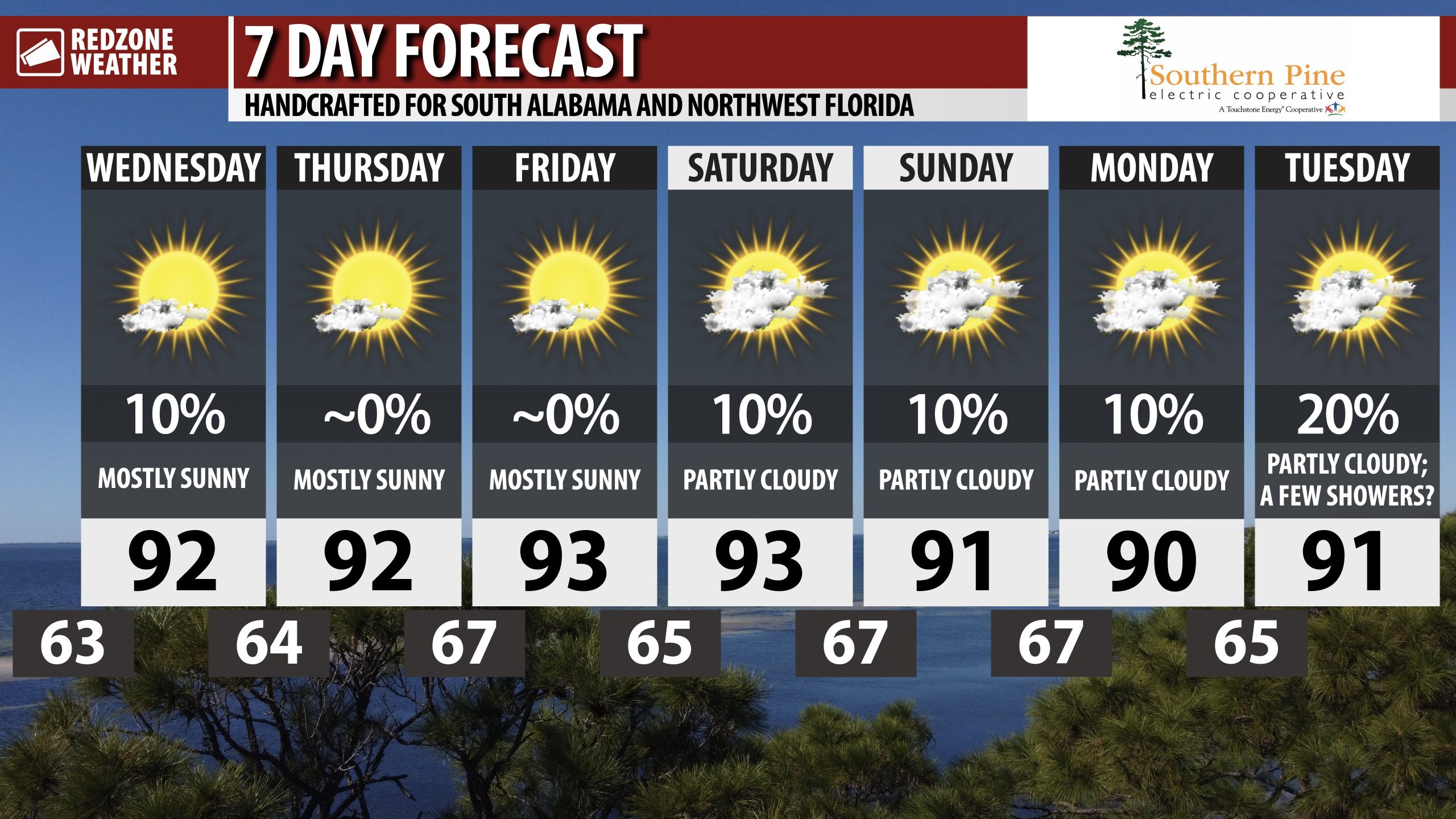
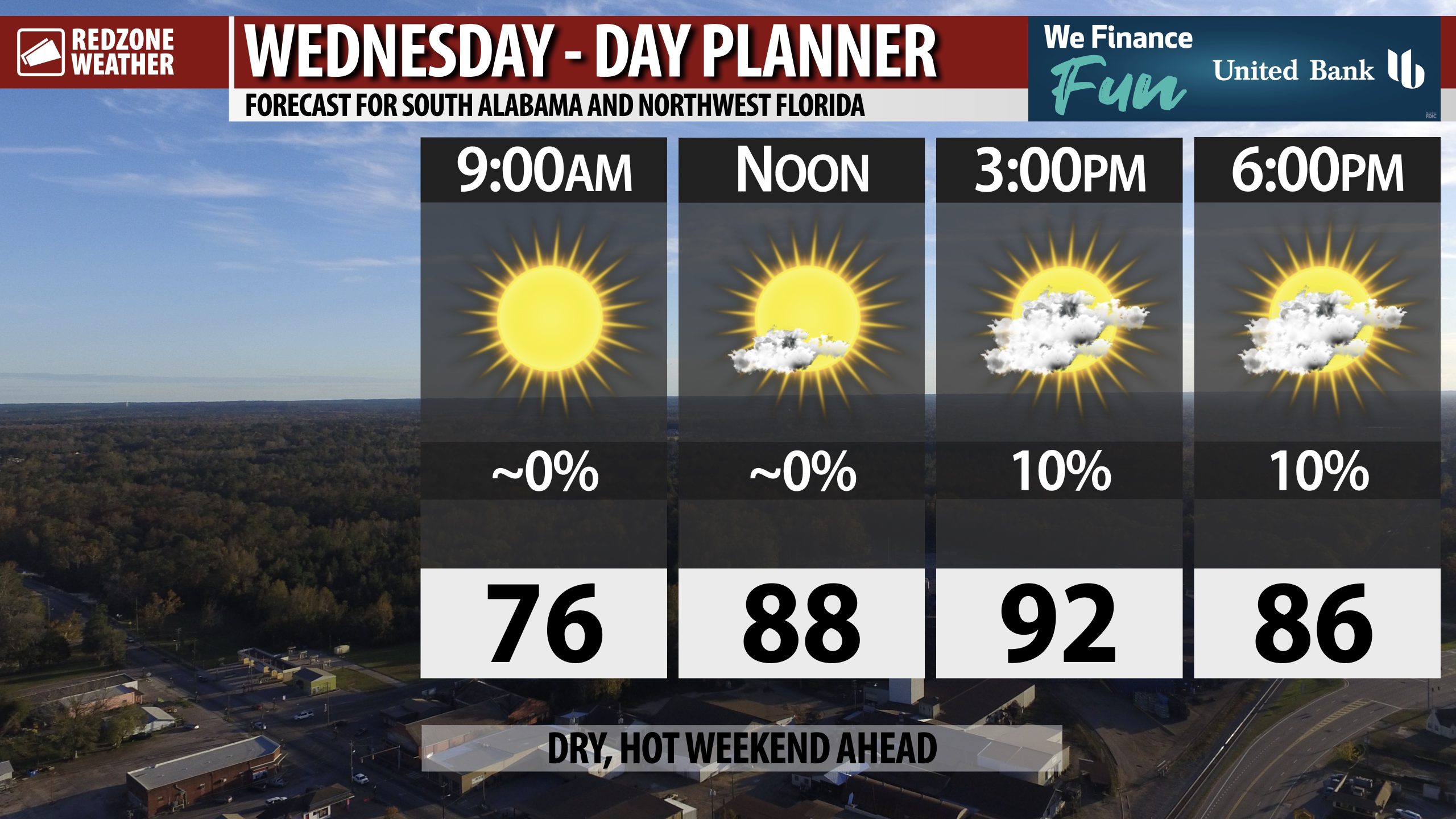
A FEW SPRINKLES INLAND LATER TODAY; SEEING SIGNS OF RAIN BEING POSSIBLE NEXT WEEK… We’re finally beginning to see real evidence in the model guidance that next week could bring some rain and perhaps a few thunderstorms to parts of Alabama and northwest Florida. A lot can and will change between now and then but it’s a sign that the grip of abnormally dry and drought conditions won’t last too much longer. Today, a few sprinkles may happen across interior stretches of south Alabama near the U.S. 84 corridor and points north. Closer to the coast, rain chances are much less. Any sprinkles and showers that happen today won’t amount to much rain, but at this point, any rain is beneficial. Mostly sunny skies are expected this morning with partly cloudy skies this afternoon. High temperatures will be in the low 90s today.
MOSTLY DRY, WARM WEEKEND… The upcoming weekend should be mostly dry with only a low-end (10%) chance of a few afternoon showers. High temperatures this weekend will be in the low to mid 90s with morning lows in the mid 60s.
TROPICS: TWO TROPICAL WAVES IN ATLANTIC… The National Hurricane Center indicates the broad area of thunderstorms associated with a tropical wave about halfway between the Lesser Antilles and the west coast of Africa has a 90% chance of becoming a named tropical storm as the system moves northwest in the days ahead. Model guidance continues to show the system recurving into the north Atlantic. We’re also watching a separate tropical wave just coming off the west coast of Africa that has a 10-20% chance of development in the days ahead. Despite the inactivity and quiet conditions in the Atlantic Basin over the last few weeks, activity like this should be expected this time of year.
TROPICS: GULF & CARIBBEAN REMAIN QUIET… The Gulf and Caribbean Sea are expected to remain quiet over the next 5-7 days with no named tropical storms expected. Great news!
APP… If you haven’t already downloaded the RedZone Weather app, now is a great time to do that. redzoneweather.com/app is the link to the free download. Once you have the RZW app installed on your iOS or Android device, be sure to visit the Alerts tab to turn on the specific notifications you’d like to receive. All notifications are handcrafted by me. No automation and we promise not to bug you!
See all the details in your Wednesday morning RedZone Weather forecast video. My next forecast video will be posted by 7:15AM tomorrow morning. I will have updates posted throughout the day, as needed, in the RedZone Weather app.
Have a good Wednesday!