6:50AM October 20, 2025
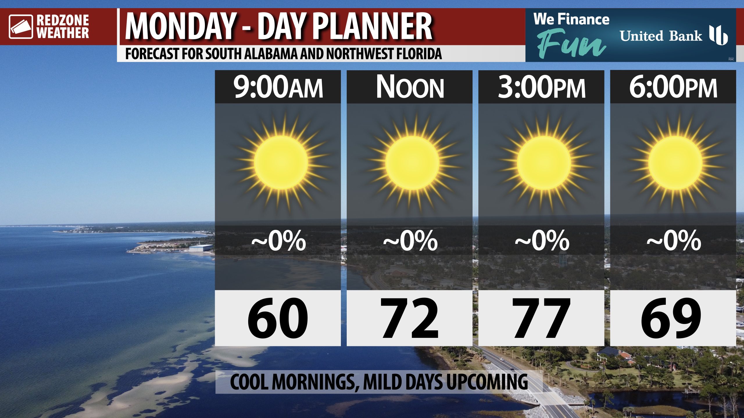
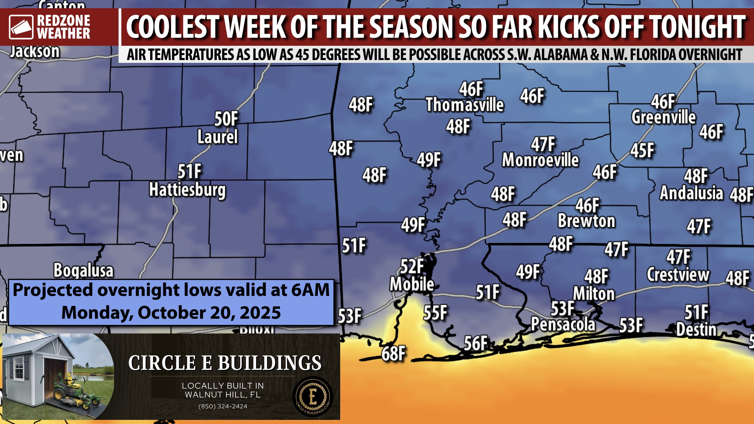
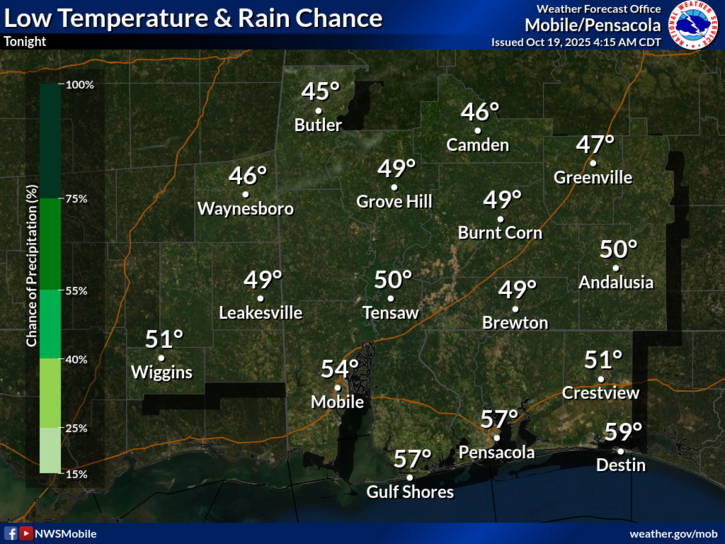
BEAUTIFUL START TO THE WEEK; COOL NIGHTS, MILD DAYS UPCOMING… Our local weather pattern does not get much better for this time of year! Sunny skies are expected across south Alabama and northwest Florida on this Monday with high temperatures set to be in the mid to upper 70s. Temperatures will fall into the 60s after 6PM ahead of overnight lows set to be in the 40s in many spots by 6AM tomorrow morning. Temperatures will warm into the 80s tomorrow ahead of another reinforcing shot of cooler air. Beautiful weather days are ahead with plenty of sunshine tomorrow, Wednesday, and Thursday. Our next chance of rain happens during the upcoming weekend.
COOL TEMPERATURES IN THE MORNING HOURS… Overnight lows will be in the 40s tonight and again on Wednesday night and Thursday night. Afternoon highs will be in the 70s and 80s this week. This will be the coolest week, overall, that our area has had in quite some time.
NEXT LOCAL RAIN CHANCE THIS WEEKEND… Quite similar to what happened this last weekend, a frontal boundary will approach the region during the upcoming weekend. Unlike this last cold front, however, there isn’t a clear cut sign that cooler, drier air will follow. Scattered showers will be possible Saturday night into Sunday. For now, severe weather parameters remain low, but there is a chance we may see an uptick in the chances for severe storms across parts of the Deep South as this event approaches.
TROPICS: TROPICAL WAVE IN CARIBBEAN MAY DEVELOP INTO TROPICAL STORM… The National Hurricane Center continues to indicate a tropical wave that is currently located near the Lesser Antilles has a high chance of becoming a named tropical storm over the next few days as the system moves over the warm waters of the eastern Caribbean Sea. Long range model guidance has been inconsistent in suggesting a future track for the system with some models showing movement abruptly to the northeast toward Puerto Rico while other models show movement to the west toward Central America. Next tropical name is Melissa if/when this system becomes a named tropical storm.
TROPICS: GULF REMAINS QUIET… No tropical storms are expected to develop in the Gulf over the next 5-7 days. The 2025 Atlantic Hurricane Season will officially end on Sunday, November 30.
APP… If you haven’t already downloaded the RedZone Weather app, now is a great time to do that. redzoneweather.com/app is the link to the free download. Once you have the RZW app installed on your iOS or Android device, be sure to visit the Alerts tab to turn on the specific notifications you’d like to receive. All notifications are handcrafted by me. No automation and we promise not to bug you!
See all the details in your Monday morning RedZone Weather forecast video. My next forecast video will be posted by 7:15AM tomorrow morning. I will have updates posted throughout the day, as needed, in the RedZone Weather app.
Hope you have a great start to your week!