12:06PM November 22, 2025
Cloudy, dreary day across much of south Alabama and northwest Florida on this Saturday. Temperatures are in the 70s just after 12 Noon. pic.twitter.com/LiEWyeivFH
— Spinks Megginson (@rzweather) November 22, 2025

Cloudy, dreary day across much of south Alabama and northwest Florida on this Saturday. Temperatures are in the 70s just after 12 Noon. pic.twitter.com/LiEWyeivFH
— Spinks Megginson (@rzweather) November 22, 2025
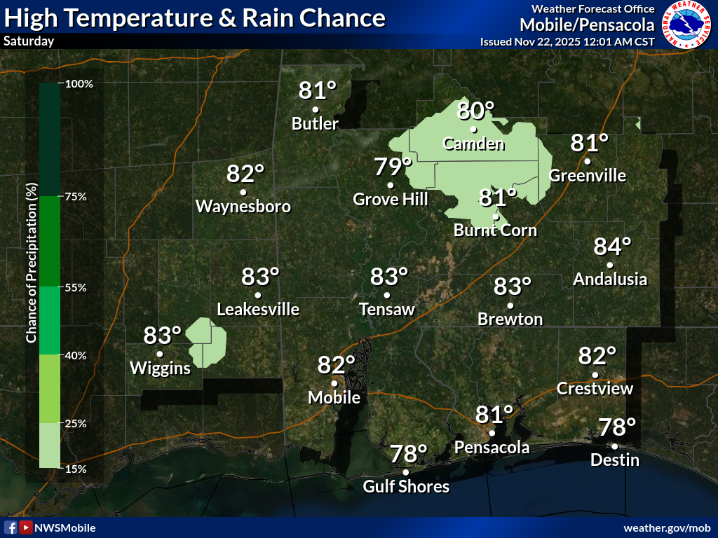
WARM TEMPERATURES TODAY… Fog is quite dense in spots this morning. Take it slow if driving.
Isolated showers will be possible on this Saturday. Most communities will remain dry.
High temperatures will be in the low 80s today.
Have a great Saturday!

Dense fog will likely affect the entire area tonight through late morning for land and adjacent AL marine waters. Visibility may be reduced to a quarter mile at times. Super fog reducing visibility to near zero is possible near Holt, FL & Claiborne, AL tonight. pic.twitter.com/xDgAEsUZNm
— NWS Mobile (@NWSMobile) November 22, 2025

All of southwest Alabama and northwest Florida are involved in a Dense Fog Advisory through 9AM tomorrow morning.
Fog will be quite dense overnight in most locales. pic.twitter.com/lDz8go4RW4
— Spinks Megginson (@rzweather) November 22, 2025

Thunderstorms near the Tombigbee River near Choctaw and Marengo counties in west Alabama continue to move east. Heavy downpours likely shortly near Nanafalia, Aimwell, and Sweet Water. pic.twitter.com/KPJlksM4Mk
— Spinks Megginson (@rzweather) November 22, 2025

Showers and storms in west Alabama, specifically in parts of Choctaw County, continue to be under severe limits.
Odds of any severe weather issues locally today will continue to drop now that sunset has happened. pic.twitter.com/20ScyJXRTC
— Spinks Megginson (@rzweather) November 21, 2025

Heads up for folks near Butler, Alabama in Choctaw County. The storm moving in from the west has exhibited signs of broad rotation. No tornado warning as of 4:50PM CST but a warning could be needed soon if this storm keeps strengthening. Folks near Nanafalia and Sweet Water… pic.twitter.com/UkWRwW3yer
— Spinks Megginson (@rzweather) November 21, 2025
