6:28AM November 21, 2025
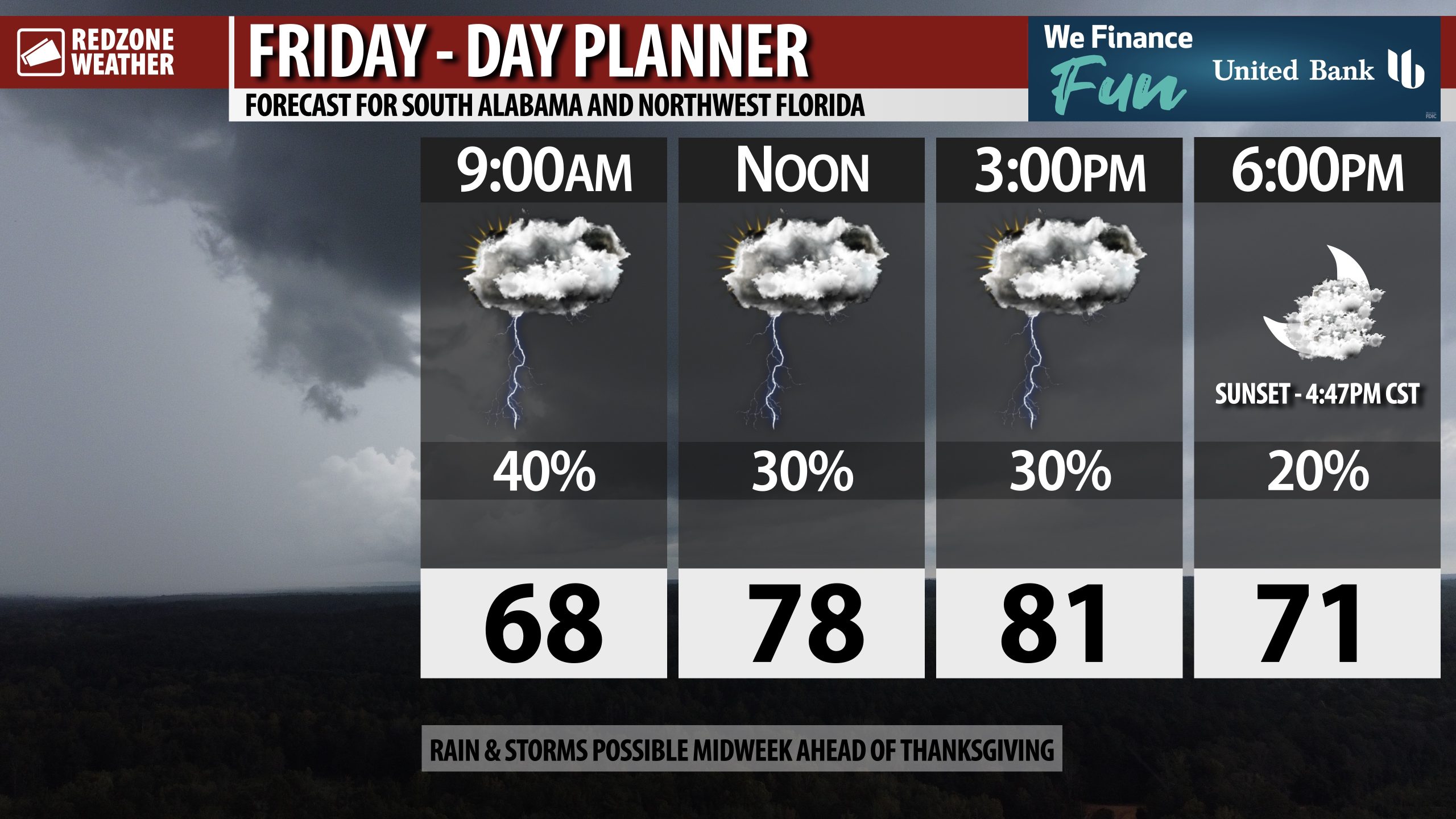
RAIN POSSIBLE AT TIMES TODAY… Scattered showers and thunderstorms will be possible at times over the next several hours. Rain chances are a bit higher across inland areas of southwest Alabama.
High temperatures will again be in the low 80s today.
Have a great Friday and a nice weekend!


