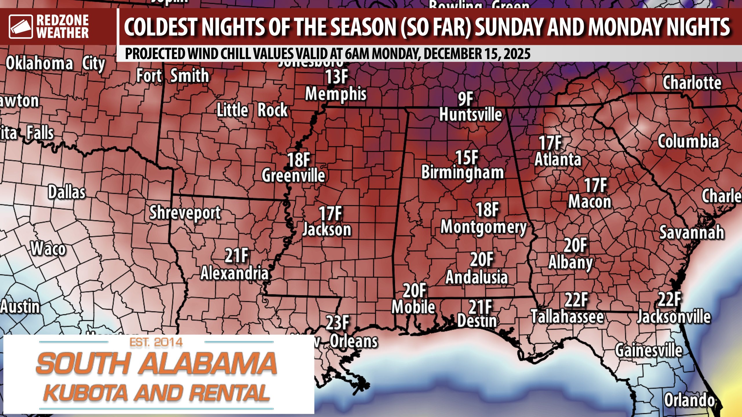
TWO VERY COLD NIGHTS TO HAPPEN SUNDAY NIGHT AND MONDAY NIGHT… Temperatures as low as 20 degrees with wind chill values in the upper 10s are expected Sunday night and Monday as the coldest air of the season arrives from the north. Interestingly, this will be a quick-hitting cold blast that will not last long at all. High temperatures tomorrow (Friday) and Saturday will be near the 70 degree mark. We’ll be in the 40s for afternoon highs by Monday with 60s likely again by Wednesday. While it won’t be a long duration cold event, air temperatures will dip into hard freeze territory on both Sunday night/early Monday morning and on Monday night/early Tuesday morning. The attached map highlights projected wind chill values at 6AM Monday morning.
Friday is going to be a gorgeous day with plenty of sunshine. High temperatures will be in the 70s tomorrow. I will have your fully updated morning forecast video posted by 7:15AM tomorrow morning.
Have a nice Thursday evening!
