4:20PM January 14, 2026
Freezing temperatures return to the area tonight, pic.twitter.com/wdt7FWBONO
— NWS Mobile (@NWSMobile) January 14, 2026

Freezing temperatures return to the area tonight, pic.twitter.com/wdt7FWBONO
— NWS Mobile (@NWSMobile) January 14, 2026
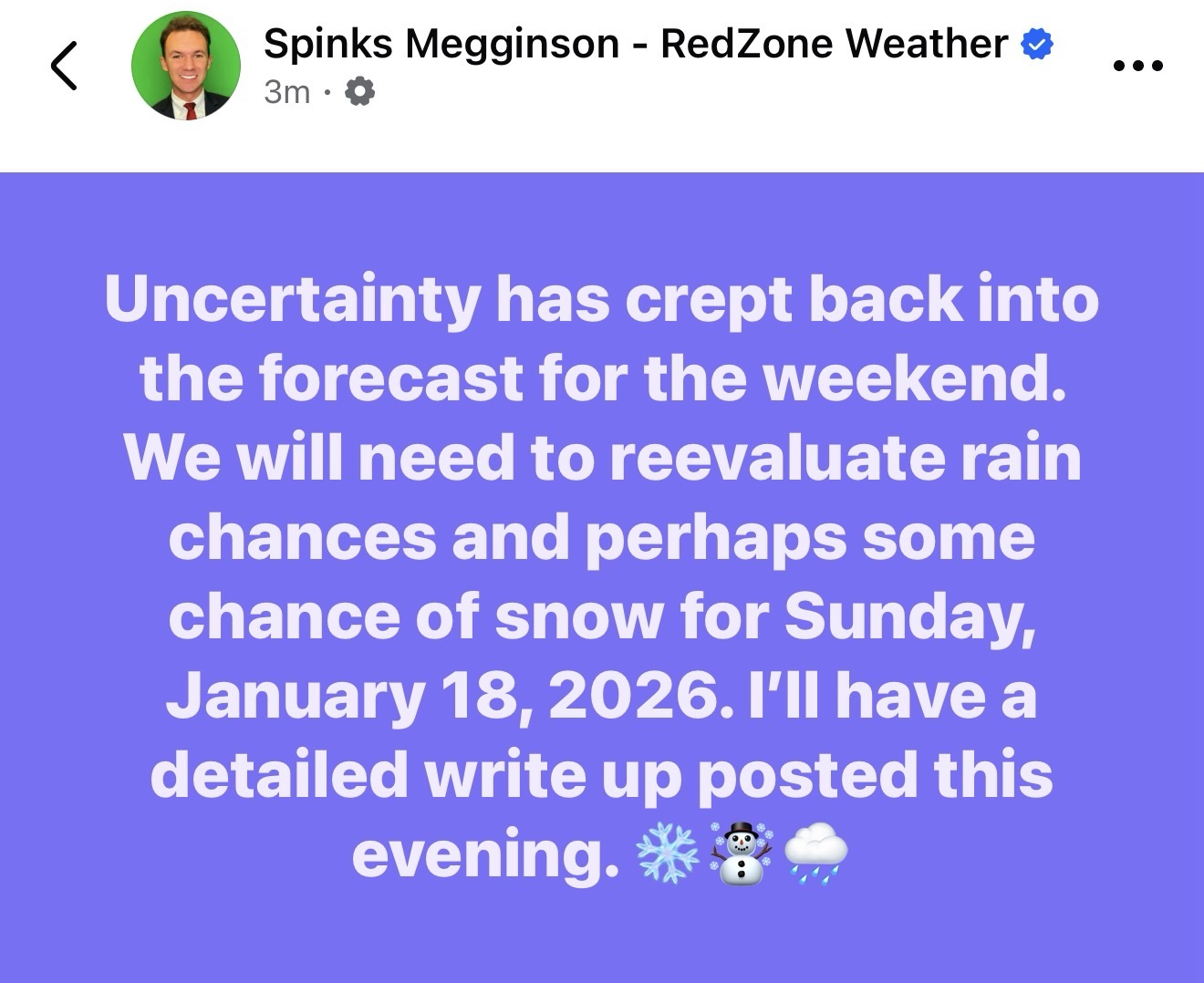
PRECIP CHANCES THIS WEEKEND… After trending drier for the last few days, this morning’s guidance has trended much wetter. Yet another humbling reminder: Snow is, BY FAR, the most difficult thing to forecast in the Deep South.
When something is rare and there aren’t a lot of analogs for models to look at, it makes forecasting a whole lot tougher.
I’ll be watching trends today. Detailed update will be posted around 9PM. Check with me then for latest info.
I am headed to Flomaton Elementary for a weather presentation this afternoon. Have a good Wednesday afternoon!

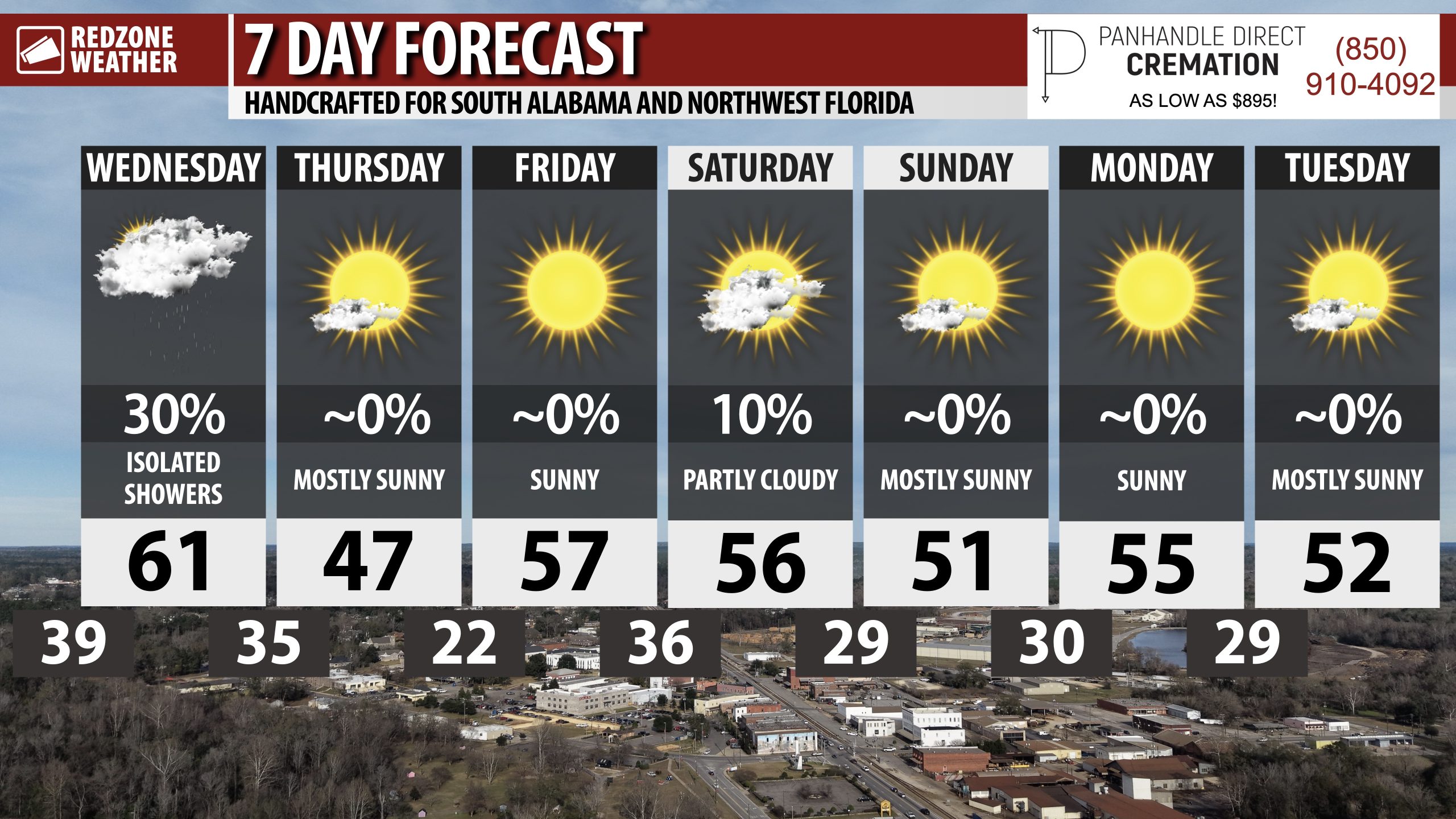
COLD DAYS UPCOMING… After rain clears out later today, we’re headed into what may be the coldest week of the year (potentially). There is a high chance we don’t see 60 degrees for about a week.
Overnight lows will be below freezing Thursday night and again on Saturday, Sunday, and Monday nights!

Spotty sprinkles and showers continue to drift east across parts of southwest Alabama this morning.
At 8:17AM, showers are happening near Old Texas, Forest Home, Starlington, Peterman, Gosport, and Deer Park. pic.twitter.com/Fh3nM5r7t7
— Spinks Megginson (@rzweather) January 14, 2026

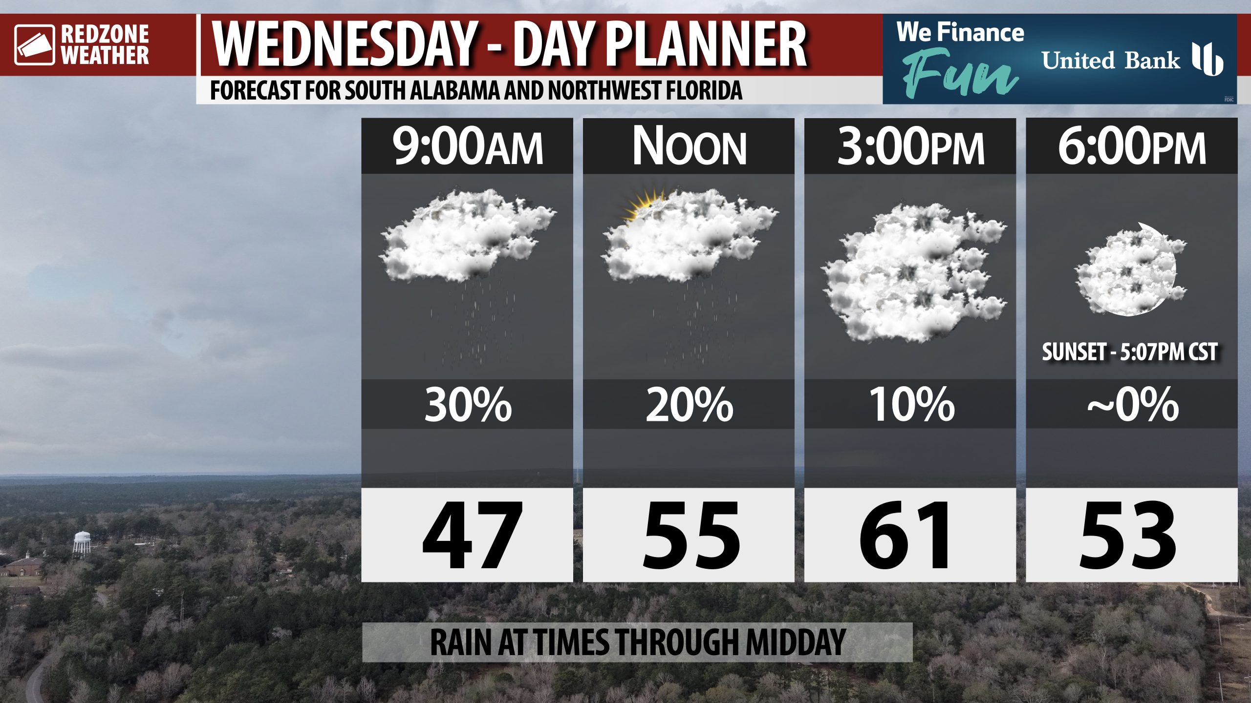
RAIN THIS MORNING, CLEARING LATER TODAY… Rain showers across the region will gradually continue to push to the east in the hours ahead. Most spots this afternoon will begin to dry out. Clouds will hang tough throughout the day. Very cold air returns tonight.
Highs tomorrow will only be in the 40s with lows in the low to mid 20s by Thursday night into Friday morning.

Showers will continue to increase in coverage over the next several hours across south Alabama and northwest Florida. pic.twitter.com/jRjfLrWiVa
— Spinks Megginson (@rzweather) January 14, 2026

Showers across parts of Mississippi will move into south Alabama and northwest Florida overnight. Rain will be possible at times throughout the day on Wednesday. No severe weather issues expected. pic.twitter.com/tBGsBlqukl
— Spinks Megginson (@rzweather) January 14, 2026
