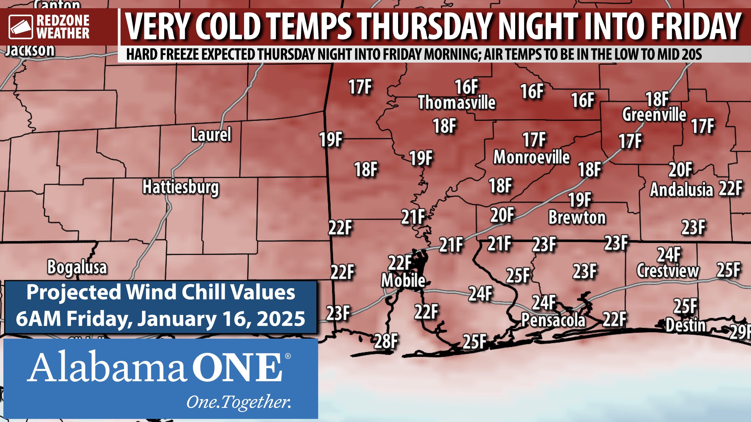
HARD FREEZE THURSDAY NIGHT; TEMPS TO BE BELOW FREEZING FOR NEARLY 12 HOURS… I am in the process of writing up a detailed report on the wintry precipitation/snow potential coming Saturday night into Sunday. I will have that posted by 9PM. Before we get there, you need to be aware we have a hard freeze coming up tomorrow night. The numbers depicted on this map are the forecast wind chill values valid at 6AM on Friday morning.
High temperatures tomorrow (Thursday) will only be in the 40s across the entire region. We rapidly fall below freezing tomorrow evening around 8-9PM. Most communities will remain at or below 32° until 8-9AM Friday morning. Definitely a night we all will need to have freeze precautions in place! Outdoor pets should be inside along with any sensitive plants.
I am writing up detailed info about the “s-word” (snow!) that everyone has been talking about today. This is definitely going to be a lot different than our big snow event last January. It looks like this precipitation may come through early Sunday morning before sunrise. Details coming around 9PM. Be sure to join me then for the latest.
Have a good Wednesday evening
