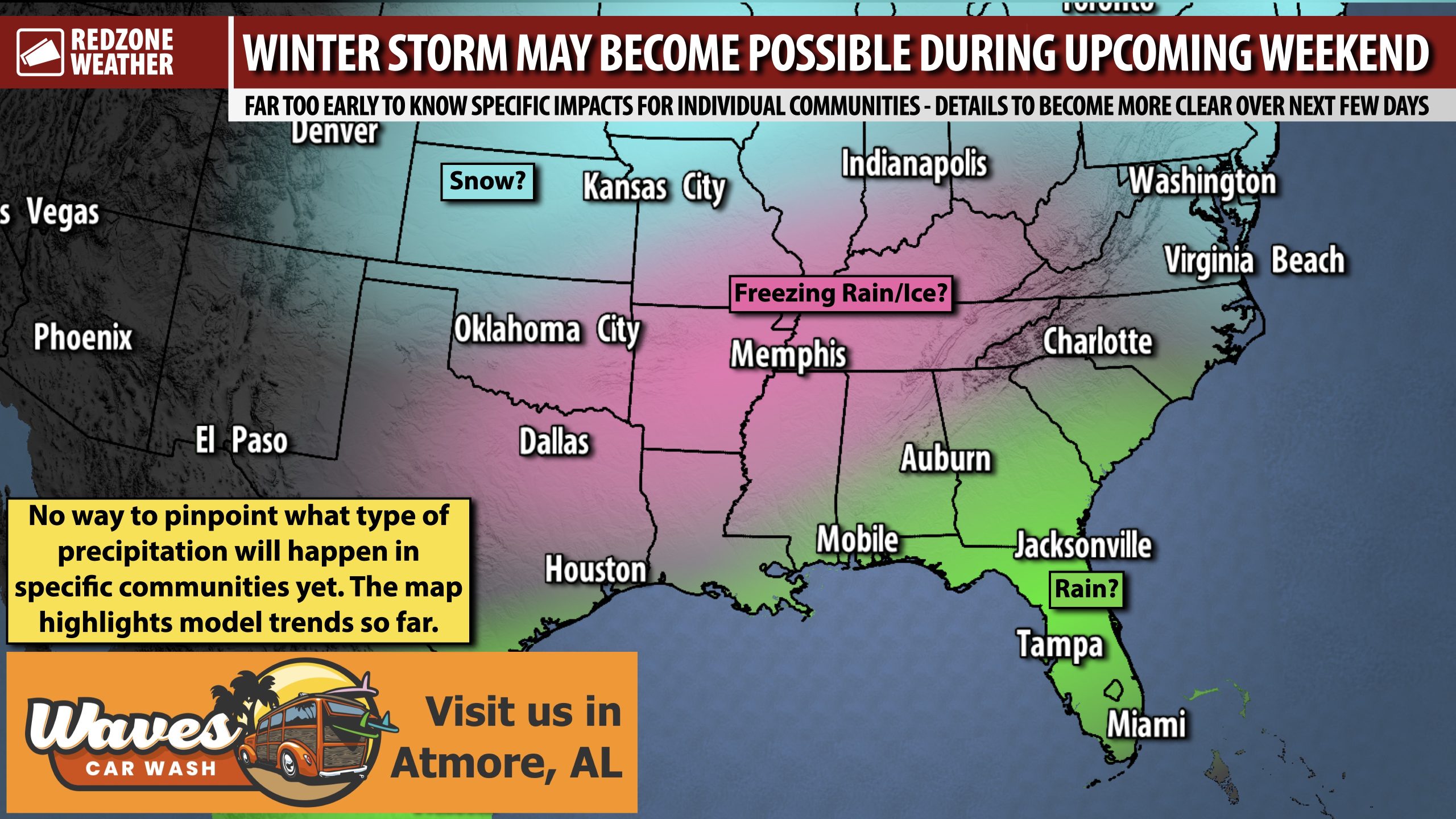
MORE WINTER WEATHER FOR DEEP SOUTH? IT IS POSSIBLE THIS COMING WEEKEND… After snow happened this morning across parts of Alabama, Florida, and Georgia, one would logically think the Deep South would be done with snow for awhile. That may not be the case, however. Model guidance has been consistent over the last 24-48 hours in showing perhaps a robust winter storm developing later this week and into the upcoming weekend. Right now, we’re very early in the process. The indications are in place that very cold air may be place along with at least some precipitation. Unlike the event this morning, overrunning precipitation may create a zone supportive of freezing rain and sleet, perhaps across a wide area.
THE WAY MODEL GUIDANCE WORKS… Picture this: You’re a camera operator. If you get your camera out and it’s all out of focus, the image is blurry. That would be the point we are at in the forecast process with this system. Details are murky and very difficult to pinpoint. Throughout the upcoming week, that camera lens will become more clear as we turn the knobs and focus the image. It will be a slow process. The equivalent of turning the knobs on the camera to focus it would be getting more data into the models and letting the models output better, refined data throughout the week. This is the exact same process we use for forecasting tornadoes, hurricanes, and all weather phenomena. The details start out murky and gradually become more clear as we get closer to the event. In this case, we can see through the camera lens that there is a strong potential SOMEONE across the southeastern U.S. may have some real winter weather issues in 6-7 days. No way to pinpoint who just yet. Be sure to check back with me for updates in the days ahead.
There is ZERO reason to change any plans for the upcoming weekend at this stage due to weather. It’s impossible to nail down anything in the way of specifics just yet.
RAIN LOCALLY, FOR NOW… I will be leaning toward including a low-end rain chance valid for the upcoming weekend in the morning video forecast for south Alabama and northwest Florida. For now, there isn’t enough credible, consistent data to include a chance of mixed precipitation or snow. Could that change in the days ahead? Absolutely, but for now, the most prudent route for the local forecast is just a few widely scattered rain showers on Saturday and Sunday. Based on the data, I’ll probably start rain chances at a 10-20% chance. We’ll see if we have to ramp those up later this week.
APP… If you haven’t already downloaded the RedZone Weather app, now is a great time to do that. redzoneweather.com/app is the link to the free download. Once you have the RZW app installed on your iOS or Android device, be sure to visit the Alerts tab to turn on the specific notifications you’d like to receive. All notifications are handcrafted by me. No automation and we promise not to bug you!
Join us tomorrow morning in the next regularly scheduled RedZone Weather forecast video that will be posted by 7:15AM for the latest information.

