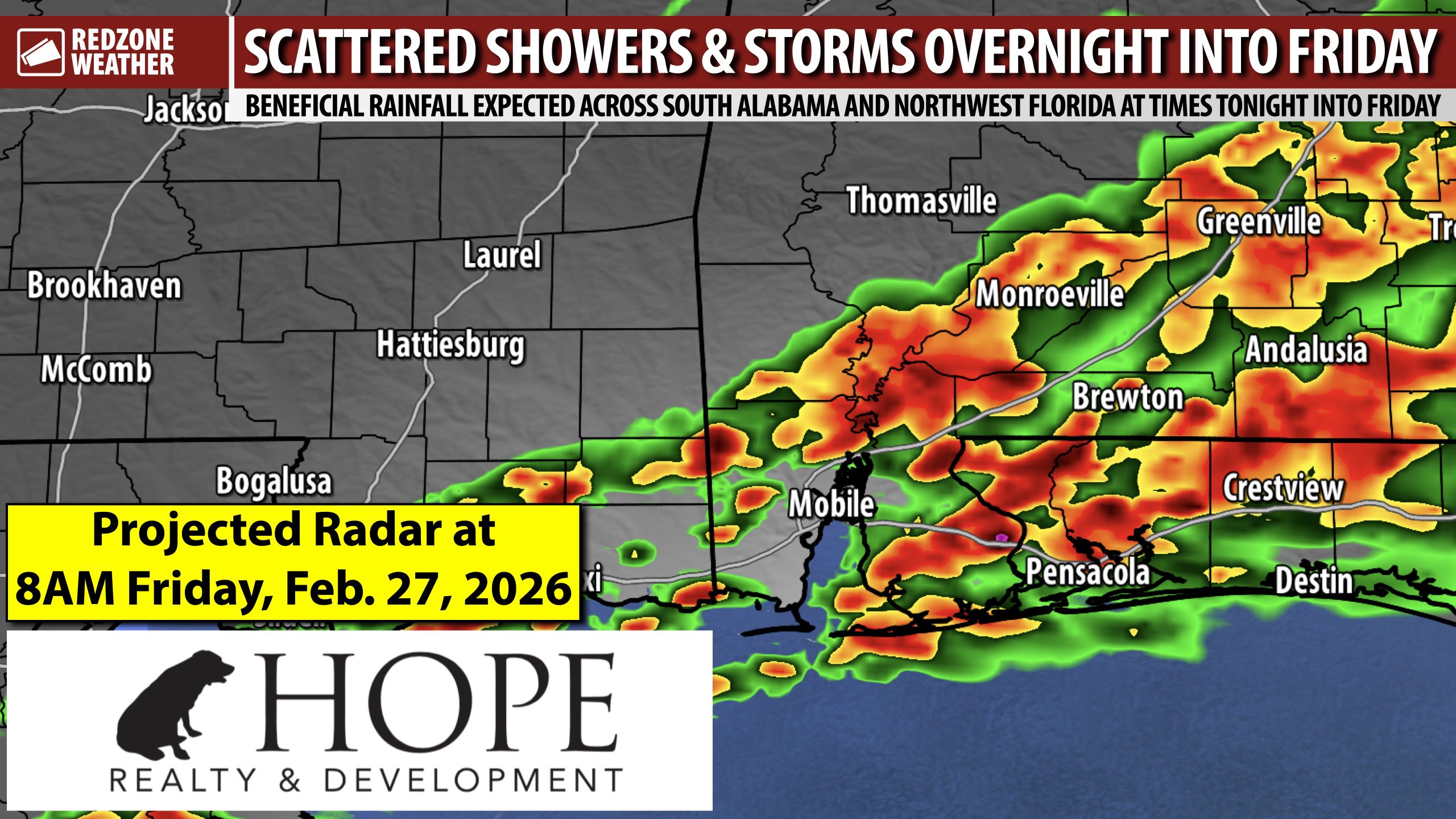
SCATTERED STORMS LIKELY FRIDAY MORNING; GUSTY WINDS POSSIBLE AS STORMS MOVE IN… Scattered severe thunderstorms in progress this evening across parts of north and central Alabama will coalesce into a complex of thunderstorms overnight. This complex of storms will move into south Alabama in the overnight hours tonight and ultimately move from north to south across the region, ultimately pushing into coastal zones and into the northern Gulf tomorrow morning. That means that some, if not most, communities across the region may have rain and thunderstorms in progress in the 4AM-8AM timeframe, during the morning commute. While widespread severe storms are NOT expected locally, some of the storms may briefly produce gusty winds (30-40 mph gusts possible). In addition, heavy rain will be a concern, particularly if any storms train over the same areas.
STORM TIMING – OVERNIGHT INTO FRIDAY… Thunderstorms are expected to push in from the north into parts of Clarke, Washington, Monroe, Butler, and Conecuh counties in the 2-4AM time frame. Storms will move through Escambia (AL), and Covington counties between 3-6AM. These scattered thunderstorms will continue moving south, ultimately ending up in parts of Mobile, Baldwin, Escambia (FL), Santa Rosa, Okaloosa, and Walton counties by 6-9AM. Scattered showers will continue into the late morning and afternoon hours before rain completely moves out tomorrow night.
SEVERE WEATHER RISK – OVERNIGHT INTO FRIDAY… The overall risk of severe storms across southwest Alabama and northwest Florida is quite low. Any storms that ramp up and briefly become strong may be capable of producing gusty winds and small hail. The overall risk of any tornadoes is very, very low. There was a confirmed tornado earlier today (not a gustnado, but an actual tornado that caused damage to structures) in Trussville, AL. This was somewhat of an outlier compared to most of the storms today. Large hail has been the primary hazard with a few reports of wind damage. I am not expecting tornado warnings overnight into Friday, however, this case goes to show we should always be prepared for tornadoes during thunderstorm events. IF, by chance, we have a tornado warning locally, I will “go live” across our platforms to bring you the very latest. Please check with me in the RedZone Weather app, even when we are not live streaming, for updates.
TORNADO WARNING POLICY… Any time there is an active tornado warning in effect for southwest Alabama or northwest Florida, we provide uninterrupted, live video coverage on Facebook Live and YouTube Live. Our detailed coverage commitment is outlined at redzoneweather.com/coverage. We are proud to cover all parts of Escambia (AL), Covington, Monroe, Conecuh, Baldwin, Mobile, Clarke, Washington (AL), Butler, Escambia (FL), Santa Rosa, and Okaloosa counties. If you live in any locale in those counties, be sure to tune into our coverage whenever there is an active tornado warning!
APP ALERTS… redzoneweather.com/app is the link where you can download the free RedZone Weather app. We post brief updates throughout each day in the app, keeping you up-to-date about the latest happenings in weather across south Alabama and northwest Florida. Once you have the free app downloaded to your iOS or Android device, be sure to visit the Alerts tab (lower right corner) then tap the large Alert Settings button to customize the alerts you would like to receive straight from me.
I will have another forecast video posted by 7:15AM tomorrow morning.
Have a nice Thursday evening!
