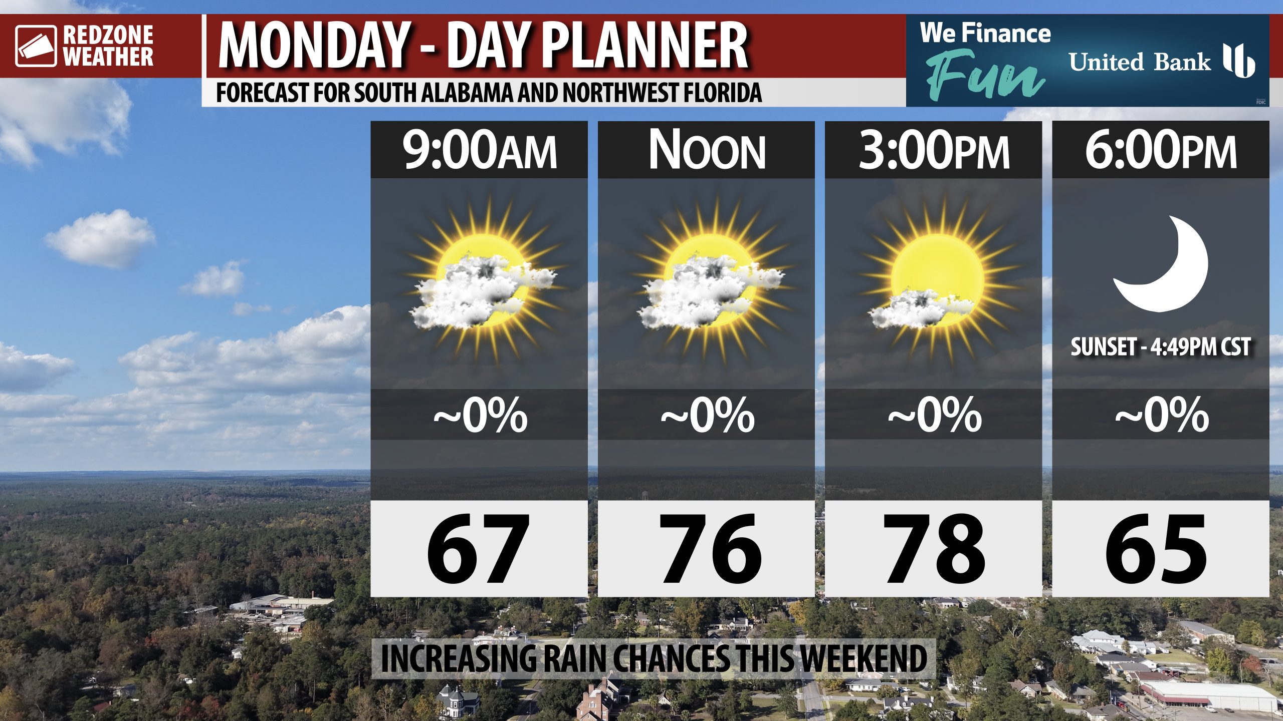
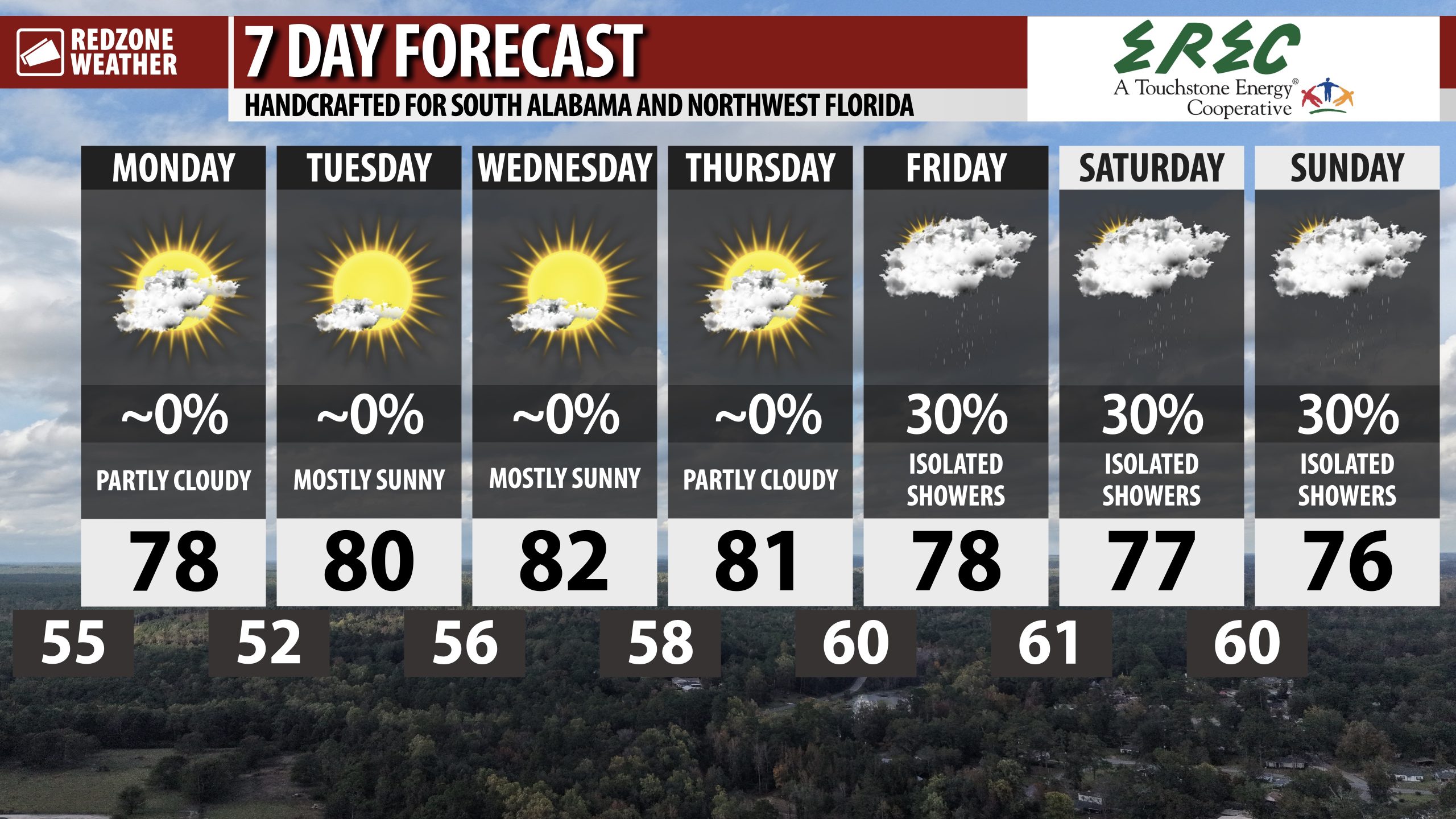
WARM DAYS, COOL NIGHTS AHEAD; SHOWERS POSSIBLE THIS WEEKEND… Rain, unfortunately, remains elusive in our forecast pattern today, tomorrow, and into midweek. Drought conditions continue to worsen. The bright side of all this is we have a streak of beautiful, warm days upcoming. High temperatures will be in the upper 70s today with highs in the low 80s expected by midweek. Our next chance of rain is slated to happen this weekend as we enter into a slightly more unsettled pattern. Early indications for Thanksgiving point to warmer than average temperatures.
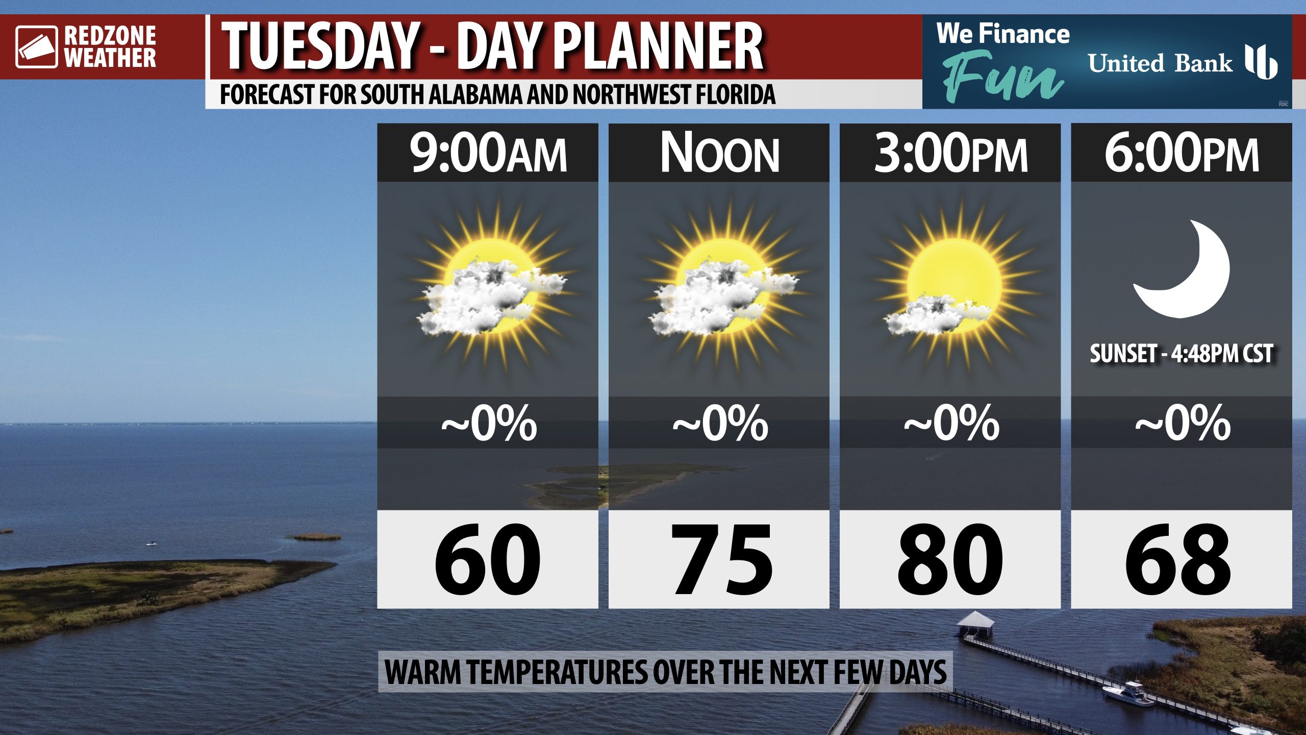
DRY, NICE DAYS THROUGH MIDWEEK… Our local area remains firmly under an area of high pressure, keeping the region dry and mild through midweek. Afternoon highs will be in the upper 70s and low 80s today, tomorrow, and on Wednesday. Morning lows will be in the upper 50s.
SHOWERS POSSIBLE DURING UPCOMING WEEKEND… Rain chances rise as we get into Friday and the upcoming weekend. We’ll be tracking an area of low pressure expected to develop well to our west that will usher in higher rain chances. This will probably be a situation with multiple rounds of rain being possible. Too early to know if a beneficial heavy rain event will happen OR if severe storms will be a real concern.
TROPICS QUIET… The Gulf, Caribbean Sea, and Atlantic Ocean remain quiet with no new tropical storms expected to develop over the next 5-7 days. The 2025 Atlantic Hurricane Season will end on Sunday, November 30.
APP… If you haven’t already downloaded the RedZone Weather app, now is a great time to do that. redzoneweather.com/app is the link to the free download. Once you have the RZW app installed on your iOS or Android device, be sure to visit the Alerts tab to turn on the specific notifications you’d like to receive. All notifications are handcrafted by me. No automation and we promise not to bug you!
See all the details in your Monday morning RedZone Weather forecast video. My next forecast video will be posted by 7:15AM tomorrow morning. I will have updates posted throughout the day, as needed, in the RedZone Weather app.
Have a great start to your week!