6:51AM December 5, 2025
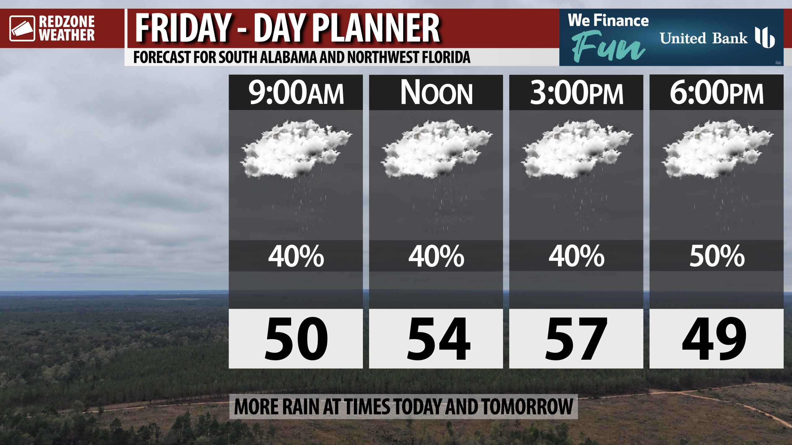
SCATTERED SHOWERS & COLD TEMPS TODAY; MORE RAIN ON SATURDAY… Rain will continue to be the norm at times on this Friday across south Alabama and northwest Florida. Temperatures will only be in the upper 40s further inland with 60s likely closer to the coast. Most of us will have high temperatures in the 50s by 3PM. More scattered showers are likely at times tonight and into Saturday. Lingering showers will be possible on Sunday ahead of drier weather setting up for Monday and Tuesday. We will begin a warming trend as we get into the middle part of the upcoming week.
RAIN AT TIMES ON SATURDAY INTO SATURDAY EVENING… I have had quite a few questions about Christmas parades and other outdoor events slated for Saturday evening. We probably will have quite a bit of rain around in the morning and early afternoon hours of Saturday. Showers will become more scattered in nature Saturday evening into Saturday night. More rain will be possible Saturday night into early Sunday morning. There is a good chance we have rain around at times during the evening hours of Saturday, although it is impossible to know with any type of accuracy or precision who will have rain and who won’t. Overall, we’re in a very wet pattern through Sunday. Have an indoor backup plan for sure! High temperatures will be in the 50s on Saturday.
FEW SHOWERS SUNDAY; TRENDING DRIER FOR MONDAY… Scattered showers will be possible through Sunday afternoon ahead of drier weather commencing on Monday. Highs on Sunday will again be in the 50s and low 60s for the most part. Highs on Monday will be in the 50s with skies becoming mostly sunny late in the day.
COLD NIGHTS EARLY NEXT WEEK; WARMER TEMPS LATER IN WEEK… Guidance suggests overnight lows will be in the 30s on Monday night and Tuesday night. High temperatures will rise into the 60s by Wednesday and Thursday of the upcoming week. We will be much drier next week compared to what has happened this week.
APP… If you haven’t already downloaded the RedZone Weather app, now is a great time to do that. redzoneweather.com/app is the link to the free download. Once you have the RZW app installed on your iOS or Android device, be sure to visit the Alerts tab to turn on the specific notifications you’d like to receive. All notifications are handcrafted by me. No automation and we promise not to bug you!
See all the details in your Friday morning RedZone Weather forecast video. My next forecast video will be posted by 7:15AM Monday morning. I will have updates posted throughout the weekend, as needed, in the RedZone Weather app.
Hope you have a great weekend!