8:15PM August 30, 2026
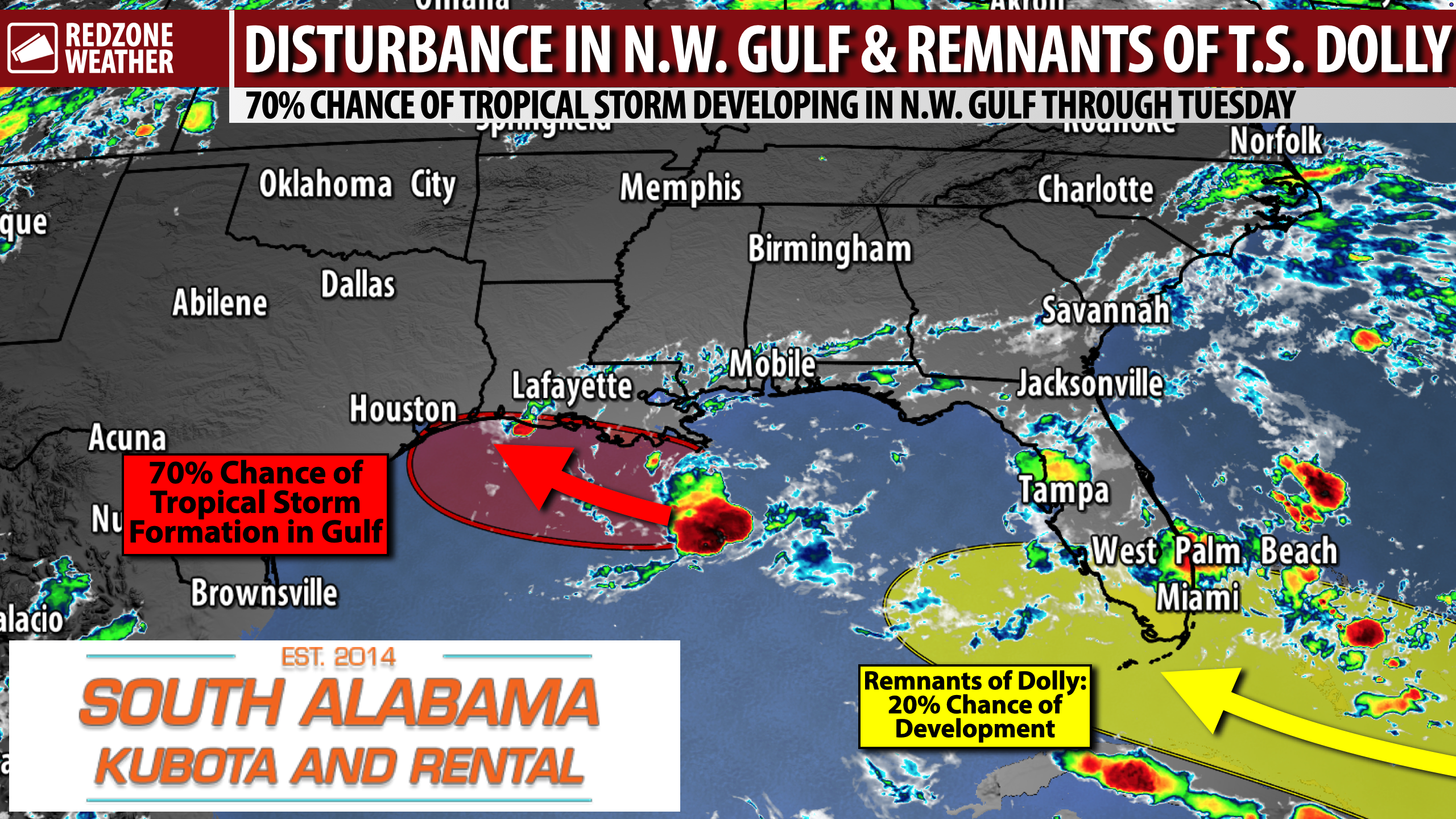
INVEST 97L LIKELY TO DEVELOP; ALSO WATCHING REMNANTS OF T.S. DOLLY… Two tropical disturbances are being monitored in the Atlantic Basin on this Sunday evening. INVEST 97L is in the northern Gulf and is increasingly likely to become a tropical depression or named tropical storm before reaching the southwest Louisiana or east Texas coast. In addition, we are also tracking the remnants of what once was Tropical Storm Dolly moving west-northwest near Puerto Rico. The remnants of Dolly will need to be monitored for potential redevelopment as the strong tropical wave approaches The Bahamas and the Florida Keys later this week.
97L: 70% CHANCE OF DISTURBANCE IN NORTHERN GULF DEVELOPING… INVEST 97L is an increasingly organized area of low pressure about 120 miles south of the Louisiana coast. The National Hurricane Center gives the system a high (70%) chance of development over the next couple of days. A short-lived tropical depression or tropical storm will likely form as 97L moves slowly west-northwestward across the Gulf before reaching the coast Tuesday or Tuesday night. The National Hurricane Center may start issuing advisories on this system under the “Potential Tropical Cyclone” designation later tonight.
97L: RAIN & IMPACTS POSSIBLE IN WESTERN LOUISIANA & EAST TEXAS… The greatest impacts from INVEST 97L are expected along the southwestern Louisiana and east Texas coastal zones. Locally heavy rain will be possible in those zones over the next several days, regardless of whether the system becomes a named storm. Tropical storm watches or warnings may be required for parts of that region later tonight or Monday morning.
DOLLY: REMNANTS OF DOLLY MOVING NORTHWEST NEAR PUERTO RICO… The remnants of Tropical Storm Dolly are producing showers and thunderstorms from Puerto Rico eastward across the Virgin Islands and northern Leeward Islands. The system does not currently have a closed circulation and is moving westward to west-northwestward around 25 mph. Locally heavy rain and gusty winds will be possible across the Leeward Islands, Virgin Islands, Puerto Rico, and Hispaniola over the next couple of days.
DOLLY: 20% CHANCE OF REDEVELOPMENT NEAR BAHAMAS & SOUTH FLORIDA… Redevelopment of Dolly is unlikely during the next day or two, with NHC indicating a near 0% chance of formation through 48 hours. Conditions may become more favorable by the middle of the week as the remnants continue westward and approach the southeastern Gulf. The chance of development in the next 7 days is around 20%. Some model guidance supports possible development over the eastern half of the Gulf later in the week, but there are far too many uncertainties to draw conclusions about where the system ultimately goes or what impacts it may produce.
LOCALLY, P.M. POP-UP STORMS REMAIN THE NORM THIS WEEK… Scattered showers and thunderstorms across south Alabama and northwest Florida have diminished this evening. Additional storms may develop near the coast late tonight before spreading farther inland Monday. Monday will feature slightly lower overall rain chances, with highs generally in the 89-94° range. The familiar cycle of P.M. pop-up showers and thunderstorms will continue Tuesday and Wednesday. These storms will remain unevenly distributed, leaving many communities dry on any given day while others receive a localized downpour. Highs will generally be in the low to mid 90s this week, with hotter temperatures later in the week. Humidity will remain elevated, meaning heat index values will trend higher later in the week.
APP… The free RedZone Weather app is the best way to keep up with my latest weather updates throughout the day. Visit redzoneweather.com/app to download the app for iOS or Android. Once installed, open the Alerts tab and customize the notifications you’d like to receive straight from me.
My next forecast video will be posted by 7:15AM tomorrow morning. Hope you’ll join us for the latest information then.
Have a nice Sunday evening!