2:59PM April 1, 2026
Excited to watch history being made this evening at 5:24PM CDT! https://t.co/0en8v2yr0j
— Spinks Megginson (@rzweather) April 01, 2026

Excited to watch history being made this evening at 5:24PM CDT! https://t.co/0en8v2yr0j
— Spinks Megginson (@rzweather) April 01, 2026
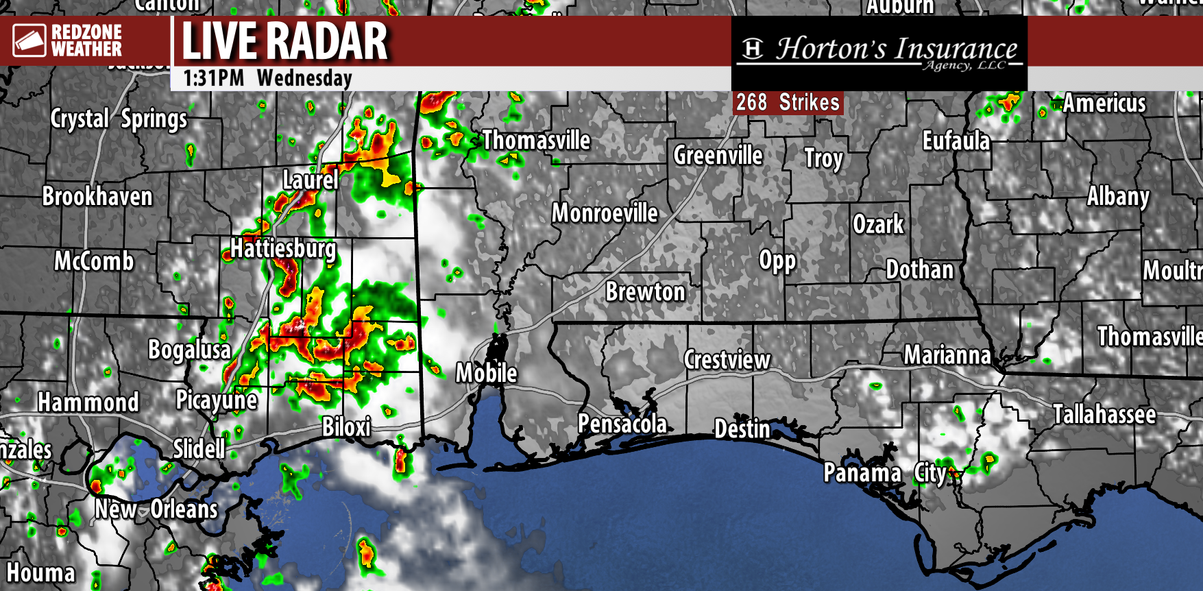
Showers continue to bubble up across the region this afternoon. The focus for showers for most of the day has been over west Alabama.
Showers are now bubbling up in parts of Covington, Monroe, Butler, Conecuh, Escambia (AL), Geneva, and Walton counties as well. https://t.co/RooaDbe0EX
— Spinks Megginson (@rzweather) April 01, 2026

SPOTTY STORMS IN SOUTHEAST MISSISSIPPI… Several showers and thunderstorms are happening this afternoon across parts of southeast Mississippi. Spotty showers are in progress in far western Alabama in areas west of the Alabama River.
Mobile, Baldwin, Clarke, and Washington counties will generally be where the showers happen locally over the next few hours.

Pockets of rain with a few thunderstorms mixed in continue to develop and stream northward across parts of west Alabama at midday. We will likely see an uptick in rain coverage in parts of Clarke, Washington, and Marengo counties this afternoon.
Beneficial rain! https://t.co/bu4Y3Z2hR9
— Spinks Megginson (@rzweather) April 01, 2026

Hearing some thunder right now in places like Bay Minette, Tanner Williams, and Wilmer. Spotty showers and thunderstorms continue to develop and move north in parts of Mobile, Baldwin, and Washington counties in SW Alabama. https://t.co/LntY2j7UNc
— Spinks Megginson (@rzweather) April 01, 2026

Showers and thunderstorms are developing this morning across parts of Mobile and Baldwin counties. Beneficial rain! https://t.co/MHTVKeQuAM
— Spinks Megginson (@rzweather) April 01, 2026

Scattered storms will be possible today, MOSTLY in areas west of the Alabama River.
High temperatures will be in the 80s through Easter Sunday. Scattered rain and storms will be possible on Easter Sunday just ahead of a cold front. Cooler temps next week! https://t.co/OVmm0X93AN
— Spinks Megginson (@rzweather) April 01, 2026
