6:53AM March 12, 2026
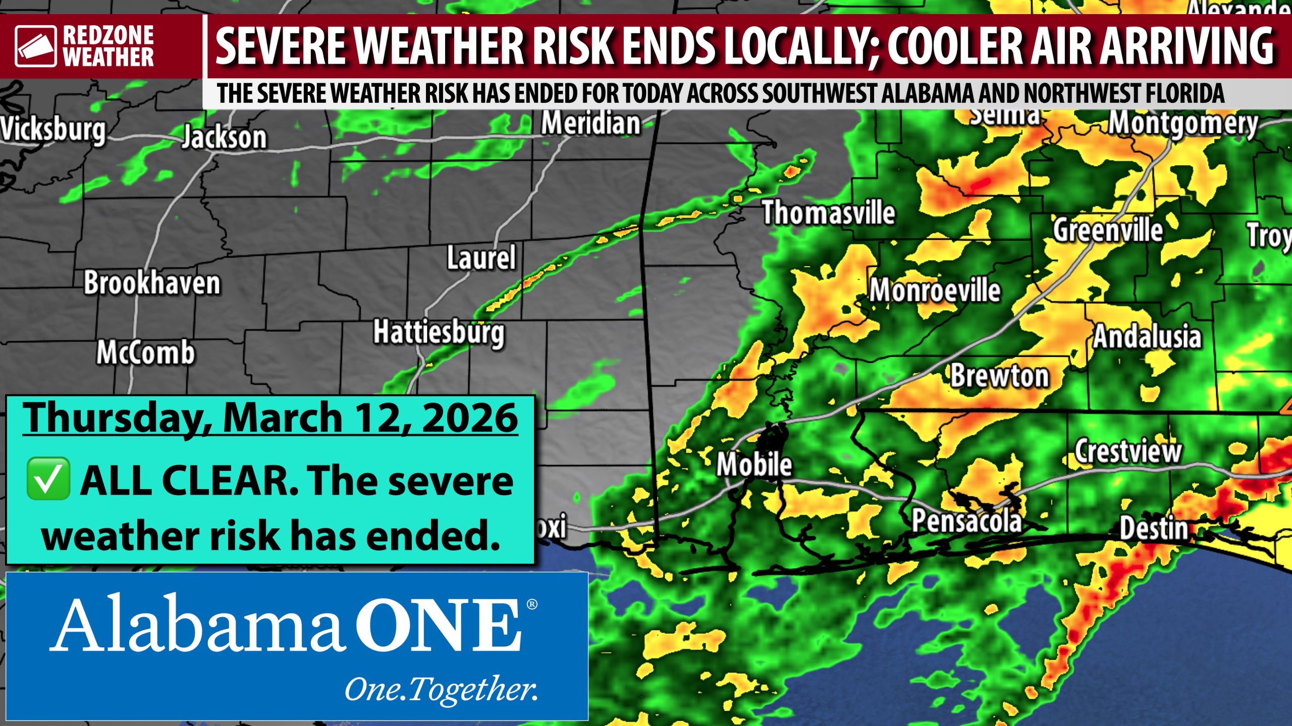
CLEARING SKIES TODAY; NICE WEEKEND; ANOTHER COLD SNAP COMING EARLY NEXT WEEK… Rain and thunderstorms continue to rapidly move east and away from south Alabama and northwest Florida on this Thursday morning. Skies will become mostly sunny by the afternoon hours with clear skies likely this evening. Afternoon high temperatures will be about twenty degrees cooler than yesterday. Most spots will peak in the low to mid 60s today. We have beautiful weather upcoming for the weekend ahead of rain being possible on Monday. Get ready for another cold snap early next week!
NICE WEATHER FOR THE WEEKEND… Sunny skies are expected across the region on Friday and Saturday. Afternoon highs will be in the low 70s tomorrow with upper 70s likely on Saturday. It will be perfect weather for outdoor activities tomorrow and Saturday. Sunday may feature just a few widely scattered showers in the evening hours, but most spots across the area will remain dry. Highs on Sunday will be around the 80 degree mark.
RAIN POSSIBLE MONDAY AS COLD AIR MOVES IN; CHILLY TUESDAY… Isolated rain showers will be possible on Monday as a cold front comes through the region. Highs on Monday will be in the 60s with overnight lows likely to be in the mid 30s on Monday night into Tuesday. There is a risk that some communities may have near freezing temperatures by 6AM Tuesday morning. Highs on Tuesday will only be in the 50s ahead of another night with temperatures in the low to mid 30s. Some spots may dip just below freezing Wednesday morning of the upcoming week.
APP… If you haven’t already downloaded the RedZone Weather app, now is a great time to do that. redzoneweather.com/app is the link to the free download. Once you have the RZW app installed on your iOS or Android device, be sure to visit the Alerts tab to turn on the specific notifications you’d like to receive. All notifications are handcrafted by me. No automation and we promise not to bug you!
See all the details in your Thursday RedZone Weather forecast video. My next forecast video will be posted by 7:15AM tomorrow morning. I will have updates posted throughout the day, as needed, in the RedZone Weather app.
Have a wonderful Thursday!