7:34AM January 18, 2026
@rzweather winter wonderland in Andalusia, Alabama pic.twitter.com/GYxEMvXny6
— Amanda (@mandyedgar02) January 18, 2026

@rzweather winter wonderland in Andalusia, Alabama pic.twitter.com/GYxEMvXny6
— Amanda (@mandyedgar02) January 18, 2026
Holt florida @rzweather @NWSMobile pic.twitter.com/JXSueTmBE6
— Danielle Brahier (@DanieRay21) January 18, 2026

@rzweather
My backyard in North Crestview Florida pic.twitter.com/9HPL4OaaS9— Marie Smoyer (@AnneBlack213) January 18, 2026

SNOW MOVING OUT TO THE EAST; BACK-TO-BACK SNOW YEARS… Hard to believe that for the 2nd consecutive year, we have several communities in Covington and Okaloosa counties waking up to snow on the ground in many communities! If you’re planning to drive in the next few hours in Santa Rosa, Covington, Okaloosa, Walton counties, or points east, PLEASE check local road conditions before you venture out. Road conditions will rapidly improve later this morning as temperatures rise into the upper 30s. Afternoon highs will be in the mid to upper 40s, helping to melt any lingering snow. We are expecting a hard freeze tonight with overnight lows in the mid 20s by 6AM Monday. This photo was taken around 6:50AM near Abbeville, AL in Henry County. Thanks to Jordan Key for the view!
SURPRISE TWO INCHES OF SNOW ON THE GROUND NEAR LAUREL HILL… While most of the snow accumulation reports I have received over the last hour have been in the 0.10″ to 0.75″ range, you can see the one photo I got from Laurel Hill, FL indicating two inches of snow on the ground. After corresponding with the viewer ensuring this was a proper ground measurement taken on the grass, this looks to be the one surprise of the event. 2 inches of snow – in Florida – for the second year in a row. Absolutely crazy!
SNOW COMING TO AN END LOCALLY… The back edge of the snow is rapidly moving east this morning and will soon exit Covington and Okaloosa counties to the east. Precipitation will stop soon, if it hasn’t already, near Opp, Florala, Lockhart, Laurel Hill, Crestview, Niceville, Destin, and Fort Walton Beach.
WINTER STORM WARNING CONTINUES TO OUR EAST… 1 to 2 inches of snowfall will be possible over the next hour or so in parts of southeast Alabama. A Winter Storm Warning continues for Houston, Henry, Geneva, Coffee, Dale, Holmes (FL), and Jackson (FL) counties. This includes places like Dothan, Geneva, Samson, Enterprise, Elba, Abbeville, Headland, Fort Rucker, and Daleville. A Winter Storm Warning is also in place for much of southwest and south-central Georgia where isolated higher snow amounts may be possible this morning.
SUNSHINE RETURNS THIS AFTERNOON… Clouds will hang tough over the next few hours, but the infrared satellite view indicates we will have some sunshine this afternoon. That will also help to get rid of any lingering ice patches on roadways and any lingering snow that hasn’t melted. Temperatures will peak in the mid to upper 40s by 2-3PM.
HARD FREEZE TONIGHT; SUNNY MONDAY… Temperatures will be below freezing for approximately 10-12 hours tonight with low temperatures in the mid 20s by daybreak tomorrow morning. Sunshine is likely all day Monday. Afternoon highs will be in the mid 50s.
THANKS FOR ALL OF THE PHOTOS, VIDEOS, AND REPORTS… I cannot thank you enough to everyone who sent in photos, videos, and ground truth reports as early as 3:30AM back in Mobile County. From then, the reports and photos really started coming in quickly. I review every single report and photo. Thank you for taking the time to send those in. I really appreciate it. It is helpful in our forecast verification process.
APP… If you haven’t already downloaded the RedZone Weather app, now is a great time to do that. redzoneweather.com/app is the link to the free download. Once you have the RZW app installed on your iOS or Android device, be sure to visit the Alerts tab to turn on the specific notifications you’d like to receive. All notifications are handcrafted by me. No automation and we promise not to bug you!
I will have your next full forecast video posted by 7:15AM tomorrow morning with the very latest information about what you can expect for the work week.
Have a great Sunday!

E Milton pic.twitter.com/I3iJ8HDeG2
— Lynda D'Alessandro (@LyndaLeeD) January 18, 2026

Minor snow accumulations in Chumuckla, FL in Santa Rosa County. Thanks to Sheila LeBrou for the view! @NWSMobile pic.twitter.com/P0D27OHDZm
— Spinks Megginson (@rzweather) January 18, 2026

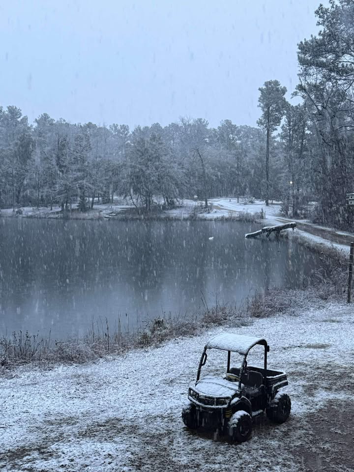
Crestview, FL pic.twitter.com/vbPrvkQ2Lm
— Matthew Whipple (@Matthew88039338) January 18, 2026
