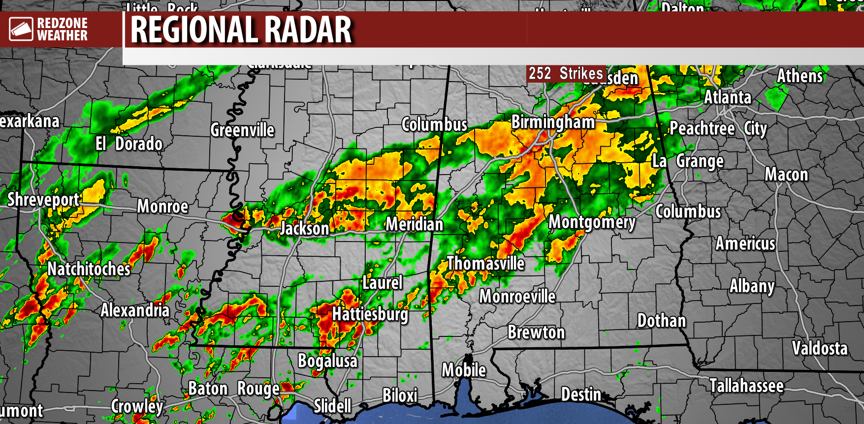
WEST ALABAMA STORMS CONTINUE… If you’re not in southeast Mississippi or west Alabama, you’re probably wondering what’s all the commotion about?! It has turned out to be a nice day across much of southwest Alabama and northwest Florida other than Clarke and Washington counties. There have been a few peeks of sunshine. Temperatures peaked in the upper 70s. Really doesn’t get much better for early January! It has been a different story, however, in west Alabama. Rain totals have already started stacking up with some communities having picked up over 2 inches of rainfall just today.
WHAT TO EXPECT – NEXT FEW HOURS… We’ll need to watch the thunderstorms near Hattiesburg, Sumrall, Lumberton, and Columbia in Mississippi. Those storms are pushing to the northeast. Based on the current trajectory of those storms, there is a chance that entire cluster of storms misses Clarke and Washington counties in southwest Alabama to the west. I’ll also be watching the small showers currently developing in parts of Jackson, George, Harrison, Pearl River, and Hancock counties in SE MS. These may eventually become storms that move toward west Alabama. It is going to be a rather nice evening across coastal Alabama and northwest Florida. If you have outdoor plans, I would absolutely proceed, knowing that there is a low-end potential for a few strong to severe storms after 9PM. I suspect most communities along, south, and east of I-65 will remain dry until the overnight hours.
BE ABLE TO HEAR WARNINGS OVERNIGHT… It looks like we may have a ramp up in storm intensity in the overnight hours toward sunrise Saturday across our local area. We encourage everyone to have multiple ways to hear warnings tonight, just in case your location goes under a tornado warning. The tornado risk is not particularly high, but it isn’t zero either. Please be able to get warnings – multiple things that can wake you up.
I am in studio and monitoring the situation carefully.


