6:52AM January 7, 2026
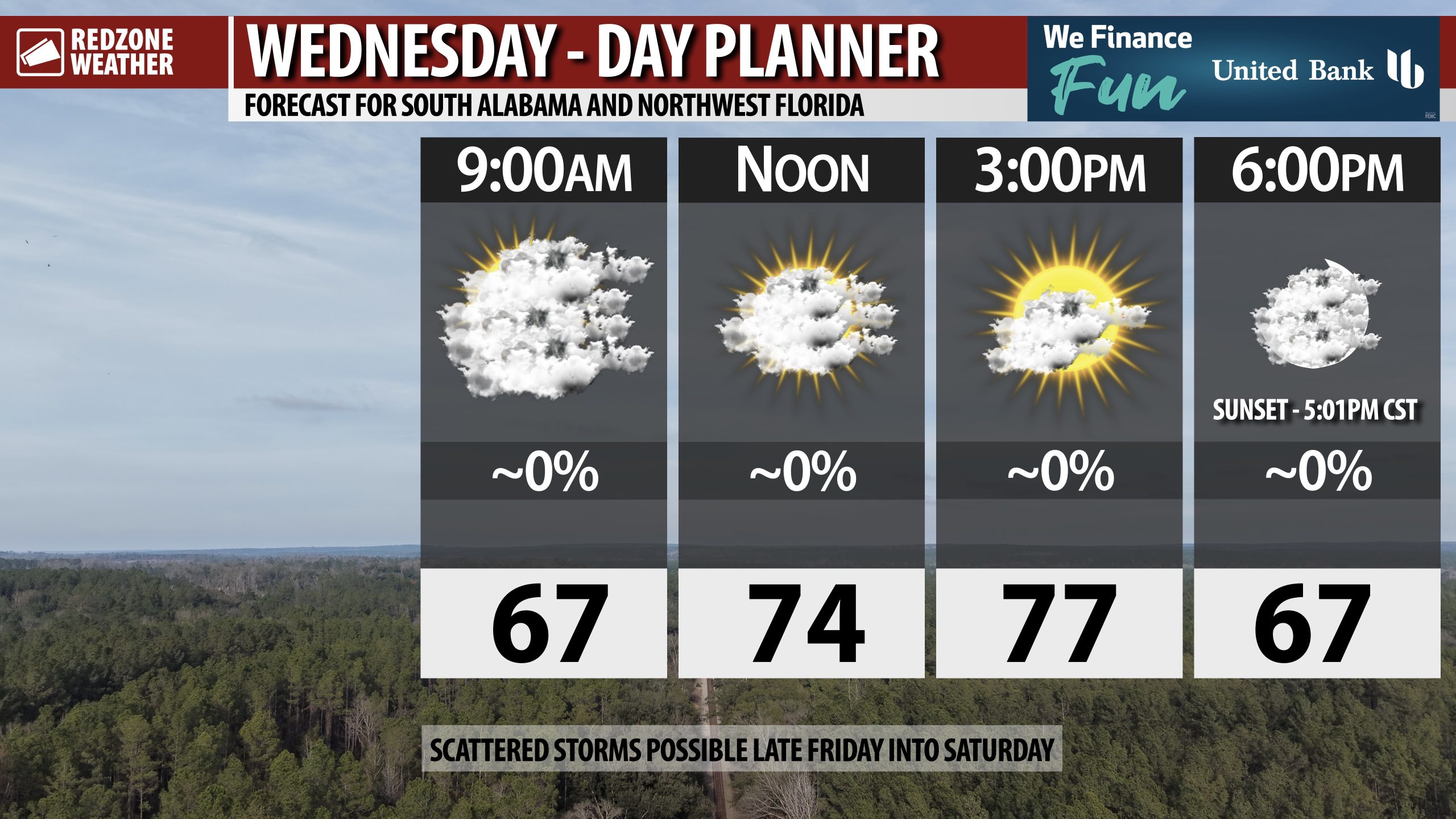
WARM TEMPS THIS AFTERNOON; SPOTTY STORMS RETURN LATE FRIDAY INTO SATURDAY… Pleasant weather is in store on this Wednesday with unseasonably warm temperatures for early January. Temperatures will peak in the mid to upper 70s across south Alabama and northwest Florida today. It will be a perfect afternoon to get out and do some yard work or go for a run. Sunset today happens at 5:01PM. Our next chance of rain sets up on Friday into Saturday as a cold front approaches. We may have a low-end risk of a few stronger storms, but the good news is the bulk of the severe storms will likely remain well to our north. Much colder air arrives on Sunday after the passage of the cold front.
MILD TEMPS TO PERSIST THROUGH FRIDAY; DENSE FOG CONCERNS… Today, tomorrow, and Friday will feature temperatures about 10-15 degrees above our climatological norms for this time of year. Afternoon highs will be in the mid to upper 70s each day with partly cloudy skies expected. Dense fog will be possible over the next few mornings.
SEVERE WEATHER RISK TO OUR NORTH & WEST ON FRIDAY… Northwest Alabama, western Tennessee, eastern Arkansas, much of north and west Mississippi, and parts of northeastern Louisiana are involved in a Level 2 (out of 5) severe weather risk valid for Friday into Friday night. A few tornadoes, damaging wind gusts, and large hail will be the main hazard concerns in any of the thunderstorms that happen in those areas on Friday into Friday night. In Alabama specifically, places like Muscle Shoals, Florence, Russellville, and Hamilton are involved in the Level 2 (out of 5) risk zone.
SCATTERED STORMS POSSIBLE LOCALLY FRIDAY INTO SATURDAY… The same weather system responsible for the severe weather risk to our north and west on Friday will move into our local area late Friday night into Saturday. Scattered showers and thunderstorms will be possible across the region, particularly Saturday morning. Our local area will likely be included in a low-end, Level 1 (out of 5) severe weather risk. This means the severe weather risk won’t be zero, but it will be quite low, most likely. Rain amounts will probably be less than 1″ in total across much of the region.
COLDER TEMPERATURES RETURN SUNDAY INTO MONDAY… Next week will certainly be more like what you would expect for the winter season across our region. Afternoon highs will be in the 50s on Monday with overnight lows in the 30s on both Sunday night and Monday night. Highs will be in the low 60s on Tuesday and Wednesday.
APP… If you haven’t already downloaded the RedZone Weather app, now is a great time to do that. redzoneweather.com/app is the link to the free download. Once you have the RZW app installed on your iOS or Android device, be sure to visit the Alerts tab to turn on the specific notifications you’d like to receive. All notifications are handcrafted by me. No automation and we promise not to bug you!
See all the details in your Wednesday morning RedZone Weather forecast video. My next forecast video will be posted by 7:15AM tomorrow morning. I will have updates posted throughout the day, as needed, in the RedZone Weather app.
Have a nice Wednesday!