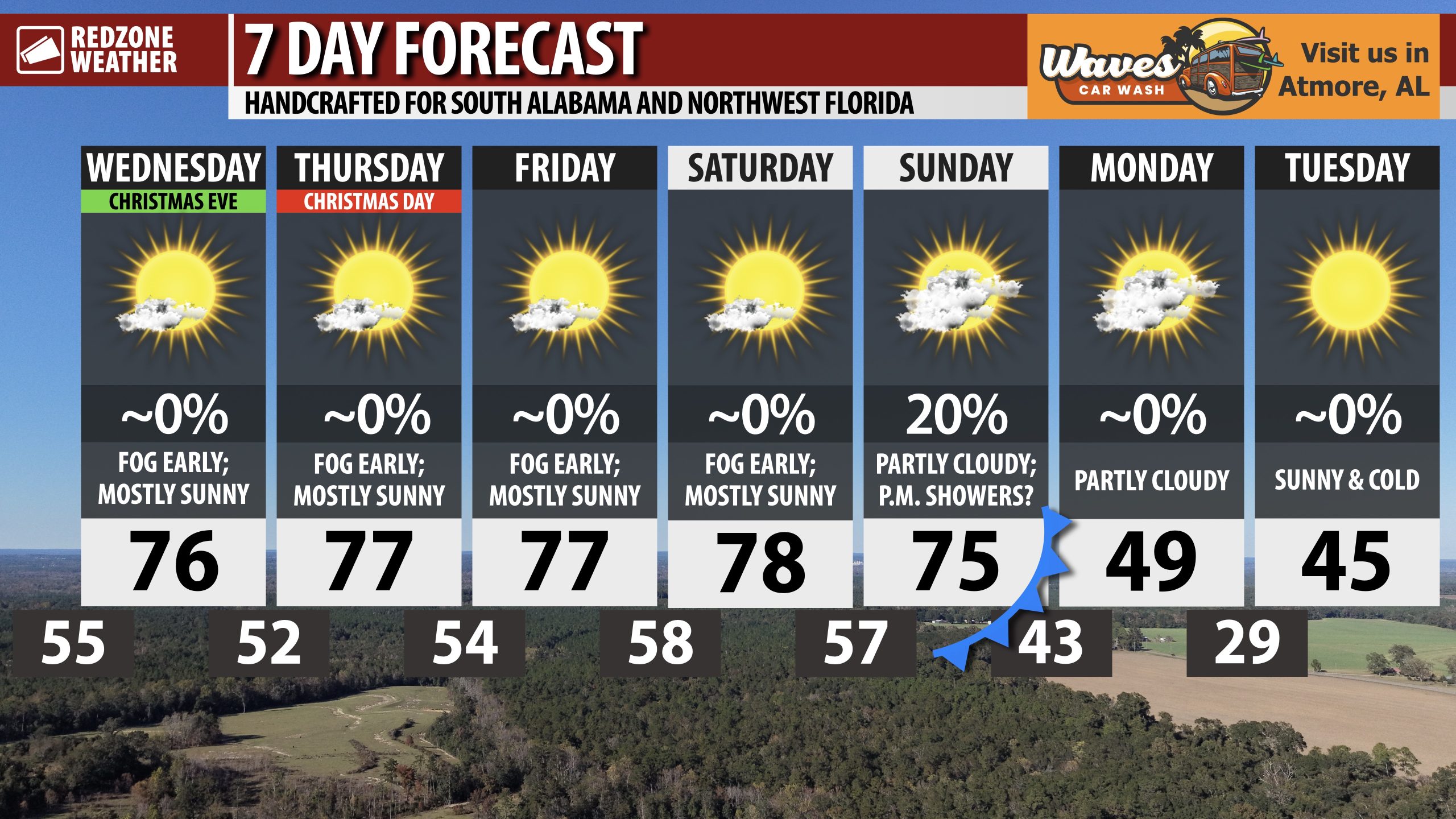
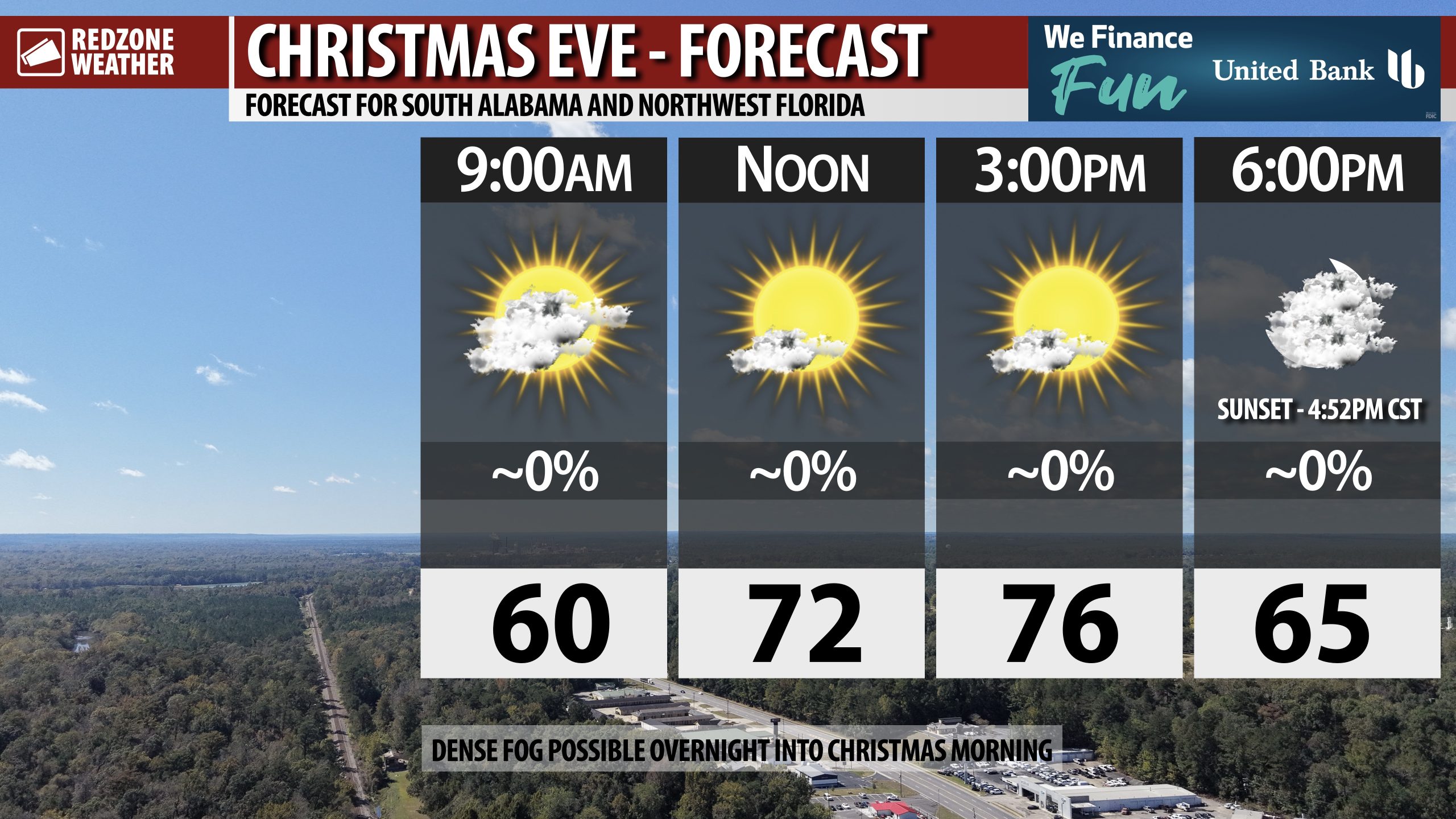
MILD CHRISTMAS EVE; PERFECT WEATHER FOR SANTA’S RIDE TONIGHT… Fog is dense across the region this morning. Take it slow if you’re driving over the next couple of hours. Tomorrow morning will be quite foggy as well. Santa Claus asked me to mention to all of the kids who regularly watch our forecast videos with their parents/folks to make sure to go to bed on time tonight! Santa won’t need the heavy jacket locally as mild conditions will persist through Christmas and into the weekend. Afternoon highs on this Christmas Eve will be in the mid 70s across the region. No rain is expected today and mostly sunny skies are likely all day. We’ll be in the 60s this evening around 6PM.
FOGGY START, PLEASANT WEATHER FOR CHRISTMAS DAY… Sunshine and mild temperatures are expected on Christmas Day, but not before the potential for dense fog across the region tomorrow morning. If you’re planning to travel tomorrow before 9AM, be aware of the potential for low visibilities due to very dense fog. If you have relatives or friends traveling tomorrow morning, it isn’t a bad idea to let ’em know we may have some low visibility due to the very dense fog. Clearing will happen in the late morning hours across much of the region (except at the immediate coast) and fog should burn off in most spots by 10AM. The remainder of the day tomorrow will be mostly sunny and pleasant. Temperatures will peak in the mid to upper 70s tomorrow, well above our climatological norm for this time of year.
MILD TEMPS FOR FRIDAY AND THE WEEKEND… Fog will be a concern each morning through Sunday morning. Mostly sunny skies are expected Friday, Saturday, and Sunday with afternoon highs in the mid 70s. Morning lows will be in the upper 50s in most communities.
COLD FRONT APPROACHES SUNDAY NIGHT; COLD START TO NEXT WEEK… Sunday will be a mild day but cold temperatures return Sunday night into Monday. Afternoon highs on Monday will only be in the upper 40s and low 50s. We’ll be near or just below the freezing mark by Tuesday morning. High temperatures on Tuesday will be in the 40s. Milder temperatures return by late next week.
APP… If you haven’t already downloaded the RedZone Weather app, now is a great time to do that. redzoneweather.com/app is the link to the free download. Once you have the RZW app installed on your iOS or Android device, be sure to visit the Alerts tab to turn on the specific notifications you’d like to receive. All notifications are handcrafted by me. No automation and we promise not to bug you!
See all the details in your Thursday morning RedZone Weather forecast video. My next forecast video will be posted by 7:15AM tomorrow morning. I will have updates posted throughout the day, as needed, in the RedZone Weather app.
Have a nice Thursday!