6:52AM November 26, 2025
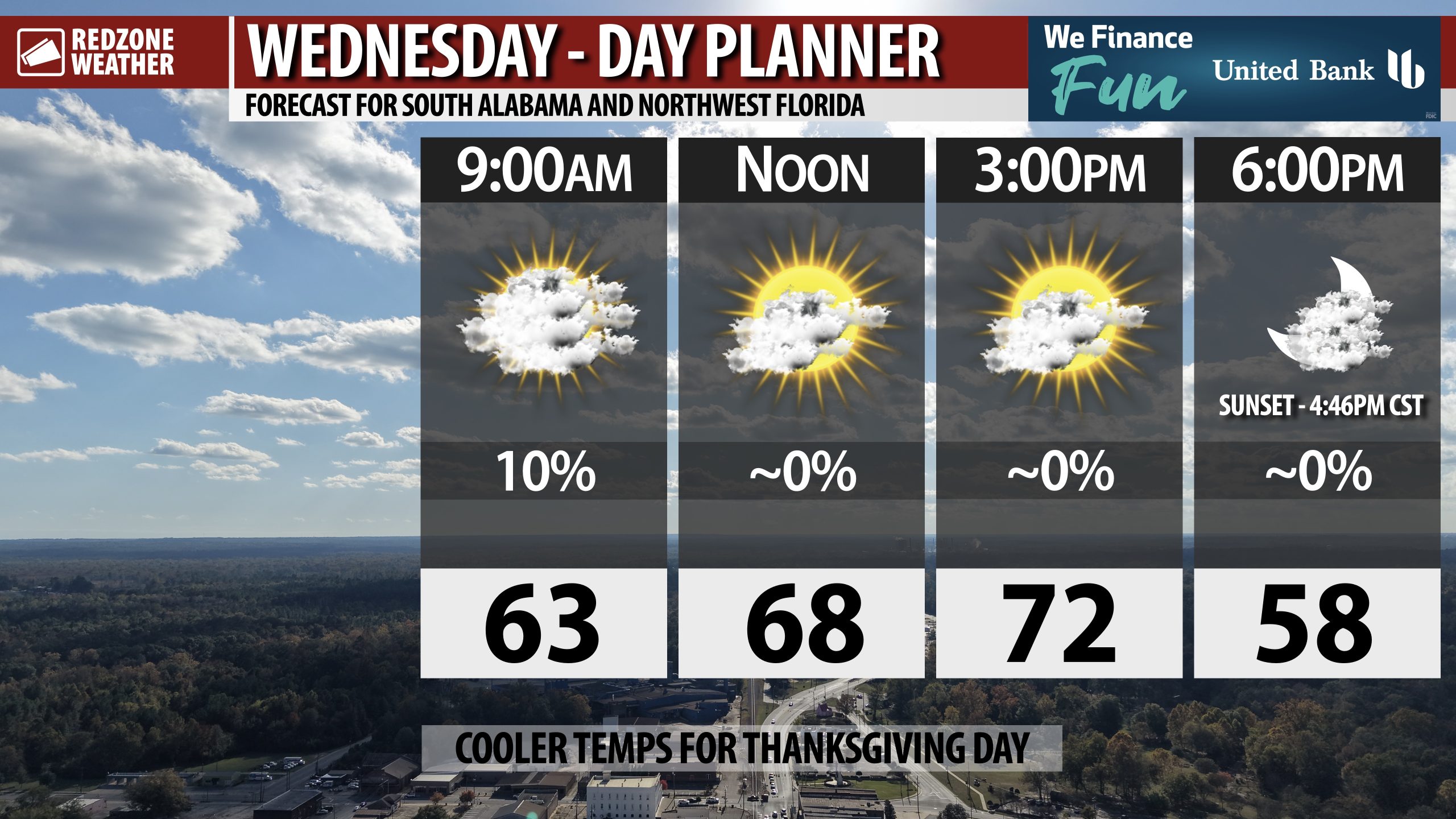
CLEARING SKIES TODAY; COLD TEMPS OVERNIGHT; SUNNY THANKSGIVING… Skies will gradually clear from west to east on this Wednesday. More sunshine is expected by the end of the day. High temperatures will range from the mid 60s further inland to the mid 70s closer to the Alabama and northwest Florida beaches. Tonight will be quite chilly with overnight lows in the 30s across the region. We have nice weather upcoming for Thanksgiving, Friday, and Saturday ahead of more showers and thunderstorms becoming possible on Sunday into Monday.
BEAUTIFUL, COOL WEATHER FOR THANKSGIVING DAY… The forecast for Thanksgiving Day across south Alabama and northwest Florida features plenty of sunshine. Highs will be in the upper 50s and low 60s across the region. It will be a near perfect weather pattern to get outside during the afternoon hours.
MORE SUNSHINE FOR BLACK FRIDAY; SLIGHTLY WARMER SATURDAY… Skies will remain mostly sunny on Black Friday. If you’re headed out for early morning shopping, temperatures will be quite chilly. Most locales will start the day near the freezing mark. Highs will be in the upper 50s by 2PM. Partly cloudy skies are expected across the local area on Saturday. High temperatures will be in the low 60s.
IRON BOWL FORECAST… The Iron Bowl will be played in Auburn, AL on Saturday with kickoff happening at 6:30PM CST. The game will be televised on ABC. Partly cloudy skies are expected during the game with kickoff temperatures near 51°. Temperatures will quickly fall into the upper 40s. Grab the jackets if you’re headed to the big game!
RAIN & STORMS POSSIBLE SUNDAY INTO MONDAY… Our local area will probably have a more unsettled weather pattern as we get into Sunday and Monday. Multiple chances of scattered showers and storms seem likely. For now, we’re holding rain chances at a 40% chance on both Sunday and Monday until we get a bit closer to the event when confidence will increase. I am optimistic we may have more rain with this event compared to the last few frontal boundaries that have moved through our region.
TROPICS QUIET; END OF SEASON APPROACHING… The 2025 Atlantic Hurricane Season officially comes to an end on Sunday, November 30. We probably have seen the final named storm (Melissa) of the season. The Gulf, Caribbean Sea, and Atlantic Ocean remain quiet with no new named storms expected to form over the next 5-7 days.
APP… If you haven’t already downloaded the RedZone Weather app, now is a great time to do that. redzoneweather.com/app is the link to the free download. Once you have the RZW app installed on your iOS or Android device, be sure to visit the Alerts tab to turn on the specific notifications you’d like to receive. All notifications are handcrafted by me. No automation and we promise not to bug you!
See all the details in your Wednesday morning RedZone Weather forecast video. My next forecast video will be posted by 7:15AM tomorrow morning. I will have updates posted throughout the day, as needed, in the RedZone Weather app.
Have a great Wednesday!