
1:57PM June 19, 2026
Severe Thunderstorm Warning for Walton County in FL until 3:00pm.
— Spinks Megginson (@rzweather) June 19, 2026

Severe Thunderstorm Warning for Walton County in FL until 3:00pm.
— Spinks Megginson (@rzweather) June 19, 2026
Severe Thunderstorm Warning for northern Okaloosa County, far southwest Covington County, and for areas near Roberts and Bradley in Escambia County (AL).
Auburn (FL), Campton, Blackman, Good Hope, Laurel Hill included.
Damaging wind gusts up to 60 mph possible. LOTS of… pic.twitter.com/vVtEvsb0YW
— Spinks Megginson (@rzweather) June 19, 2026

Getting numerous reports over the last few minutes of power outages in eastern Covington County, specifically around Opp.
Heavy storms in Covington County have moved into Onycha, Green Bay, Florala, and Lockhart. Be inside!
Storms continue to become stronger in parts of Conecuh https://t.co/w6a9q4e7G6
— Spinks Megginson (@rzweather) June 19, 2026

Severe Thunderstorm Warning till 2PM for parts of Geneva (AL), Walton, Holmes, and Washington (FL) counties. This includes DeFuniak Springs, Geneva, Vernon, Mossy Head, and Glendale.
Damaging wind gusts up to 60 mph are the main concern.
This is being issued for the storms https://t.co/zDEuk84VD1
— Spinks Megginson (@rzweather) June 19, 2026

Severe Thunderstorm Warning for Walton County in FL until 2:00pm.
— Spinks Megginson (@rzweather) June 19, 2026

Severe Thunderstorm Warning for Geneva County in AL until 2:00pm.
— Spinks Megginson (@rzweather) June 19, 2026

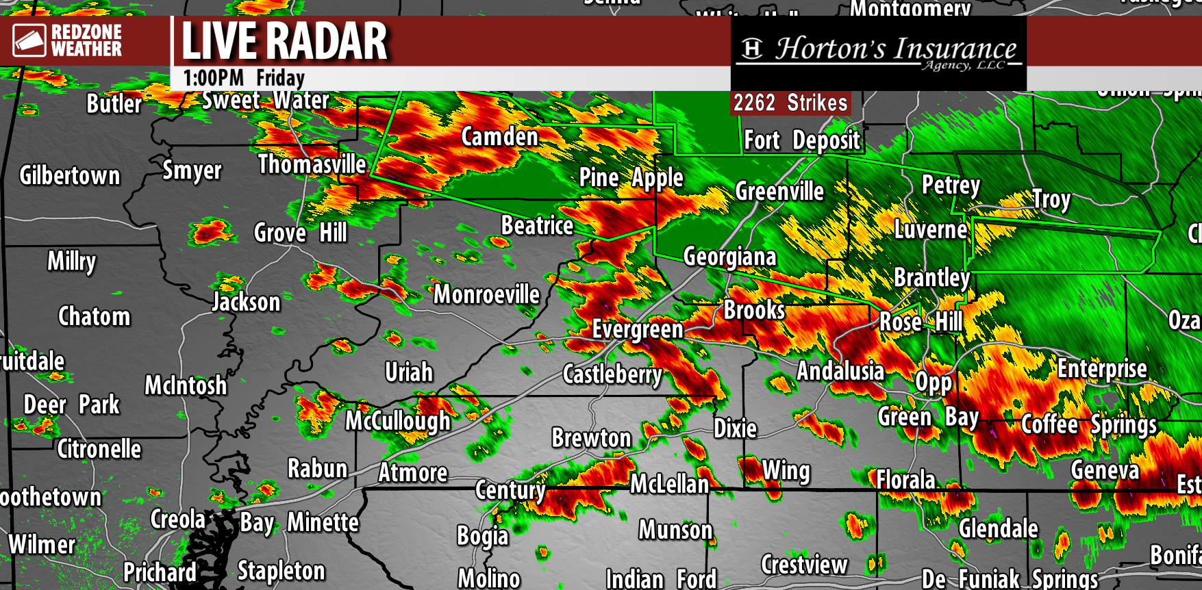
STRONG STORMS WITH INTENSE LIGHTNING MOVING SOUTHEAST… Numerous thunderstorms have developed across south Alabama and interior stretches of northwest Florida this afternoon. These storms are just under severe limits in most cases, for now. The strongest storms locally are happening near Andalusia, Straughn, Opp, Babbie, and Gantt in Covington County. These storms are capable of producing 40-50 mph wind gusts while moving southeast toward Libertyville and Onycha.
Strong storms have also developed near Evergreen, Belleville, Lyeffion and Johnsonville.
Heads up also if you’re near Jay, Dixonville, Thomasville, Gosport, McCullough, Huxford, and Wing. Spotty storms are strengthening near these communities as well.
WHAT TO EXPECT – NEXT FEW HOURS… Scattered thunderstorms will likely continue to increase in coverage and intensity across the region. This, unfortunately, means that widespread flash flooding may quickly become a concern today, mainly because the ground is so incredibly saturated after the 6-12″ rain totals yesterday. In addition to the significant flash flooding concerns, pockets of damaging wind gusts and a brief tornado or two will be possible in the strongest of the storms.
We encourage everyone to have multiple ways to hear warnings into this evening. PLEASE heed the flash flood warnings today and do NOT attempt to drive through a water-covered roadway!
I will have radar updates posted throughout the afternoon and evening in the RedZone Weather app.
