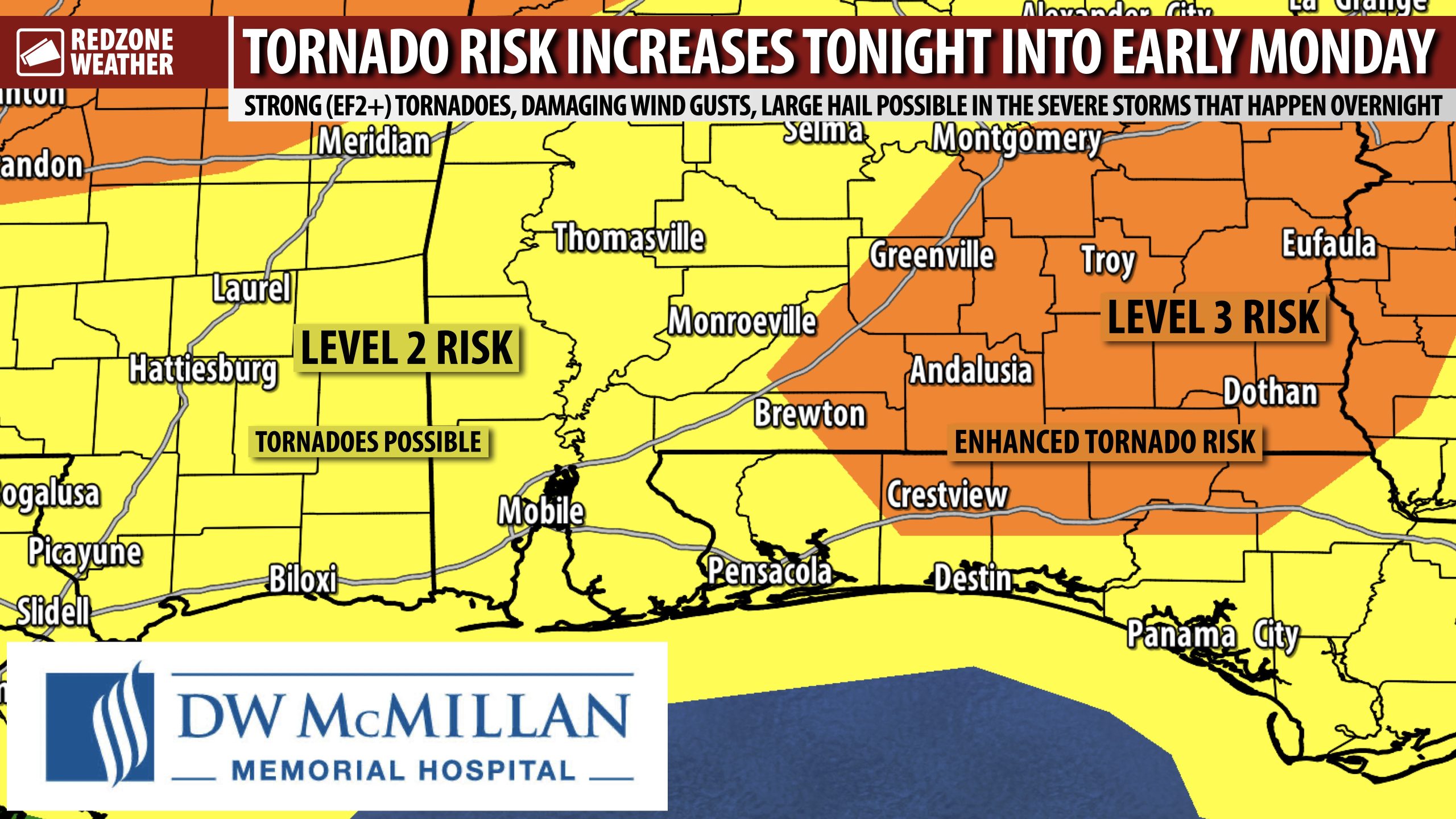
OUTLOOK UPGRADE: TORNADO RISK INCREASES TONIGHT INTO EARLY MONDAY… The Storm Prediction Center has upgraded parts of south Alabama and northwest Florida into their Level 3 (out of 5) enhanced severe weather risk zone, driven by an increasing risk of tornadoes overnight into early Monday morning. Unlike the round of storms that happened a few days ago with a squall line, the event tonight looks to be a few supercell thunderstorms (out ahead of the squall line) followed by the squall line itself. That means we will have a risk of tornadoes and large hail first followed by a risk of damaging wind gusts and tornadoes when the fast-moving squall line pushes through and brings the severe weather event to a close. This will all happen in the overnight hours tonight. We strongly encourage everyone to have multiple ways to hear warnings tonight. You need something loud, like a NOAA Weather Radio, that can wake you up in case your location goes under a tornado warning.
SEVERE WEATHER TIMING – TONIGHT INTO MONDAY MORNING… 11PM tonight to 8AM Monday current window for strong to severe thunderstorms across south Alabama and northwest Florida. Severe thunderstorms are likely much earlier across areas to our northwest in Arkansas and Mississippi this afternoon into this evening. Please have a way to hear warnings tonight into Monday morning!
A FEW STRONG TORNADOES POSSIBLE… The latest discussions from the local National Weather Service office and from the Storm Prediction Center indicate that a few strong (EF2+) tornadoes will be possible with this event tonight. Unlike the very brief tornadoes that happen in squall lines, supercell-induced tornadoes usually are stronger and last longer, thus causing more damage. If supercells begin developing overnight, we will need to monitor for rapid tornado development as shear values are quite high with this event. People that have the best outcomes in tornadoes have a few things in common: 1) They’re able to hear warnings with multiple devices. 2) They have a PLAN of where they would go and what they would do if a tornado warning is issued for their location. 3) They take decisive action when a warning is issued and don’t wait around to see what will happen. This is the recipe for safety during tornado situations! Have a plan, get the warnings, do something about it!
I will have more updates posted throughout the day in the RedZone Weather app.
TORNADO WARNING POLICY… Any time there is an active tornado warning in effect for southwest Alabama or northwest Florida, we provide uninterrupted, live video coverage on Facebook Live and YouTube Live. Our detailed coverage commitment is outlined at redzoneweather.com/coverage. We are proud to cover all parts of Escambia (AL), Covington, Monroe, Conecuh, Baldwin, Mobile, Clarke, Washington (AL), Butler, Escambia (FL), Santa Rosa, and Okaloosa counties. If you live in any locale in those counties, be sure to tune into our coverage whenever there is an active tornado warning!
APP ALERTS… redzoneweather.com/app is the link where you can download the free RedZone Weather app. We post brief updates throughout each day in the app, keeping you up-to-date about the latest happenings in weather across south Alabama and northwest Florida. Once you have the free app downloaded to your iOS or Android device, be sure to visit the Alerts tab (lower right corner) then tap the large Alert Settings button to customize the alerts you would like to receive straight from me.
Have a great Sunday!
