
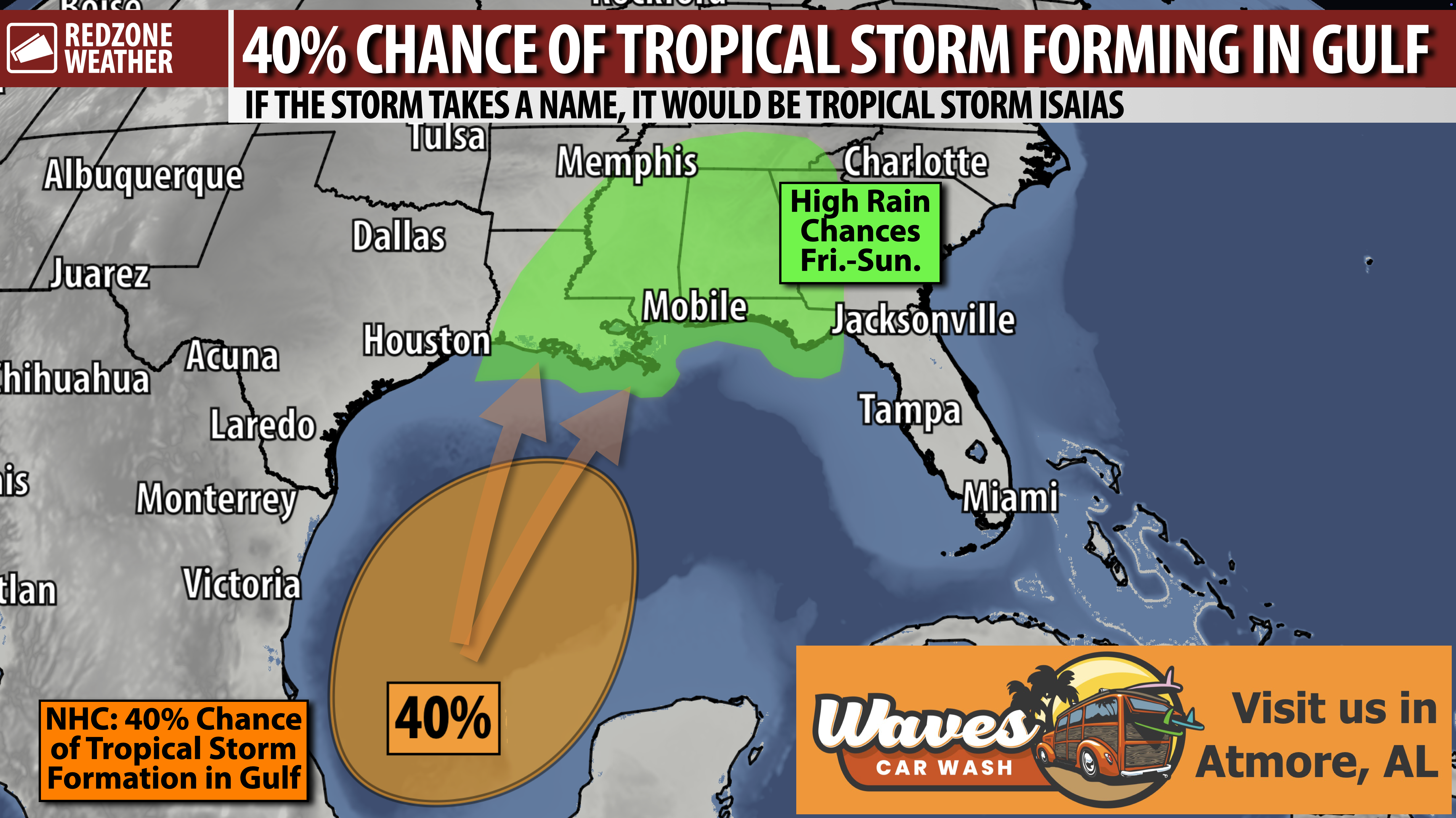
TROPICAL SYSTEM LIKELY TO BRING RAIN, PERHAPS OTHER IMPACTS, TO LOCAL AREA LATER IN WEEK… We’re looking at another very wet pattern setting up in a few days as a developing tropical storm takes shape in the Gulf. The odds of a tropical storm forming in the southern or western Gulf have increased to a 40% chance this evening. Confidence is growing that heavy rain will be possible into the upcoming weekend due to this system across parts of the Deep South, including in south Alabama and northwest Florida. Depending on the intensity of the storm, we will need to monitor a potential tornado threat along with a potential for high winds, storm surge, and other coastal hazards IF the system becomes a named tropical storm. Details will become much more clear in the days ahead.
POTENTIAL LOCAL IMPACTS – ALABAMA & N.W. FLORIDA… Since impacts from this system will be possible 5-6 days from now, it remains far too early to be able to give any real specifics. These details will become much more clear over the next few days. At minimum, I am expecting higher rain chances coming into our local area on Friday and into Saturday and Sunday. There is a chance that one or two of the days could be “all day washouts” with numerous periods of rain and storms. In addition, minor coastal flooding, a high risk of rip currents, and high surf may become possible at the local beaches. It is too early to know if a tornado risk or a widespread damaging wind risk will exist. This is something I will be carefully monitoring in the days ahead. Please check back in for updates.
COULD THIS BECOME A HURRICANE?… The probability of the system setting up in the southern Gulf becoming a tropical storm continues to increase. NHC odds of a tropical storm developing are now at a 40% chance. We note that some of the traditional models and AI models ramp the system up to hurricane intensity before a northern Gulf Coast landfall later this week or this weekend. That does NOT mean, for sure, that a hurricane will happen. In fact, some models (like the usually reliable ECMWF/Euro) show the system remaining BELOW tropical storm status and being disorganized on approach to the northern Gulf Coast. The best estimate of what will happen is probably in between those two extreme scenarios. The most likely scenario is a tropical storm developing and moving north toward Louisiana, Mississippi, Alabama, and/or Florida later this week. More question marks than answers at this point surrounding intensity.
LIMITING FACTOR: QUITE A BIT OF SHEAR… One of the things that may ultimately hinder the system from becoming a hurricane is the high amount of atmospheric shear in place across the northern Gulf right now. This shear could rip the system apart and keep it rather weak. On the flip side, if shear subsides a bit, there is a chance this developing storm could be a bit stronger, perhaps as a strong tropical storm or hurricane on approach.
WHAT TO EXPECT – TONIGHT INTO MONDAY… Rain and thunderstorms will continue to be possible at times through tomorrow at midday. The low-end tornado risk that happened earlier today is now likely over. Rain and storms will move to our east tomorrow afternoon. Drier weather is expected Tuesday through Thursday ahead of the higher rain chances setting up for the weekend.
APP… Be sure to have the free RedZone Weather app installed on your phone to keep up with the latest weather information across south Alabama and northwest Florida. redzoneweather.com/app is the link for the free download. After installing the app, visit the Alerts tab to choose exactly which notifications you’d like to receive.
My next forecast video will be posted by 7:15AM Monday morning with the latest information.
Have a nice Sunday night!
