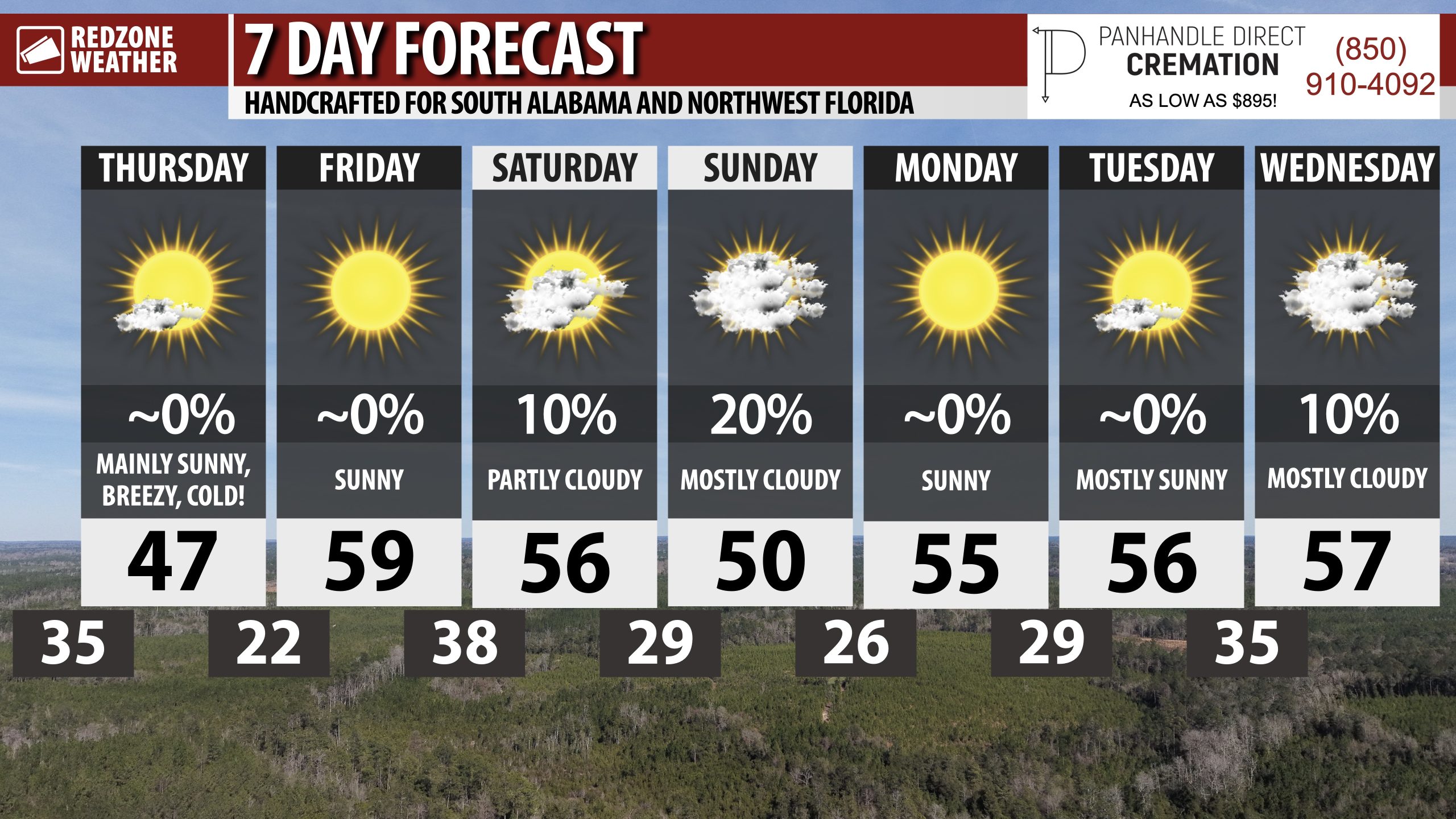
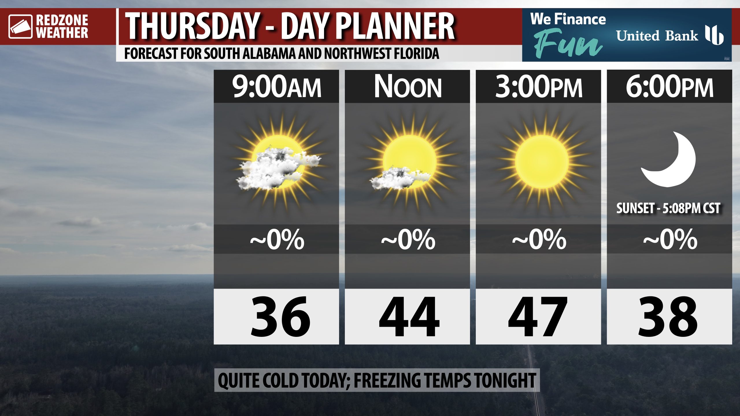
COLD, WINDY THURSDAY; SNOW SHOWERS POSSIBLE SATURDAY NIGHT… Winter is in full swing today and in the days ahead across south Alabama and northwest Florida. Temperatures today will struggle to get to the upper 40s in most communities across the region. Breezy conditions are likely throughout the day with wind gusts as high as 25 mph being possible this afternoon. Most communities will have afternoon highs in the 43-47° range. We quickly dive below the freezing mark after 8PM tonight. Overnight lows will be in the low to mid 20s across much of the area by 6AM Friday. We’ll be dry today, tonight, and Friday ahead of our next chance of precipitation – which could come in the form of rain and perhaps some snow on Saturday night.
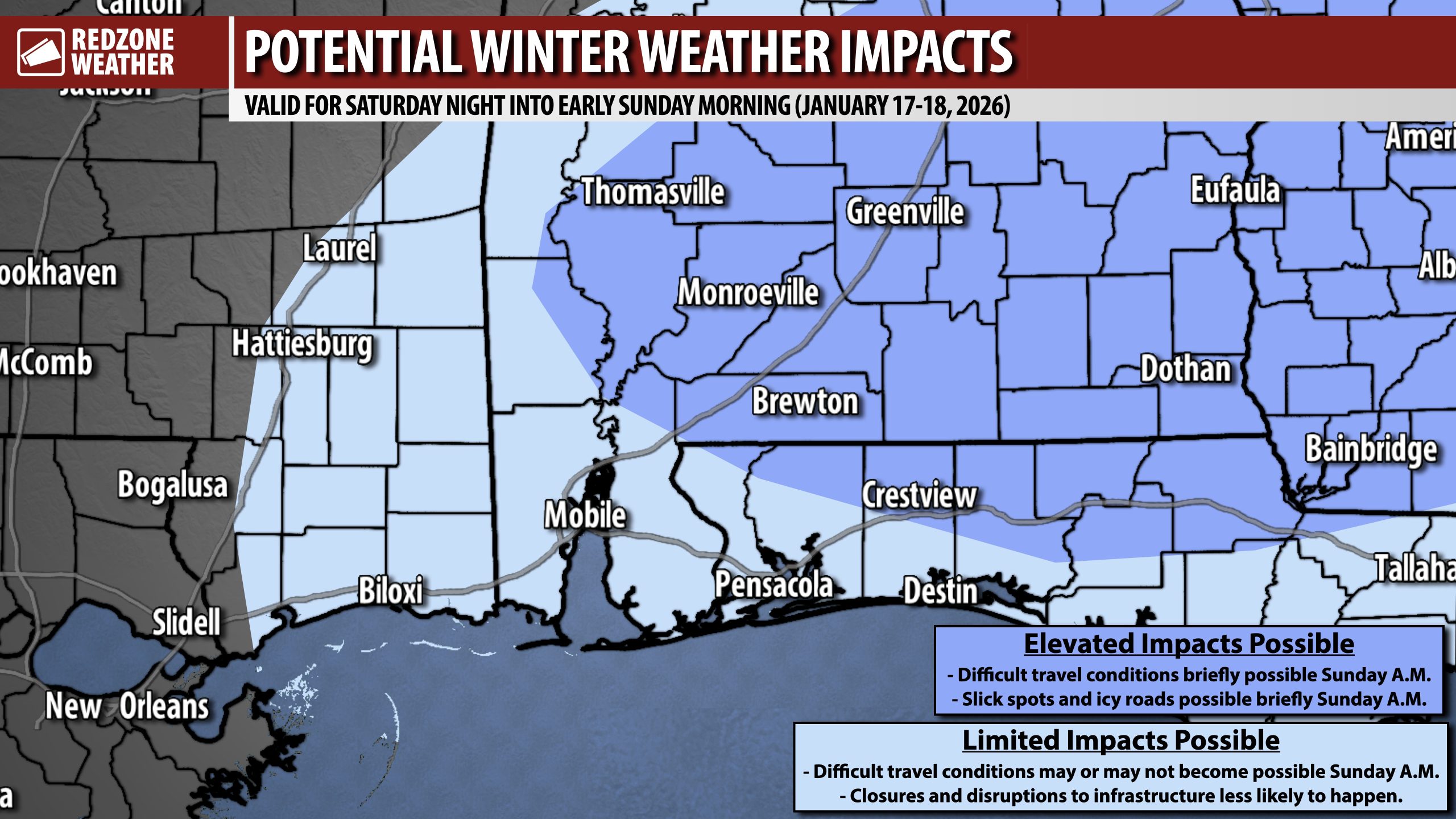
AN UPDATE ON THE SNOW POTENTIAL FOR THE WEEKEND… Overnight model guidance has continued to trend toward a much wetter/snowier solution compared to this time yesterday. That means parts of our local area may very well have rain showers that transition to snow showers on Saturday night into Sunday morning. It remains too early to resolve any type of precision as far as which communities have the highest chance of snow AND who will have accumulation, if any happens. Confidence is quite high that cold air will be in place on Saturday, Saturday night, and into Sunday. The question mark is the precipitation placement. Will we have enough moisture to cause widespread rain and snow? We simply do not know yet. See my rundown in the morning video for more thoughts.
COLD TEMPS TO PERSIST INTO EARLY NEXT WEEK… High temperatures on Sunday will be in the 40s and low 50s with overnight lows well into the 20s by Sunday night and potentially Monday night as well. Temperatures will remain below our climatological norms through at least the middle part of the upcoming week.
APP… If you haven’t already downloaded the RedZone Weather app, now is a great time to do that. redzoneweather.com/app is the link to the free download. Once you have the RZW app installed on your iOS or Android device, be sure to visit the Alerts tab to turn on the specific notifications you’d like to receive. All notifications are handcrafted by me. No automation and we promise not to bug you!
See all the details in your Thursday RedZone Weather forecast video. My next forecast video will be posted by 7:15AM tomorrow morning. I will have updates posted throughout the day, as needed, in the RedZone Weather app.
I hope you have a great Thursday!