8:11PM February 3, 2026
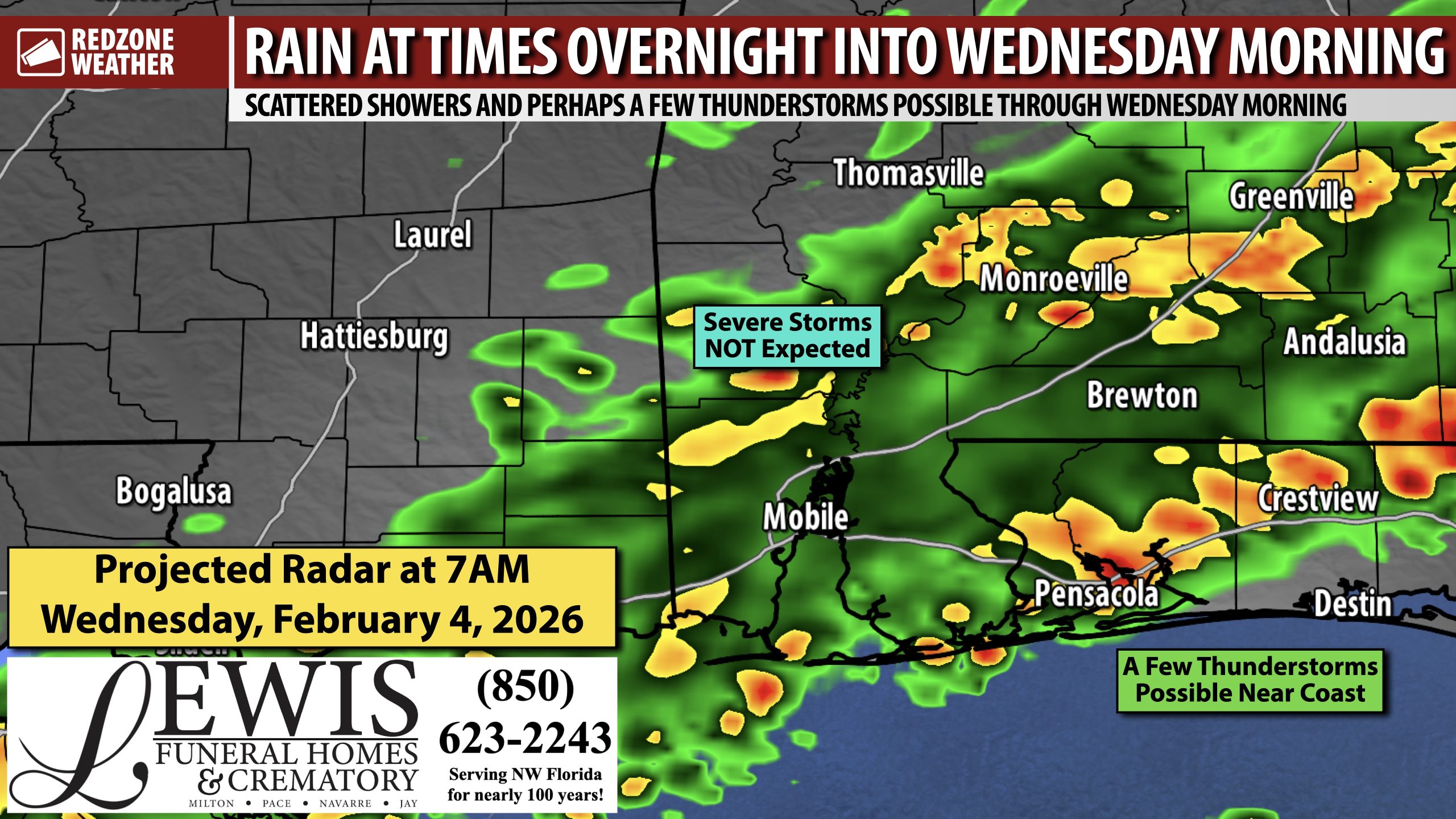
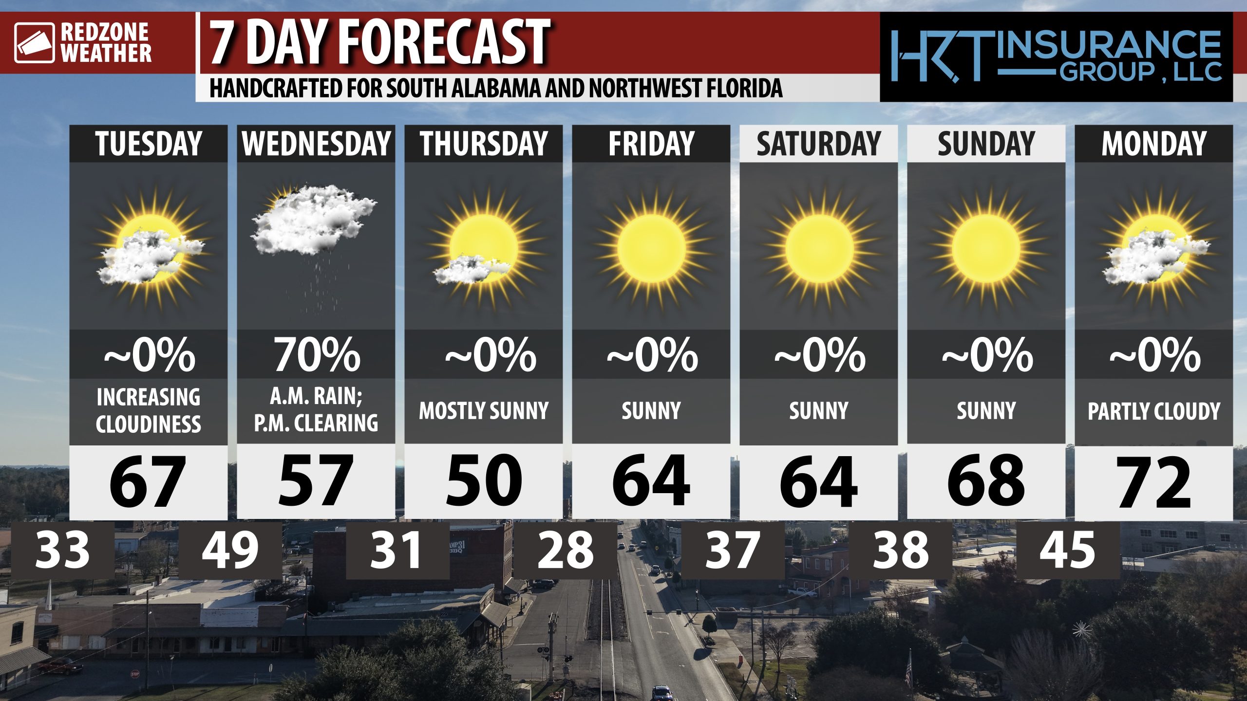
SHOWERS & STORMS THRU WEDNESDAY MORNING; NOT EXPECTING SEVERE STORMS… Rain and perhaps a few thunderstorms will be possible at times overnight into Wednesday morning. Thankfully, I am not expecting severe storms with this system. Rain amounts, in total, will generally be in the 0.25″ to 1″ range when all the rain ends tomorrow. A few claps of thunder will be possible near the coast, but I expect RAIN to be the norm tomorrow morning. Widespread flash flooding is not expected.
TIMING – RAIN & STORMS… Scattered showers are happening now across parts of southwest Alabama. The main window for rain and storms will happen from 11PM tonight through 11AM tomorrow morning. Widespread thunderstorms are not expected, but a few rumbles of thunder will be possible around the Alabama and northwest Florida beaches. Severe storms are not expected.
COLD AIR RETURNS TOMORROW… Rain will clear out to our east by the early afternoon hours tomorrow. Cold, dry air moves in tomorrow evening. Overnight lows will be in the 20s inland with low 30s closer to the coast tomorrow night. High temperatures on Thursday will only be in the 40s and 50s with warmer air returning for the weekend.
APP… If you haven’t already, be sure to download the free RedZone Weather app to keep up with all the latest information on the world of weather in south Alabama and northwest Florida. redzoneweather.com/app is the link for the free download. Once you have the app downloaded to your iOS or Android device, be sure to visit the Alerts tab (lower right corner) and tap the Alert Settings button to customize the alerts you would like to receive straight from me.
I will have the latest forecast rundown posted in the morning forecast video tomorrow morning at 7:15AM. Be sure to join me then for the latest info.
Have a great Tuesday evening!