11:36AM January 23, 2026
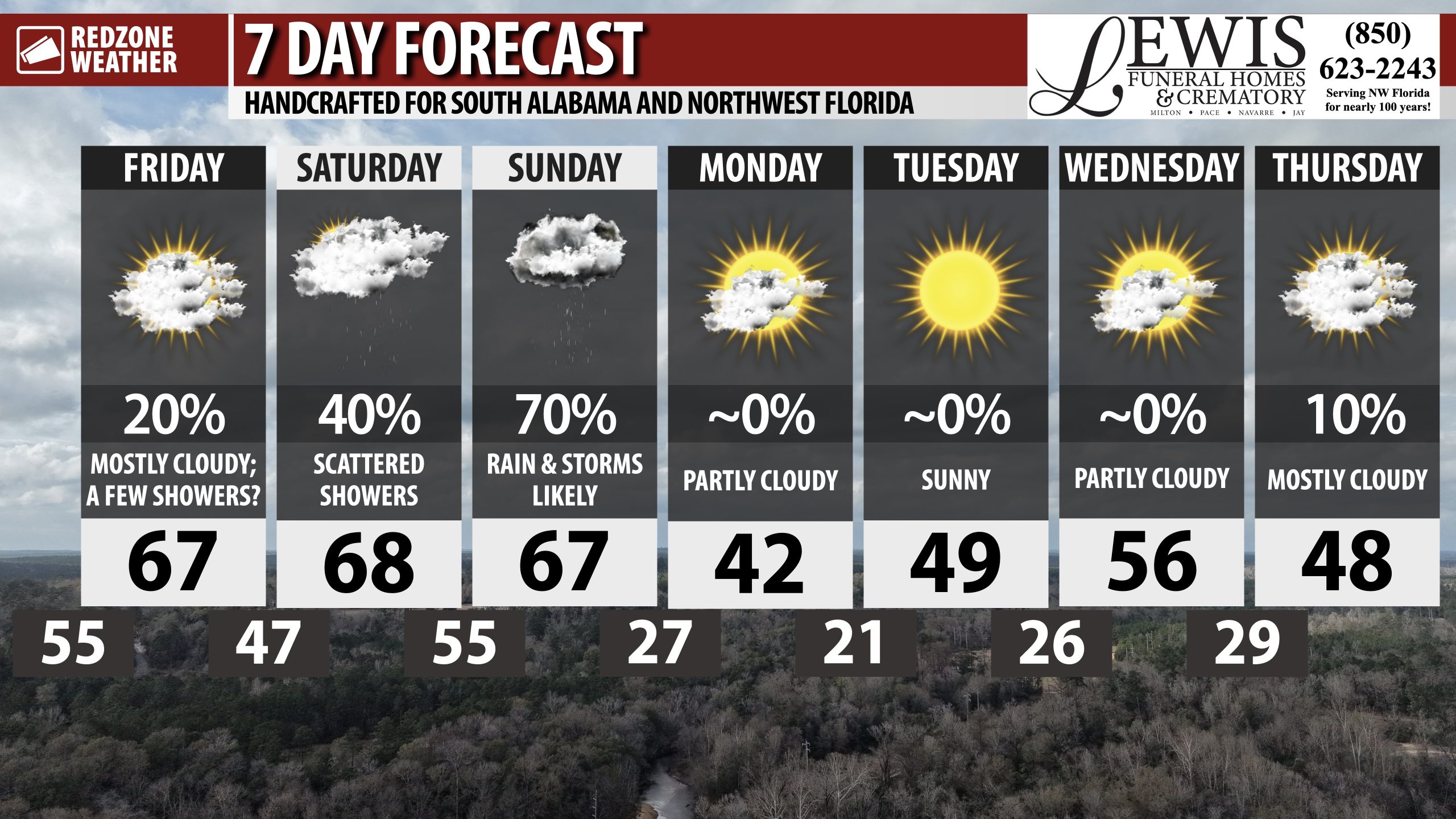
Extreme Cold Watch issued for ALL of southwest Alabama and northwest Florida valid Sunday night into Monday morning. Wind chill values in the single digits will be possible.
VERY cold conditions next week! pic.twitter.com/Ps6TT3HBoX
— Spinks Megginson (@rzweather) January 23, 2026