
6:20PM July 29, 2026
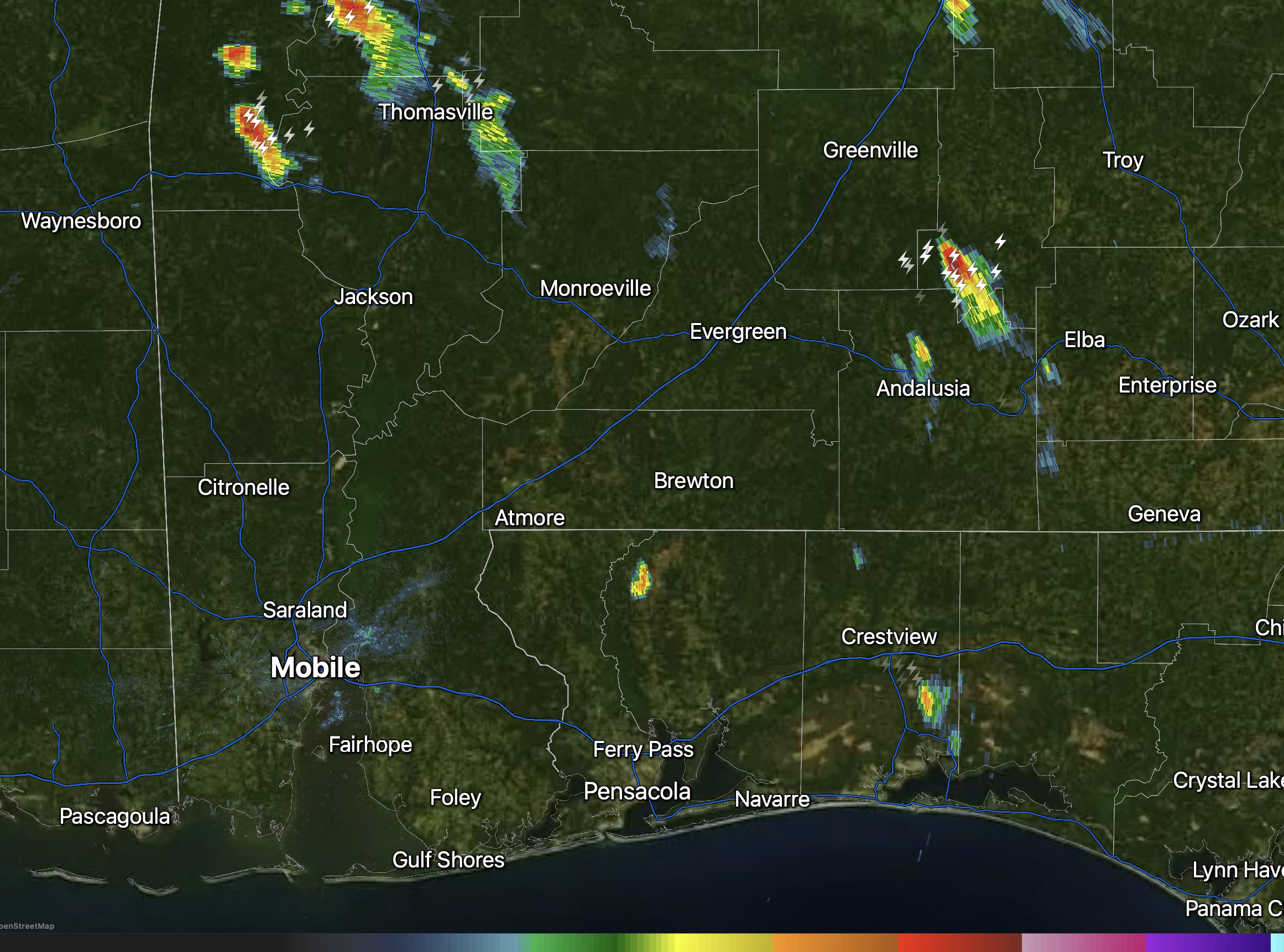
SPOTTY STORMS DRIFTING SOUTH… Scattered showers and storms continue to develop and drift south this evening. Rain is happening near Thomasville, Rose Hill, and Coffeeville.

SPOTTY STORMS DRIFTING SOUTH… Scattered showers and storms continue to develop and drift south this evening. Rain is happening near Thomasville, Rose Hill, and Coffeeville.
Only a few isolated showers and thunderstorms are in progress across the region this evening just after 5 o’clock.
Rain is happening near Gulf Breeze, Pensacola Beach, Beulah, Crestview, Baker, Appleton, Greenville, and Thomasville.
I expect an increase in coverage in pop-up https://t.co/ZdIXF3BJyH
— Spinks Megginson (@rzweather) July 29, 2026

Storms have popped up on the western side of the Pensacola metro.
These storms are slowly drifting south.
Occasional cloud-to-ground lightning is happening. https://t.co/0WKqJHA5Yv
— Spinks Megginson (@rzweather) July 29, 2026

Spotty thunderstorms are developing near Mobile Bay and near the Alabama beaches.
Downpours are happening near the south side of Foley, Gulf Shores, Orange Beach, Perdido Key, Dog River, and Alabama Port. https://t.co/4ikYXnWnjg
— Spinks Megginson (@rzweather) July 29, 2026

El Niño. https://t.co/5KafEBExY8
— Spinks Megginson (@rzweather) July 29, 2026

RT @NWSMobile: Reminder:🥵 We’ll see another round of EXTREME heat – mainly along coastal areas today! Remember, if spending time outdoors:…
— Spinks Megginson (@rzweather) July 29, 2026

Rain chances will increase this weekend. Probably won’t be an all day rain event on Saturday, but we will likely have a higher coverage of pop-up showers and storms.
After today, high temperatures will ease back to near 90° over the next few days. https://t.co/0XhTMll2nC
— Spinks Megginson (@rzweather) July 29, 2026
