6:28AM December 22, 2025
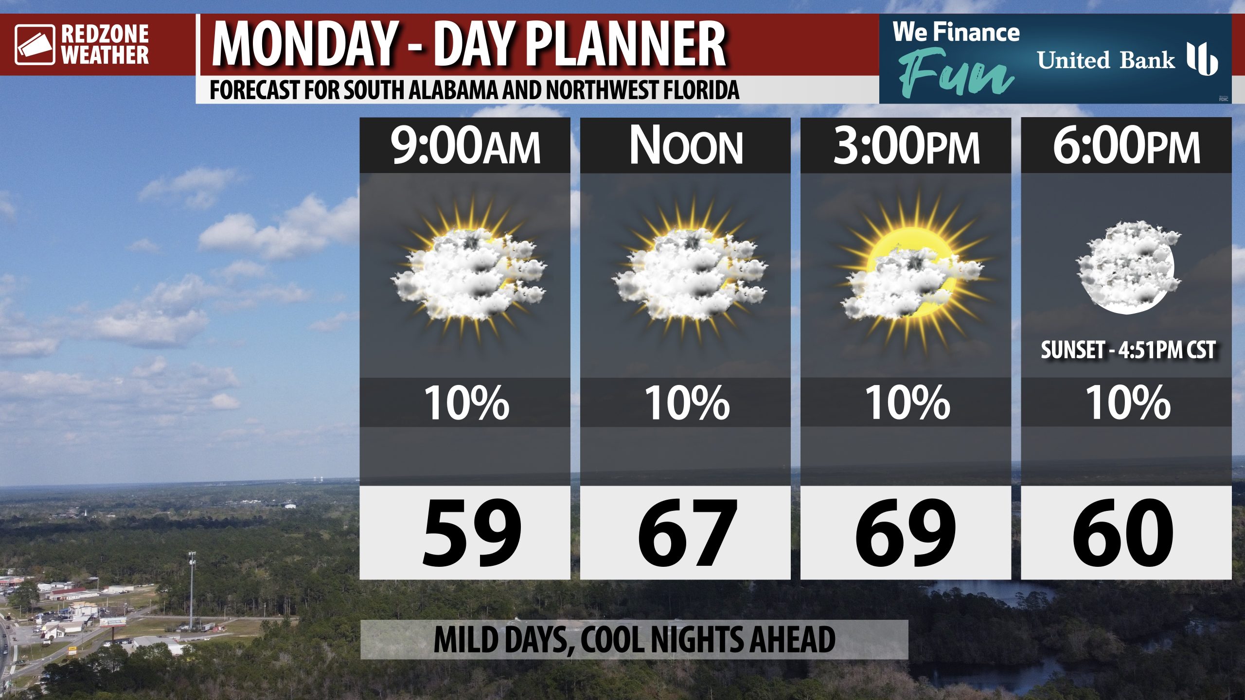
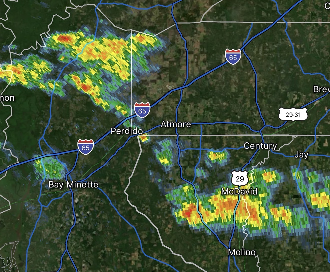
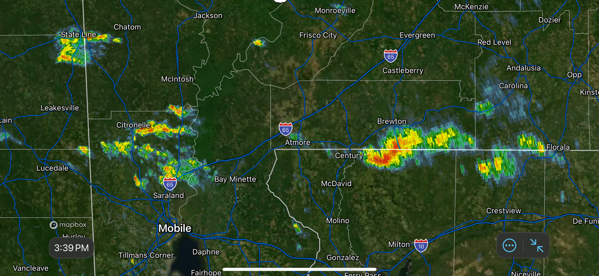
FEW SHOWERS POSSIBLE TODAY… Isolated showers will be possible today, mainly across parts of west Alabama. Most locations across south Alabama and northwest Florida will remain dry.
High temperatures will be near the 70 degree mark this afternoon.
Have a great start to your week!