
2:30PM October 4, 2026
Flash Flood Warning for Mobile County in AL until 5:30pm Sunday.
— Spinks Megginson (@rzweather) October 04, 2026

Flash Flood Warning for Mobile County in AL until 5:30pm Sunday.
— Spinks Megginson (@rzweather) October 04, 2026
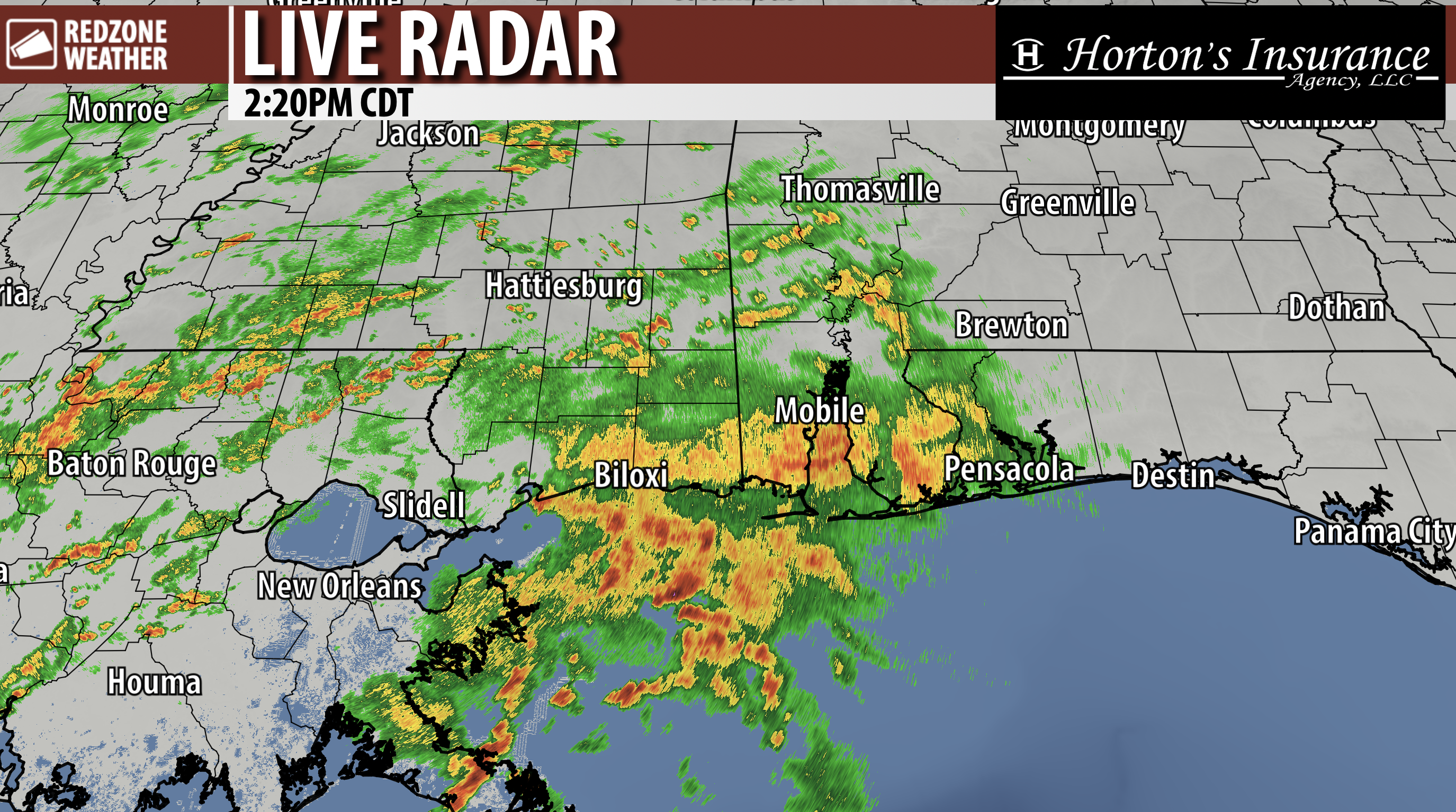
RAIN CONTINUES TO MOVE IN FROM THE SOUTHWEST… This is the current radar data from the KHDC NEXRAD site in Hammond/New Orleans, Louisiana, showing scattered to numerous showers and thunderstorms continuing to stream into south Alabama and northwest Florida from the southwest on this Sunday afternoon.
The local radars (Mobile, Eglin AFB, and Ft. Rucker) remain down due to communications issues.
Rain will continue to move in over the next several hours.

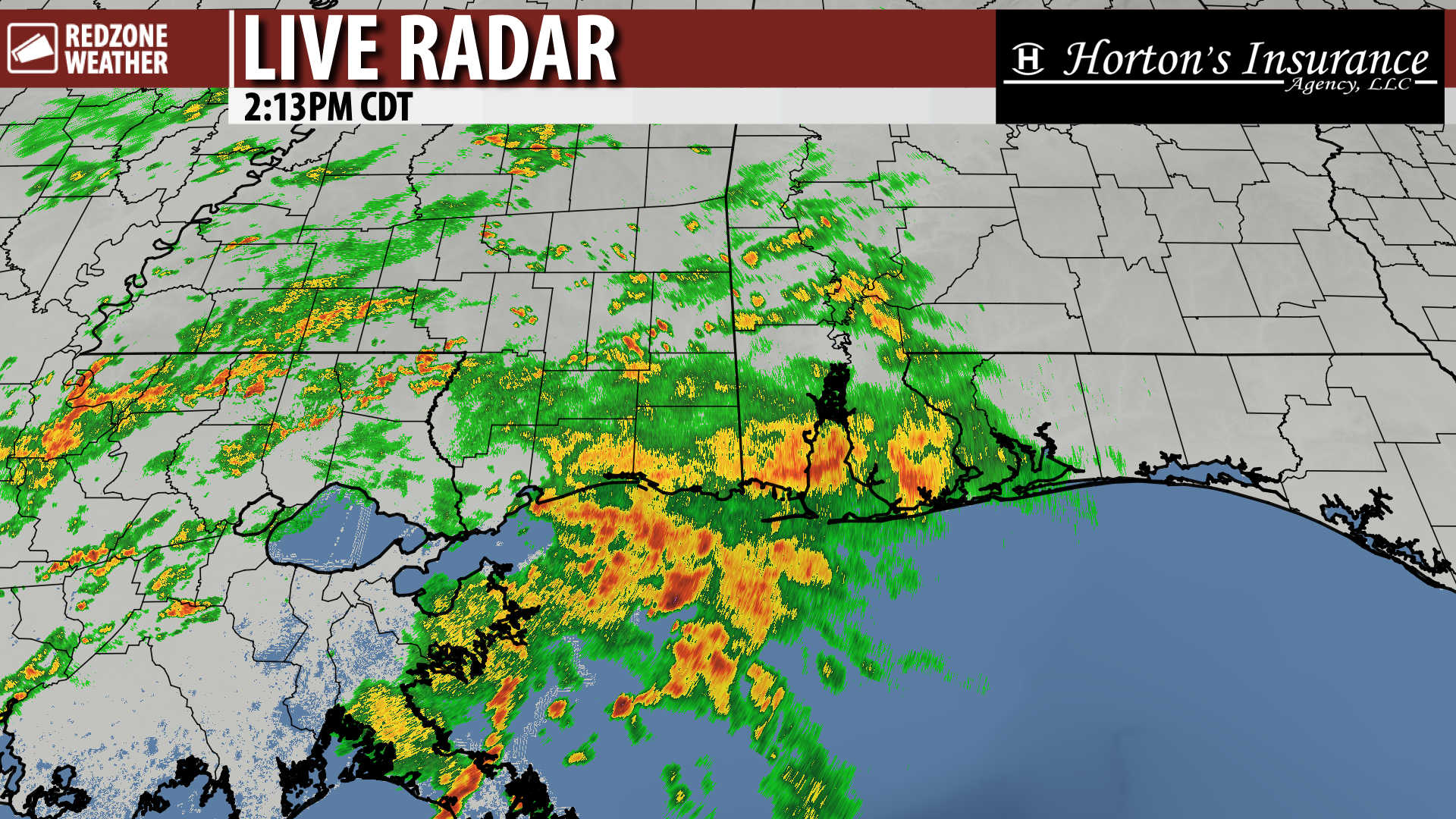
RAIN CONTINUES TO PUSH IN FROM SOUTHWEST… Scattered showers and occasional thunderstorms continue to push into south Alabama and northwest Florida from the southwest this afternoon. A Flash Flood Warning continues near Foley in southern Baldwin County until 4:45PM. Several flood advisories are also in effect near the coast in Alabama and northwest Florida.
Rain and storms will continue to move into our region over the next several hours. Some communities further inland have remained mostly dry today, so far, but rain will become more likely as we get into the evening hours.
LOCAL NEXRAD RADAR OUTAGE CONTINUES… All 3 of our primary local NEXRAD radars remain down this afternoon.
KMOB – Mobile, AL
KEVX – Eglin AFB, FL
KEOX – Ft. Rucker, AL
2 other radars are also out.
KTLH – Tallahassee, FL
KVAX – Moody AFB, GA
Estimated restoration is “by 11PM CDT tonight.”
It should be emphasized that the local National Weather Service offices in Mobile and Tallahassee still have access to at least one of their local radars (the ones that are down) but that data is NOT making it to the outside world. So that’s a positive in this bad situation. They can still issue warnings!
So what happens if we get a tornado warning locally? My plan would be to “go live” per our longstanding coverage policy outlined at https://www.redzoneweather.com/coverage and use the long distance radars AND one-minute satellite imagery to do our best to get you through it.
Thankfully, I am not expecting numerous tornado warnings today.

📡 Radar Outage Update
All 3 of our primary local NEXRAD radars remain down this afternoon.
KMOB – Mobile, AL
KEVX – Eglin AFB, FL
KEOX – Ft. Rucker, AL2 other radars are also out.
KTLH – Tallahassee, FL
KVAX – Moody AFB, GAEstimated restoration is “by 11PM CDT tonight.”
— Spinks Megginson (@rzweather) October 04, 2026

Flash Flood Warning till 4:15PM for parts of southern Baldwin County, including Foley, Magnolia Springs, Summerdale, Elberta, Miflin, and Bon Secour.
Got a viewer report about 10 minutes ago indicating worsening street flooding in Foley. Stay off the roads near Foley if https://t.co/jFeFoUM4ze
— Spinks Megginson (@rzweather) October 04, 2026

Notice that our area (southwest Alabama and northwest Florida) has FRINGE coverage from Montgomery and Hammond/New Orleans.
There is ZERO radar coverage right now near Panama City, Port St. Joe, Apalachicola, Carrabelle, and St. Marks.
I hope there will be a major investigation https://t.co/3l9PD1qhch
— Spinks Megginson (@rzweather) October 04, 2026

Flash Flood Warning for Baldwin County in AL until 4:15pm Sunday.
— Spinks Megginson (@rzweather) October 04, 2026
