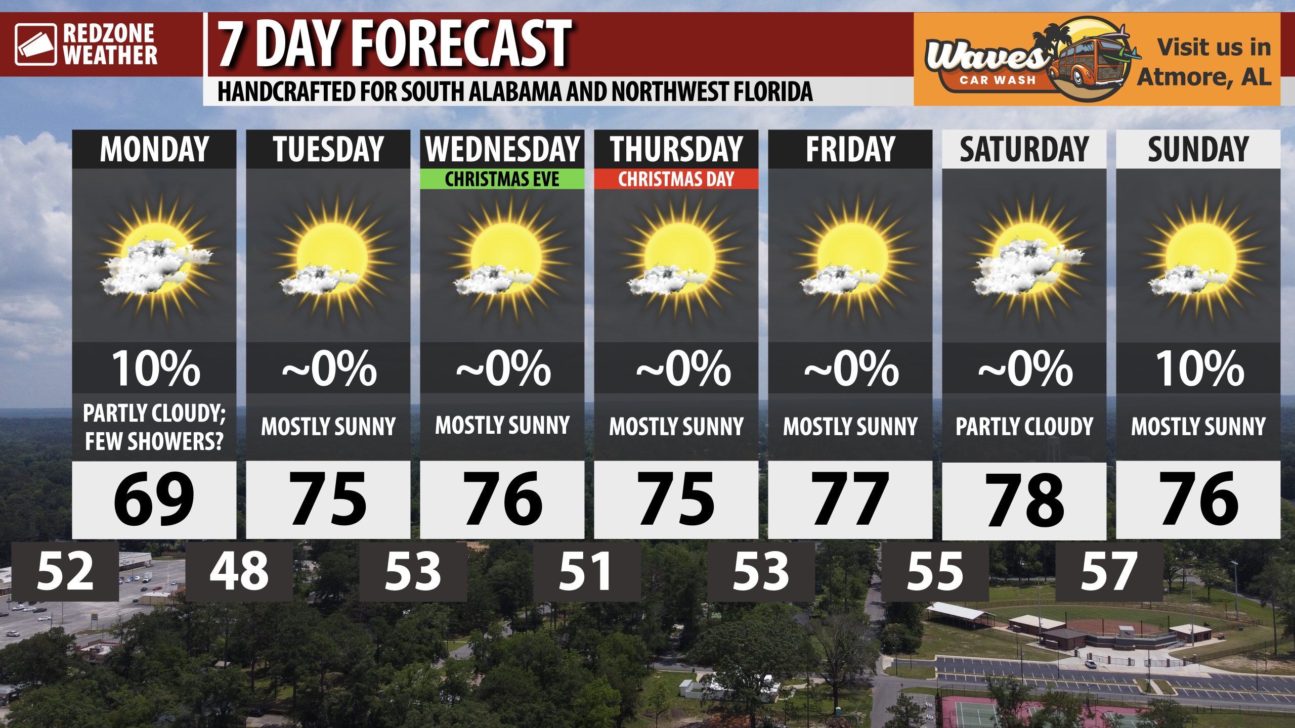
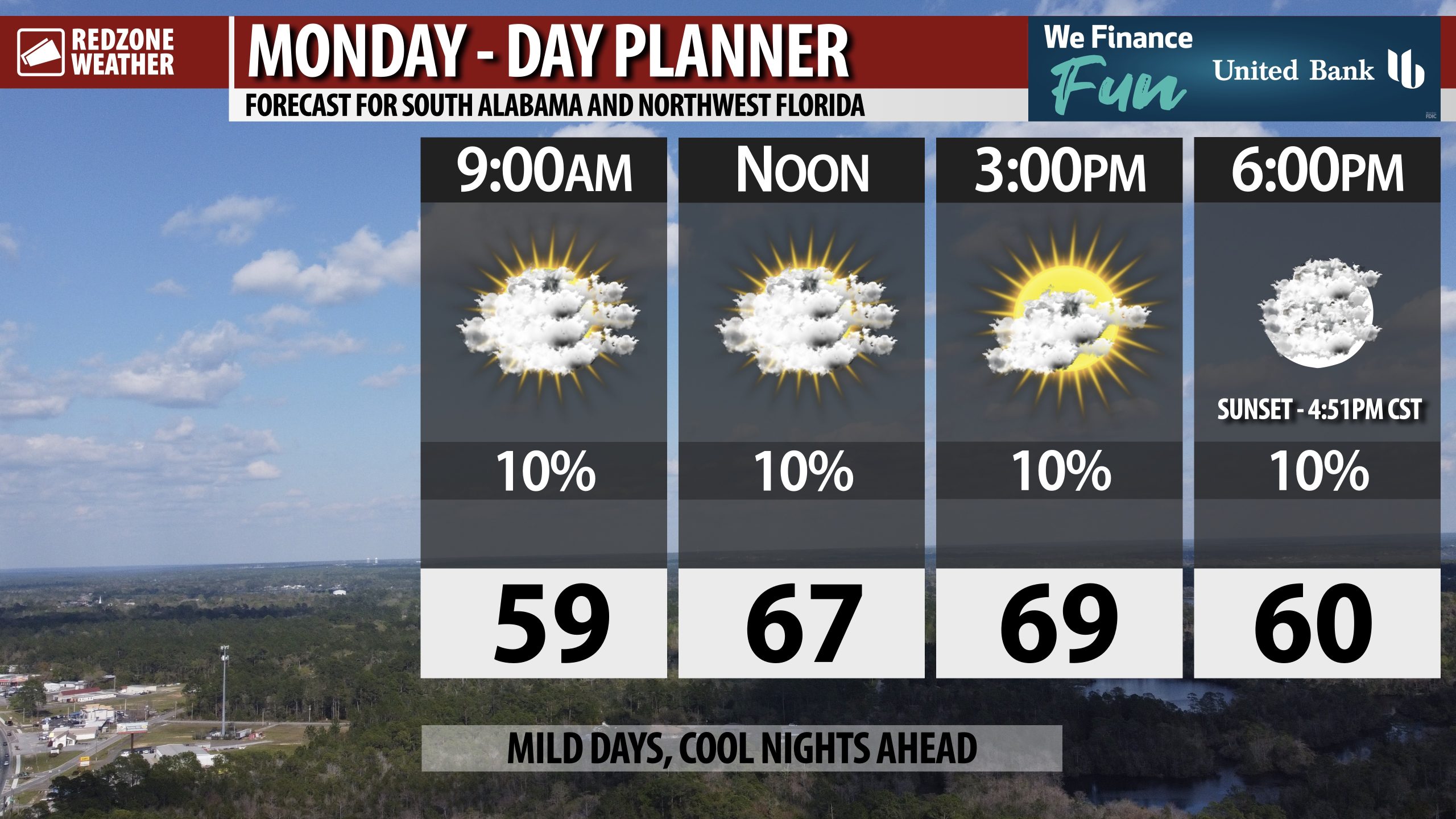
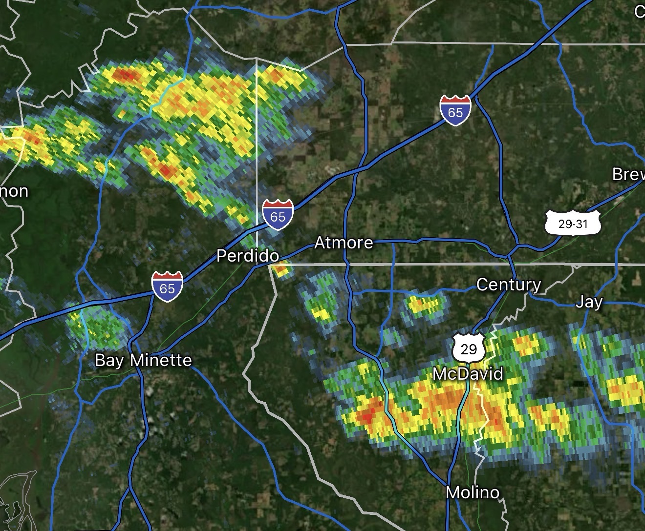
FEW SHOWERS TODAY; MILD DAYS, COOL NIGHTS FOR CHRISTMAS WEEK… This week will feel more like October or early November rather than late December with afternoon highs set to be in the low to mid 70s this week. Overnight lows will be in the 40s and 50s tonight but we will be firmly in the 50s for lows by the end of the week. Christmas Eve and Christmas Day will be warm – not “record territory” warm, but mild/warm nonetheless. Our next cool down may happen around a week from today, although confidence in that idea remains low for now. A few showers will be possible at times today.
TEMPERATURES WARMING TO MID 70s FOR HIGHS LATER THIS WEEK… The big weather headline across south Alabama and northwest Florida this week will be the abnormally mild temperatures for this time of year. I know a lot of folks want a chilly Christmas. That won’t happen, but it will be QUITE nice for any outdoor activities later this week. Afternoon highs on Christmas Eve and Christmas Day will surge into the mid 70s. There is an off chance some communities make a run at the 80 degree mark on Friday or Saturday.
NO RAIN THIS WEEK AFTER TODAY… A ridge of high pressure will keep our weather pattern across the Deep South quiet this week into the upcoming weekend. This will make for near perfect travel weather for any folks traveling across our local area this week into the weekend. Isolated showers may happen to our north and west across parts of north Alabama and Mississippi at times this week but I do not see any credible evidence pointing to rain for our local area in south Alabama or northwest Florida.
NEXT COOL DOWN MAY HAPPEN A WEEK FROM TODAY… Looking for a cold front? It won’t happen this week but you may be in luck NEXT week, depending on the exact setup. Some of the global models have hinted we may have a cold front push through the region a week from today. That isn’t a slam dunk by any metric as some other models have hinted we may remain warm/mild until after the 1st of January. I’ll keep watching trends and bring you the latest in the days ahead. For now, enjoy the nice, sunny weather!
APP… If you haven’t already downloaded the RedZone Weather app, now is a great time to do that. redzoneweather.com/app is the link to the free download. Once you have the RZW app installed on your iOS or Android device, be sure to visit the Alerts tab to turn on the specific notifications you’d like to receive. All notifications are handcrafted by me. No automation and we promise not to bug you!
See all the details in your Monday morning RedZone Weather forecast video. My next forecast video will be posted by 7:15AM tomorrow morning. I will have updates posted throughout the day, as needed, in the RedZone Weather app.
Have a great start to your Christmas week!