SCATTERED P.M. STORMS TODAY; SLIGHTLY COOLER TEMPS LATER THIS WEEK… Scattered thunderstorms will be possible this afternoon into this evening across parts of south Alabama and northwest Florida. Generally, the further west you are in our local area today, the higher your rain chance will be. That means places like Mobile, Citronelle, Thomasville, Monroeville, Jackson, and Chatom have a slightly higher rain chance than places further east like Andalusia, Opp, Crestview, and Destin. Rain will be unevenly distributed, so many communities will remain dry while others have a passing storm. The greatest chances of rain and pop-up storms today will happen from 3PM to 9PM. Hot temperatures continue today before a gradual cooling trend begins later this week, something that a lot of folks have been looking forward to for quite some time!
RAIN CHANCES GREATEST ACROSS WEST ALABAMA THIS EVENING; HOT TEMPS ACROSS REGION… Rain chances will generally be in the 30-40% range today, with scattered storms most likely happening in parts of west Alabama. This will not be an all-day rain event. High temperatures will be in the mid 90s across the region with heat index values ranging from the upper 90s to the low 100s this afternoon.
LOW-END SEVERE WEATHER RISK TO OUR NORTH… The northern portions of Mississippi, Alabama, and Georgia, along with much of Tennessee and western North Carolina are involved in a low-end, Level 1 (out of 5) severe weather risk valid for later today. Gusty winds are the main concern in the strongest of the storms in those zones. The overall tornado risk remains quite low. There is no formal risk of severe weather locally in south Alabama or northwest Florida today.
HOT TEMPERATURES PERSIST TUESDAY AND WEDNESDAY… Tuesday and Wednesday will remain hot, but rain chances will be lower compared to today. High temperatures will generally be in the low to mid 90s tomorrow with similar temperatures expected Wednesday. Isolated P.M. showers and thunderstorms will be possible, meaning MOST communities will remain dry on both days.
SLIGHTLY COOLER TEMPERATURES THURSDAY AND FRIDAY… A slow-moving cold front and an increasingly dry, northwesterly flow will bring slightly cooler temperatures to the region by Thursday and Friday. This will be welcome relief from the prolific heat and humidity our area has had over the last several weeks! Highs will be in the upper 80s and near 90° on Thursday, followed by mid to upper 80s on Friday. Rain chances will be very low, if not zero, across much of the region later this week.
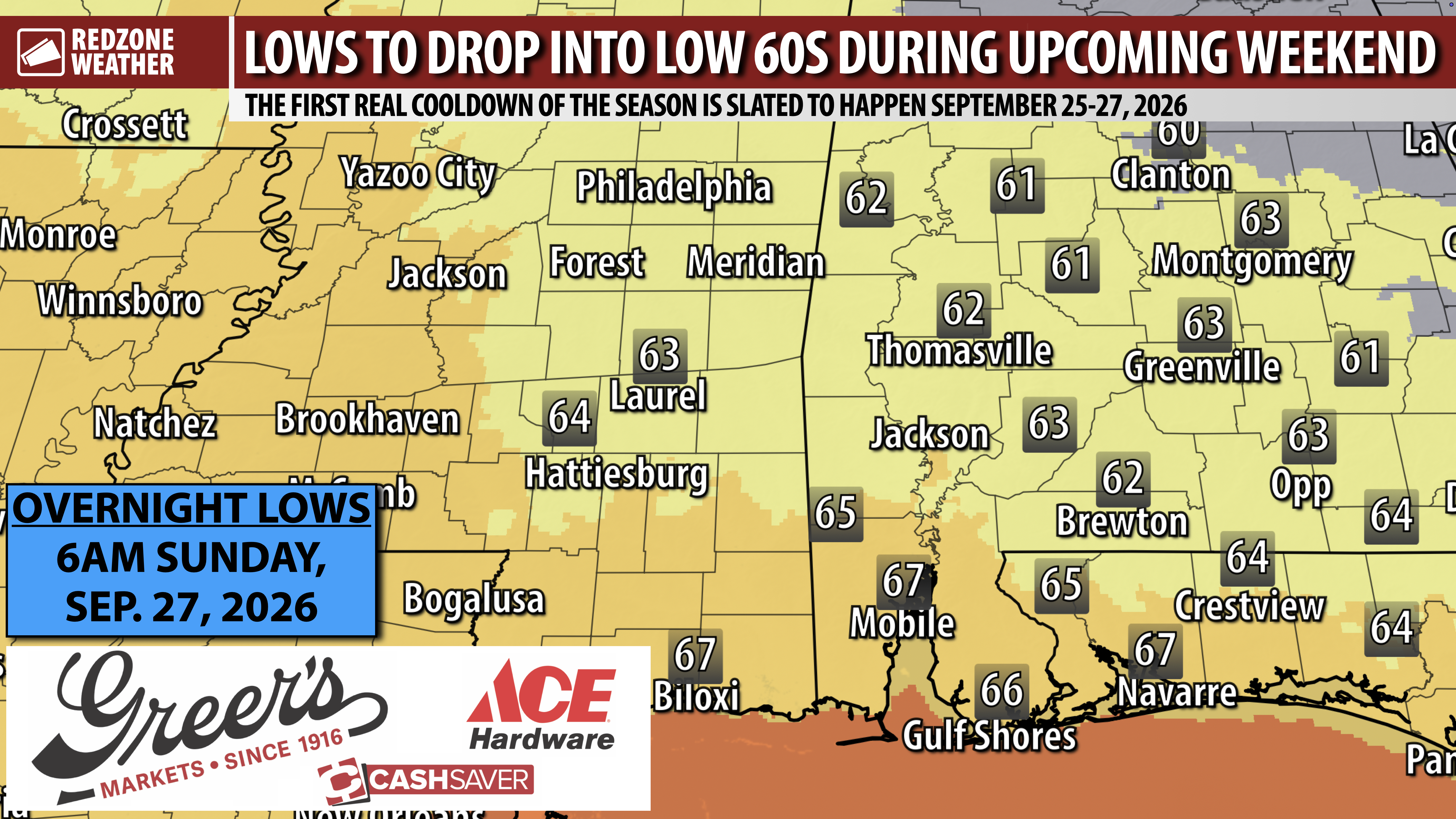
LOWER HUMIDITY W/ HIGHS IN 80S THIS WEEKEND… Lower humidity and slightly cooler temperatures are expected this weekend. High temperatures will generally be in the 85-88° range Saturday and Sunday. Rain chances will remain quite low, with mostly dry conditions expected across the region. Don’t misunderstand – it will continue to be quite warm this weekend, but not nearly as oppressive as the last few weeks!
TROPICS: TROPICAL STORM FAY IN THE NORTHERN ATLANTIC… Tropical Storm Fay is located in the open waters of the northern Atlantic, about 430 miles southwest of the Azores. Maximum sustained winds were near 60 mph in the latest advisory. Fay is expected to begin gradually weakening today. Direct impacts from Tropical Storm Fay are not expected in the United States.
TROPICS: GULF & CARIBBEAN REMAIN QUIET… No tropical development is expected in the Gulf or Caribbean Sea over the next 5-7 days. The 2026 Atlantic Hurricane Season will officially end on November 30.
APP… If you haven’t already downloaded the RedZone Weather app, now is a great time to do that. redzoneweather.com/app is the link to the free download. Once you have the RZW app installed on your iOS or Android device, be sure to visit the Alerts tab to turn on the specific notifications you’d like to receive. All notifications are handcrafted by me. No automation and we promise not to bug you!
See all the details in your Monday RedZone Weather forecast video. My next forecast video will be posted by 7:15AM tomorrow morning. I will have updates posted throughout the day, as needed, in the RedZone Weather app.
Have a nice start to your week!