
2:18PM August 20, 2026
Severe Thunderstorm Warning for Santa Rosa County in FL until 3:00pm.
— Spinks Megginson (@rzweather) August 20, 2026

Severe Thunderstorm Warning for Santa Rosa County in FL until 3:00pm.
— Spinks Megginson (@rzweather) August 20, 2026
Scattered strong thunderstorms are beginning to develop across parts of south Alabama and northwest Florida this afternoon.
Heavy storms have developed near Crestview, Milton, Pace, Pea Ridge (FL), Navarre, and Holt.
More storms will fire up across the region over the next https://t.co/9JjCaiJOYn
— Spinks Megginson (@rzweather) August 20, 2026

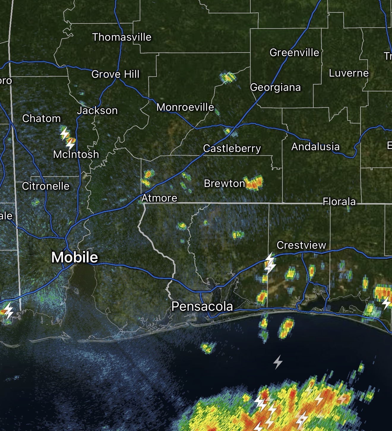
SPOTTY STORMS DEVELOPING… Showers and thunderstorms are quickly popping up this afternoon across south Alabama and northwest Florida. Isolated strong to severe thunderstorms will be possible this evening. Gusty winds are the main concern. Overall, the tornado risk is very, very low today.
All the storms will be capable of producing cloud-to-ground lightning, loud thunder, gusty winds, and heavy rain.

Isolated showers have developed this afternoon near Navarre, Mary Esther, Hurlburt Field, Niceville, and Freeport.
These will likely be the first of many showers and storms that develop across the region over the next few hours. https://t.co/HXTkB8xLH3
— Spinks Megginson (@rzweather) August 20, 2026

The latest U.S. Drought Monitor now has abnormally dry conditions noted across nearly all of south Alabama and northwest Florida. Level 1 (out of 4) drought conditions have developed in parts of southwest Alabama.
Despite the recent downpours, we need more rain! https://t.co/5m3U4dbWum
— Spinks Megginson (@rzweather) August 20, 2026

RT @RyanWeather: Tropical Depression 02C –> will become Tropical Storm Moke and head in the direction of Hawaii into the weekend.
Still u…
— Spinks Megginson (@rzweather) August 20, 2026

RT @JenLovesTheSky: East of Freeport, FL this morning.
#FLwx @ChrisSmithPW @rzweather @spann @StormHour @ThePhotoHour @RyanMichaelsWX http…— Spinks Megginson (@rzweather) August 20, 2026
