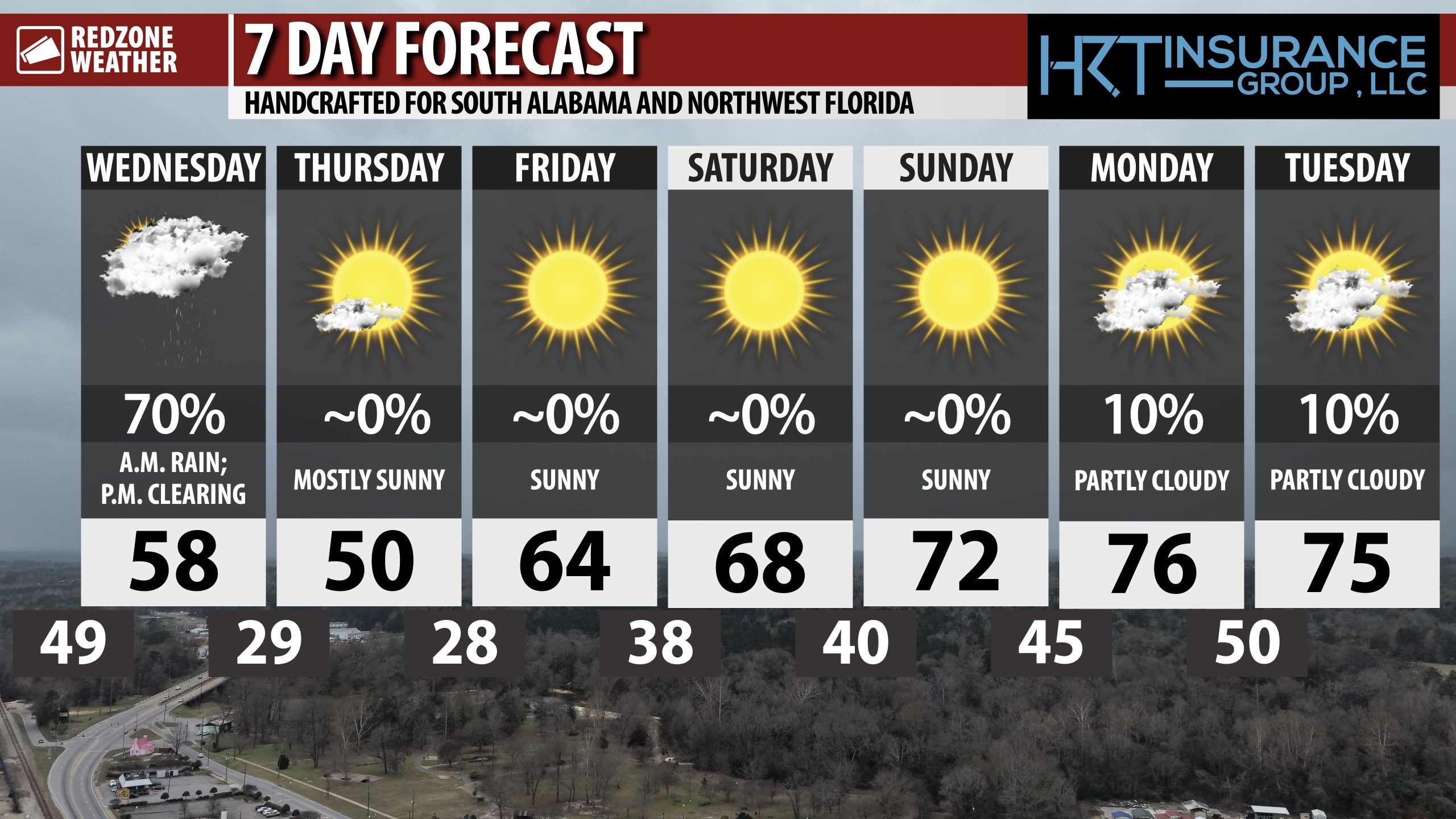
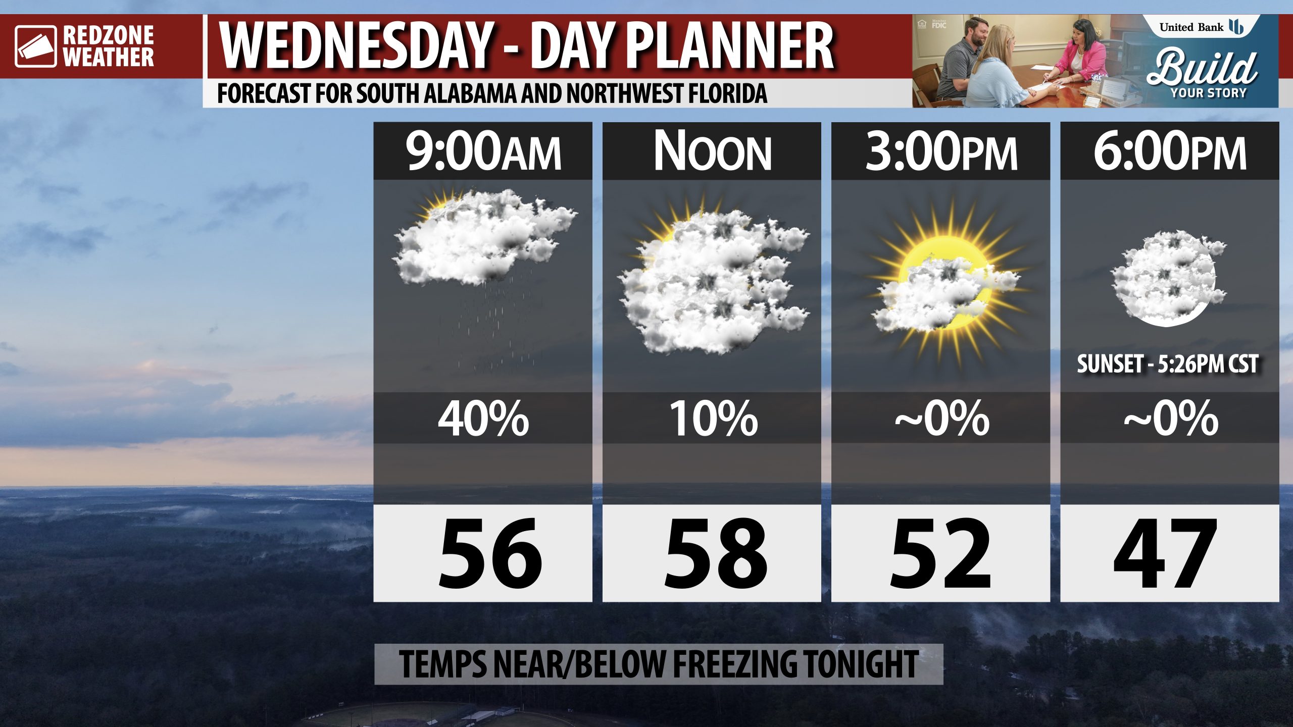
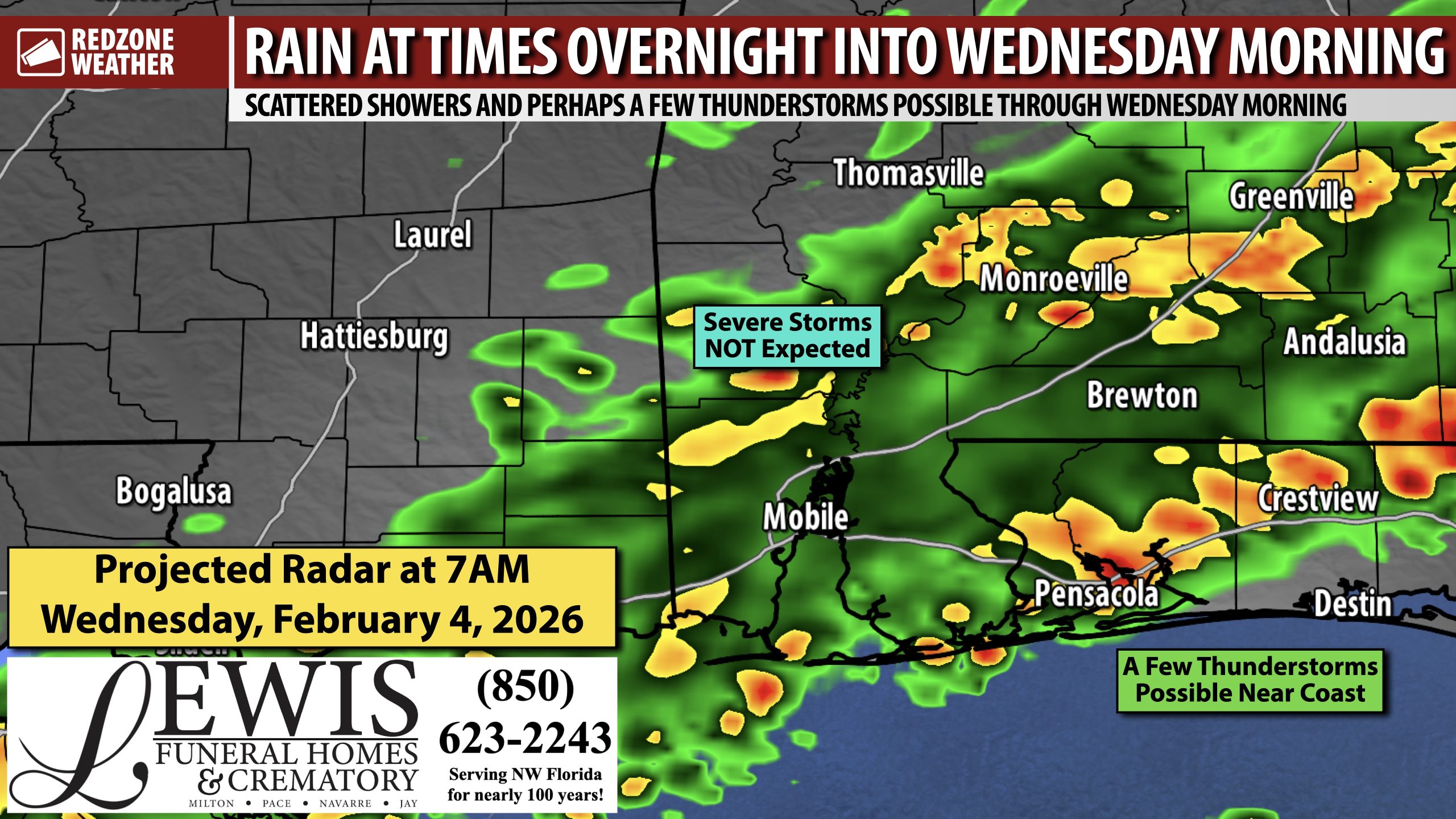
RAIN MOVING OUT; TWO COLD NIGHTS AHEAD; WARMER WEEKEND… Scattered showers will continue to be possible over the next several hours ahead of colder, drier air pushing into the local area at midday and into the afternoon hours. High temperatures have already occurred today in many communities across the region due to a strong cold front pushing in. Temperatures around 3PM will be in the 40s inland with 50s likely closer to the coast. Get ready for more cold weather, at least temporarily. High temperatures tomorrow will struggle to get to the 50 degree mark. Warmer weather will arrive just in time for the weekend.
TEMPERATURES NEAR OR BELOW FREEZING TONIGHT & TOMORROW NIGHT… After rain moves out, much colder, drier air arrives behind the advancing cold front this evening. Temperatures will fall into the 30s this evening. Most spots will have an overnight low in the 26-33° range across the region with the colder values happening north of US84. Wind chill values will be as low as 17° further inland. Tomorrow, afternoon highs are expected to be in the 40s inland with 50s likely closer to the coast. Another night with subfreezing temperatures is expected tomorrow night into Friday morning.
WARMER TEMPERATURES COMING THIS WEEKEND; DRY PATTERN… Milder temperatures are on the way for the upcoming weekend. Afternoon highs will top out in the 60s on Saturday with highs in the low 70s on Sunday and on Monday. Sunny, dry conditions are likely this weekend into early next week.
APP… If you haven’t already, be sure to download the free RedZone Weather app to keep up with all the latest information on the world of weather in south Alabama and northwest Florida. redzoneweather.com/app is the link for the free download. Once you have the app downloaded to your iOS or Android device, be sure to visit the Alerts tab (lower right corner) and tap the Alert Settings button to customize the alerts you would like to receive straight from me.
See all the details in your Wednesday morning RedZone Weather forecast video. My next forecast video will be posted by 7:15AM tomorrow morning. I will have updates posted throughout the day, as needed, in the RedZone Weather app.
Have a great Wednesday!