10:56PM November 5, 2025


4:18PM November 5, 2025

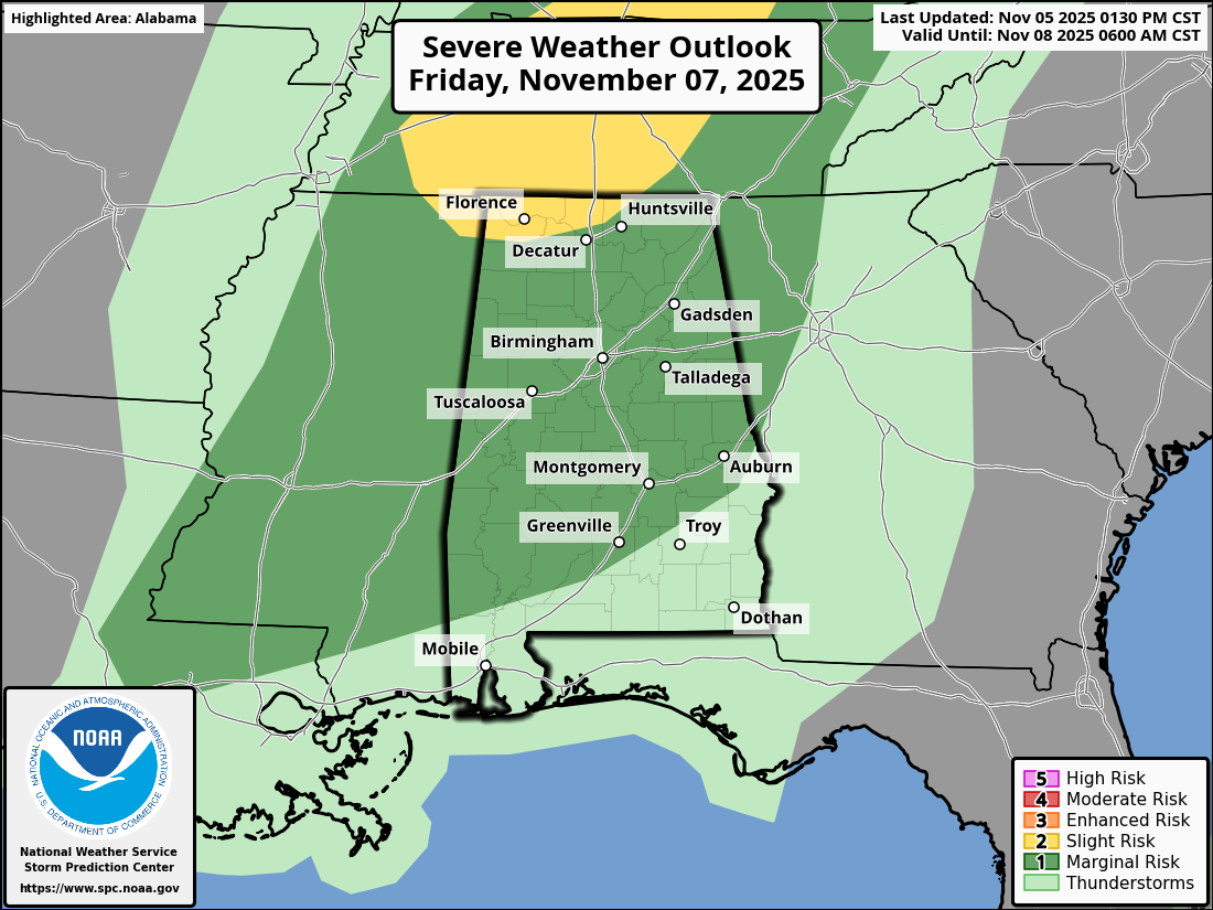
ISOLATED SEVERE STORMS POSSIBLE FRIDAY P.M. LOCALLY… The Storm Prediction Center has added a Level 1 (out of 5) low-end severe weather risk for much of Alabama valid for Friday into early Saturday morning.

Locally, parts of Butler, Conecuh, Monroe, Clarke, and Washington counties are involved.

8:11AM November 6, 2025

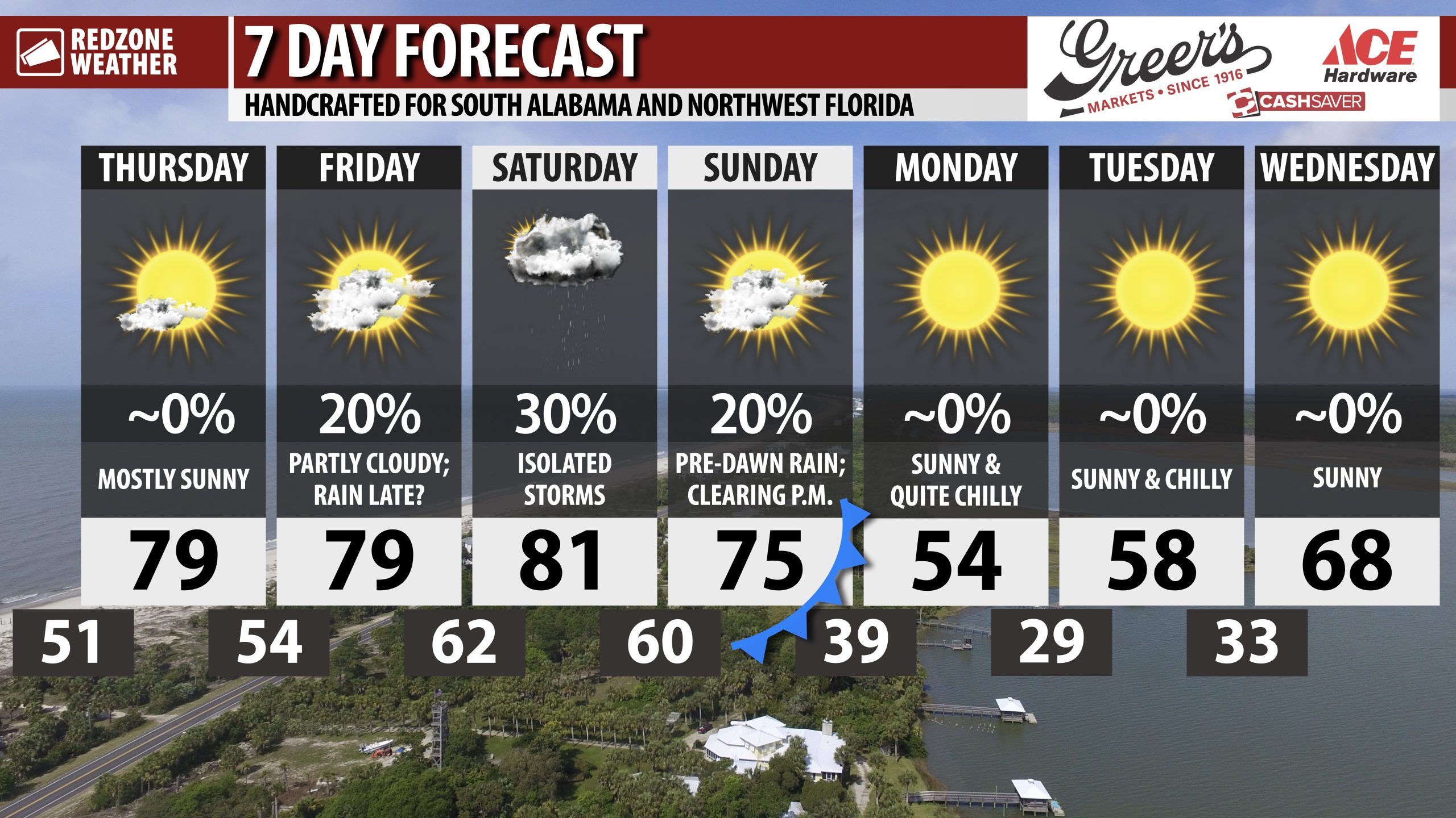
MUCH COLDER AIR ARRIVES NEXT WEEK… Monday will be the coldest day our area has had in quite some time. High temperatures may struggle to get to the mid 50s with a northwest wind expected throughout the day. Overnight lows Monday night into Tuesday morning will be below freezing in many spots locally.

6:28AM November 6, 2025

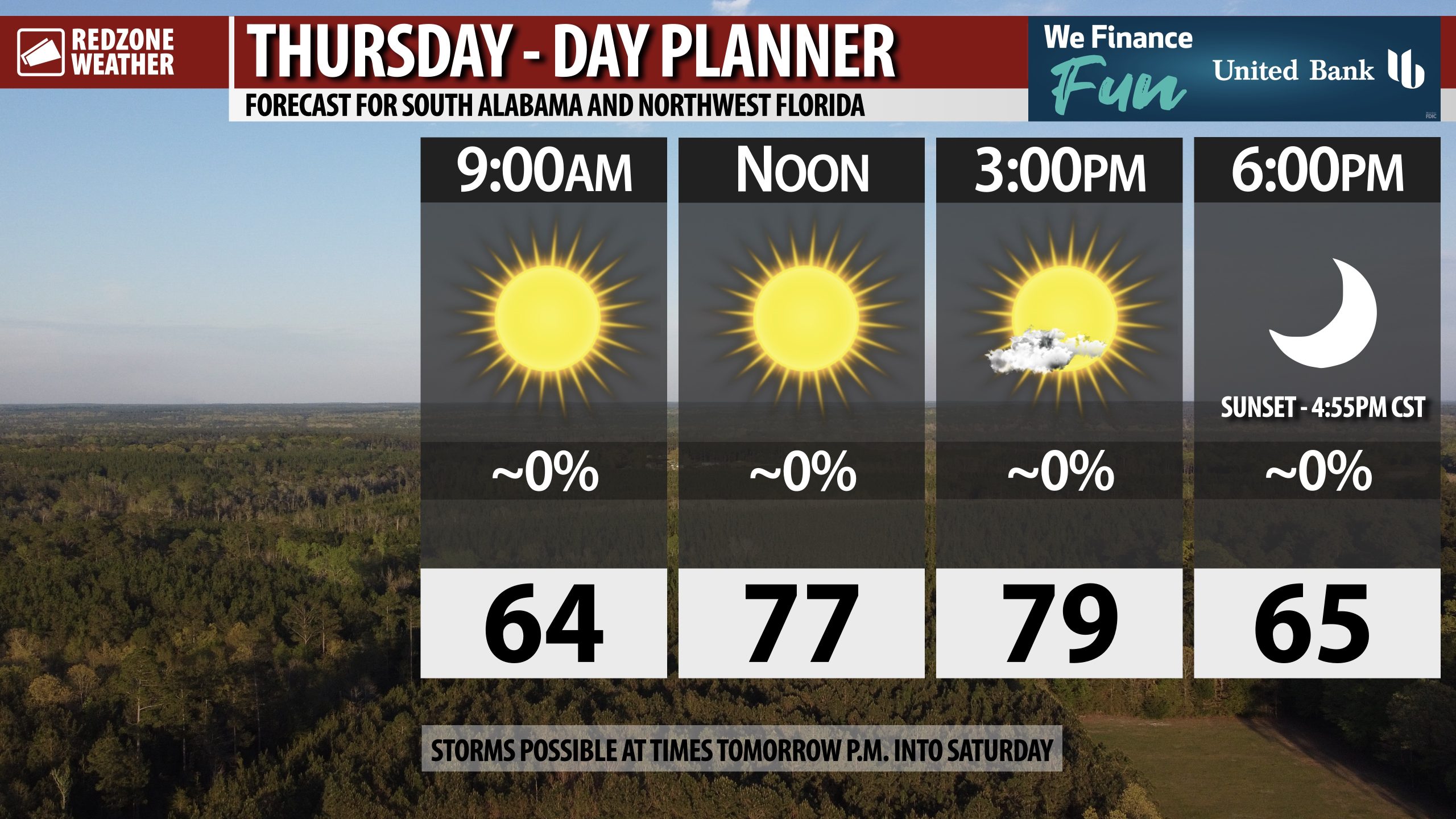
MAINLY SUNNY TODAY; SHOWERS & STORMS POSSIBLE TOMORROW NIGHT… Mostly sunny skies on this Thursday will give way to increasingly more cloudy skies tonight into Friday. Scattered showers and storms possible Friday night into Saturday. Low-end risk of a few stronger storms to our north tomorrow evening.

Hope you have a great Thursday!