6:39PM November 4, 2025
Overnight lows will be in the 40s in many communities at 6AM Wednesday morning unless you're right at the immediate coast where 50s are more likely. pic.twitter.com/91v9iMmKZW
— Spinks Megginson (@rzweather) November 5, 2025
Overnight lows will be in the 40s in many communities at 6AM Wednesday morning unless you're right at the immediate coast where 50s are more likely. pic.twitter.com/91v9iMmKZW
— Spinks Megginson (@rzweather) November 5, 2025
Numerous controlled burns are happening across the Deep South this afternoon, particularly across parts of central Alabama, Mississippi, and Georgia.
Sunny, nice day in progress across the region. pic.twitter.com/7j2kLQ2GWS
— Spinks Megginson (@rzweather) November 4, 2025
MORE SUNSHINE TODAY; STORMS POSSIBLE FRIDAY NIGHT AND INTO THIS WEEKEND… Temperatures will be slightly increased today compared to the last few days. Afternoon high temperatures will be in the mid to upper 70s across the region. We’re headed to the 40s again tonight for overnight lows. Looking ahead, our next chance of rain happens this weekend, most likely in the form of isolated or scattered showers and perhaps a few thunderstorms. The greatest chance of rain probably will happen on Saturday, but not every community across the local area will have rain before the end of the day. Before we get to Saturday, we may have a risk of a few isolated severe storms on Friday night. Much colder, drier air arrives early next week after the passage of a strong cold front.
LOW-END SEVERE WEATHER RISK SETTING UP FOR FRIDAY NIGHT… Most of the daytime hours on Friday are expected to be dry but Friday night may be a different story. A few strong to severe thunderstorms may be possible on Friday night due to the overlap of atmospheric shear and instability. Unfortunately, this looks like a threat that will maximize in the overnight hours Friday night into early Saturday morning. It is a bit too early for specifics as far as where the risk will maximize, but be aware as we get toward Friday that a few severe storms may be possible. Tornadoes and damaging wind gusts will be possible.
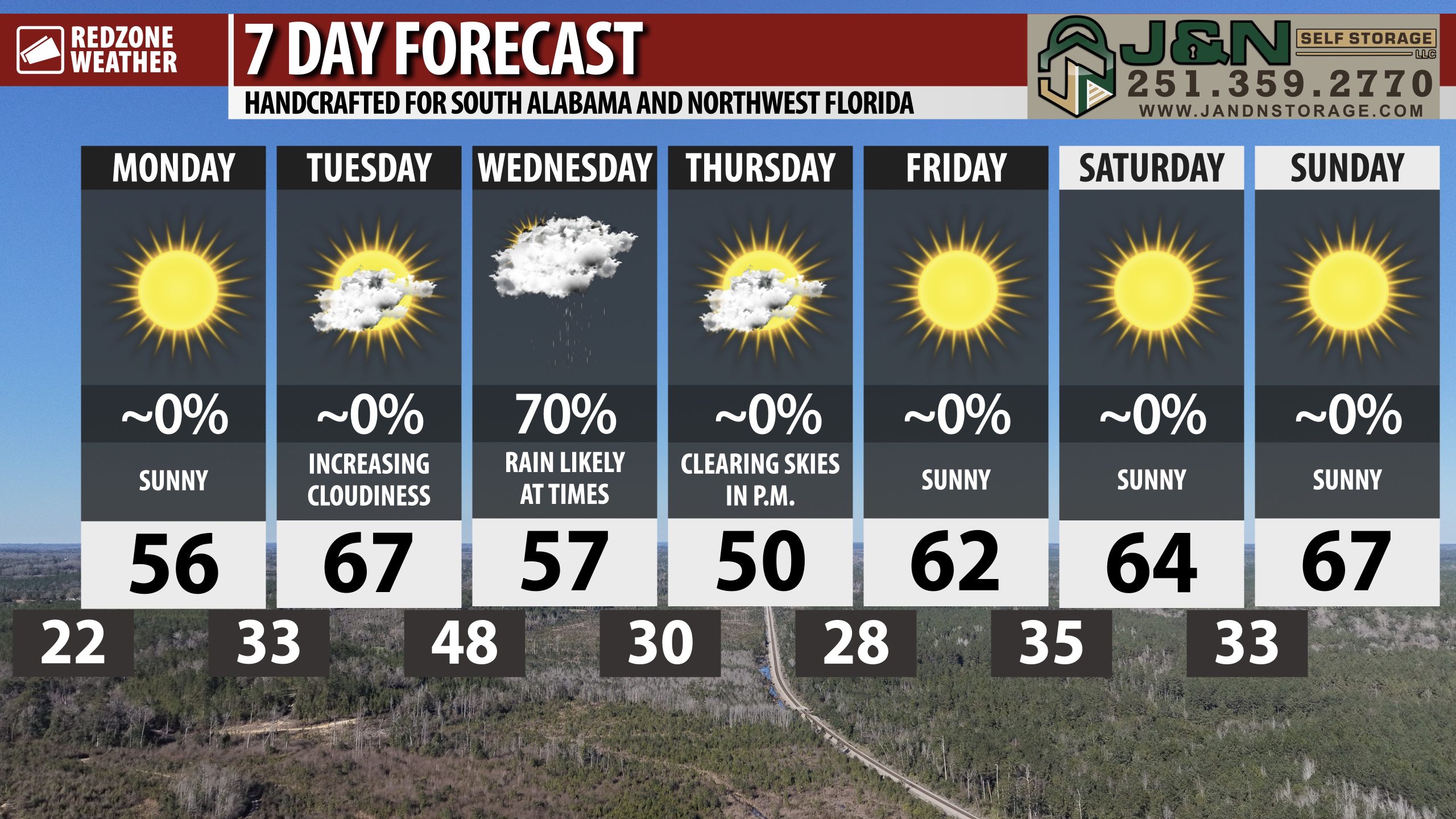
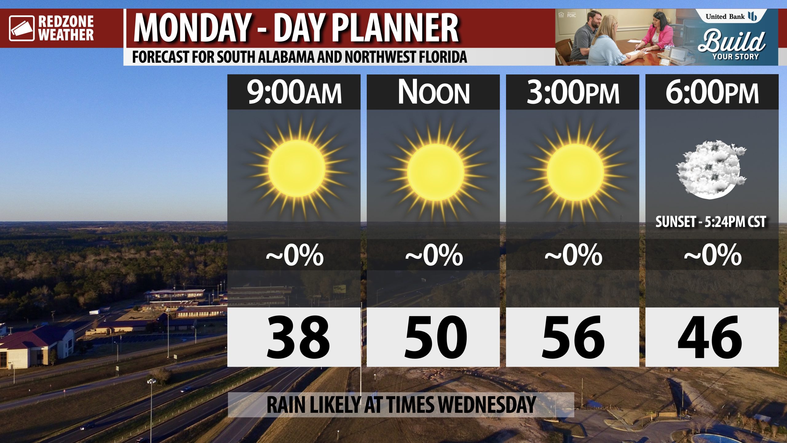
SIGNIFICANTLY COLDER AIR ARRIVES SUNDAY NIGHT INTO MONDAY… The coldest air of the season will invade the Deep South as we get into Sunday night after a strong cold front moves through. High temperatures on Monday will struggle to get beyond 55° with overnight lows expected to be in the 20s by the time we get to late Monday night and into Tuesday morning.
TROPICS: GULF & CARIBBEAN QUIET, FOR NOW… The Gulf, Caribbean Sea, and Atlantic Ocean remain quiet with no new named tropical storms expected to form over the next 5-7 days.
APP… If you haven’t already downloaded the RedZone Weather app, now is a great time to do that. redzoneweather.com/app is the link to the free download. Once you have the RZW app installed on your iOS or Android device, be sure to visit the Alerts tab to turn on the specific notifications you’d like to receive. All notifications are handcrafted by me. No automation and we promise not to bug you!
See all the details in your Wednesday morning RedZone Weather forecast video. My next forecast video will be posted by 7:15AM tomorrow morning. I will have updates posted throughout the day, as needed, in the RedZone Weather app.
I was asked at a public event recently is our local area "overdue" for a major hurricane? (last MAJOR hurricane strikes locally were in 2004 and 2005 – Ivan and Dennis)
The answer: We are not "overdue" but we are getting close to the return period intervals for our area.… pic.twitter.com/qfLHShkxgj
— Spinks Megginson (@rzweather) November 4, 2025

13 NAMED STORMS THIS YEAR, SO FAR… Odds are increasing we may have seen the final named storm in the Atlantic Basin for the 2025 season (Melissa).
Still a chance for a named storm to happen through the end of the calendar year, but chances seem to be decreasing everyday.