8:14PM October 24, 2025
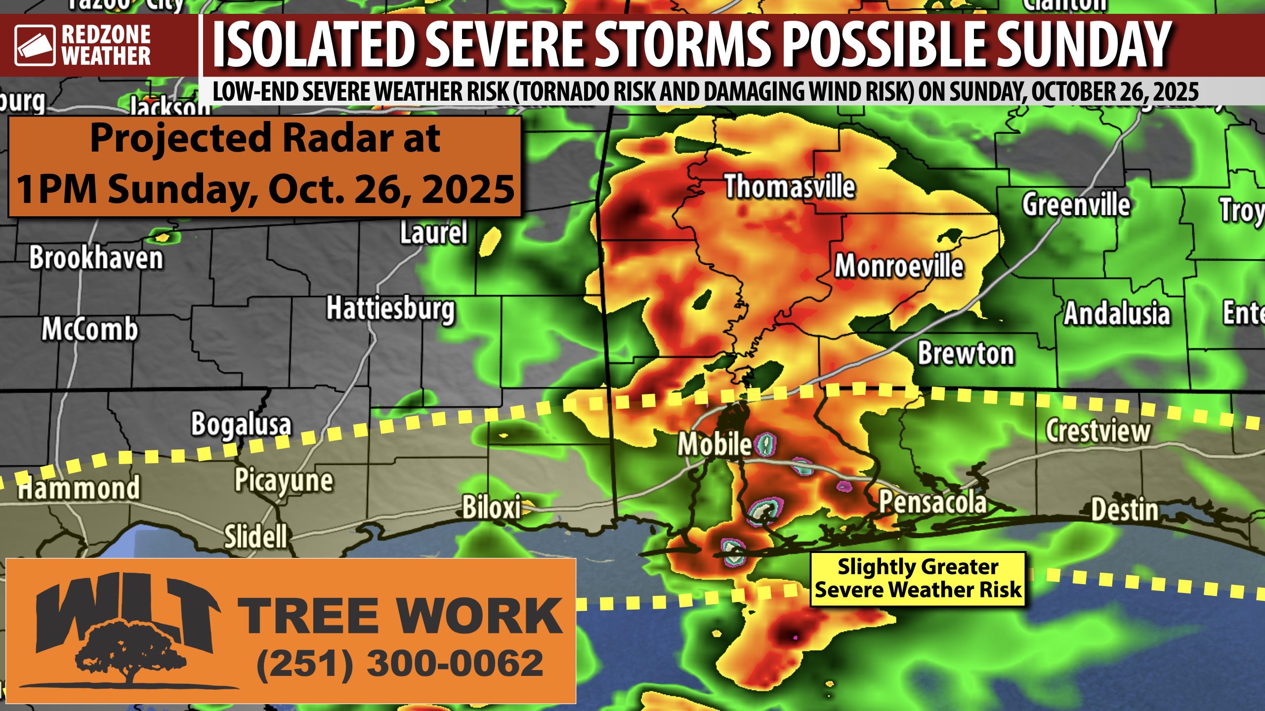
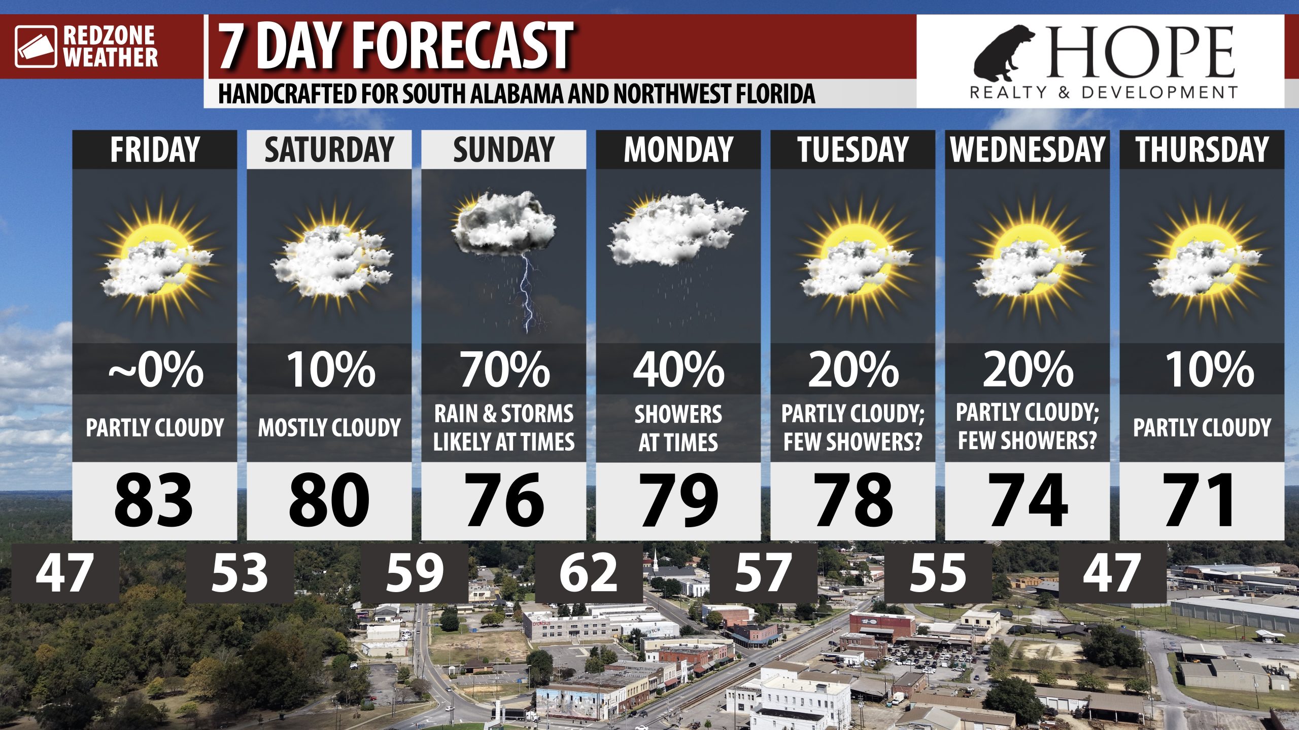
LOW-END SEVERE WEATHER RISK SUNDAY; BENEFICIAL RAIN EVENT… Isolated strong to severe storms will be possible on Sunday, in addition to beneficial rain, across south Alabama and northwest Florida. Just like what happened last weekend, we have another round of rain and thunderstorms set to move through the region this weekend. Isolated severe thunderstorms may become possible, particularly if a warm front moves inland. Unlike last weekend, however, this is shaping up to be a low-end severe weather risk that sets up in the daytime hours of Sunday, perhaps extending into the evening hours. The concern on Sunday will be the potential for a few, brief tornadoes and gusty winds.
SEVERE WEATHER TIMING – SUNDAY… 8AM to 8PM Sunday is the current twelve hour window for strong to severe thunderstorms across south Alabama and northwest Florida. The risk will very likely maximize closer to the beaches IF a threat materializes at all. We encourage everyone to have multiple ways to hear warnings, just in case tornado warnings become required.
BENEFICIAL RAIN EXPECTED… This will be a beneficial rain event across south Alabama and northwest Florida, perhaps exceeding the event that happened last weekend. 1 to 3 inches of rainfall will likely be the norm across the region. Drought conditions, particularly inland in parts of Clarke, Monroe, Marengo, and Wilcox counties, are severe.
APP… If you haven’t already downloaded the RedZone Weather app, now is a great time to do that. redzoneweather.com/app is the link to the free download. Once you have the RZW app installed on your iOS or Android device, be sure to visit the Alerts tab to turn on the specific notifications you’d like to receive. All notifications are handcrafted by me. No automation and we promise not to bug you!
I will have another update posted on Saturday along with rolling updates in the RedZone Weather app.
Have a nice Friday evening!